I got a slow start this morning. It was nearly noon before I left the campground to see more of the sights in the area. Because of the late start I didn’t wander a long distance from the tri cities area. I followed the roads along the east/south bank of the Columbia river back into Oregon. It goes from farm lands to deep canyons within a few short miles. Eventually the terrain returns to rolling hills. The river is wide and calm behind the McNary Lock and Dam. Traffic and unmarked turnouts made it impossible for me to stop, but it was a pretty drive.
The campground was very lively this weekend.
The campground is very lively this weekend. There are many multiple site groups with lots of kids running between sites. A very family oriented atmosphere prevails. There was even a Saturday night movie for the kids at the amphitheater. Tomorrow morning is likely going to be very busy with people trying to beat the noon checkout time.
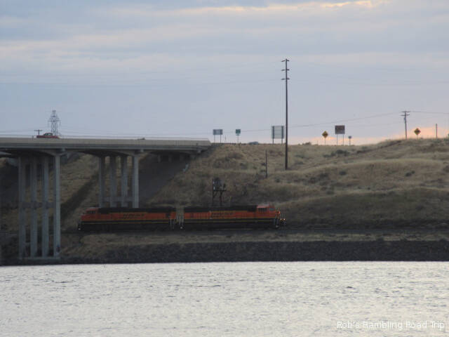
Two engines moving along the rails (left to right) looking for a train. Over the next half an hour they did a lot of horn blowing as they hooked onto a number of rail cars at the fuel tank area just up river.
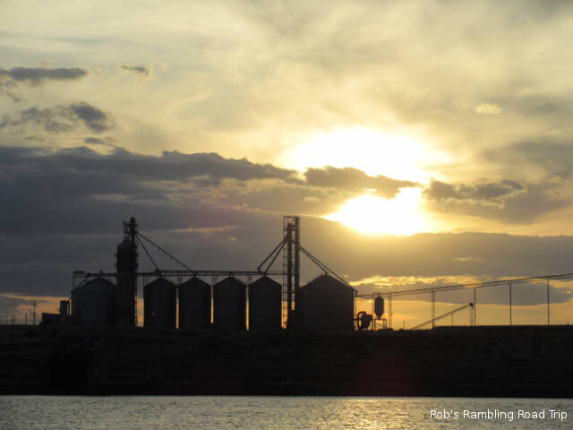
Sun getting low in the sky behind the grain storage.
I hope to get a better start tomorrow morning so I can travel further away on my touring. The temperature is forecast to be a little cooler on an overall cloudier day.
After a little more overnight rain it turned into a cloudy first two thirds of the day. The clouds didn’t allow the temperature to climb very high. Late in the day the clouds started to break up and the high temperature of the day in the low seventies was reached. Tomorrow is forecast to be closer to normal high temperatures in the eighties.
Clouds starting to break up to the southwest over the Snake River about 3:30PM.
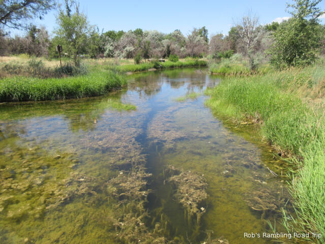
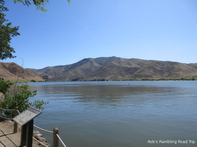
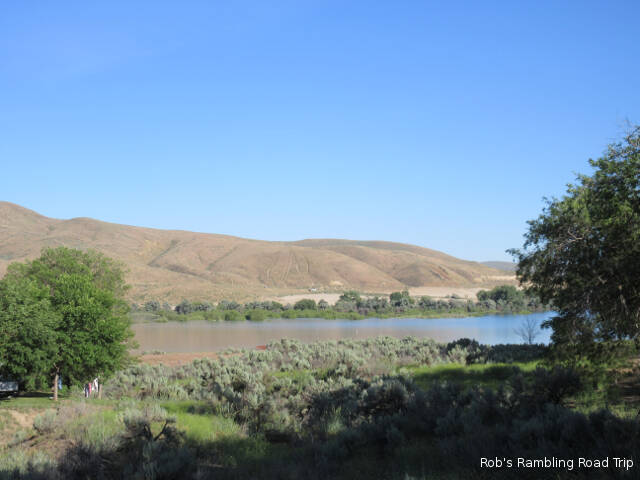
The climate in the Tri-cities area of Washington is very arid. It is located in the rain shadow of the Cascade Mountains. Most of the area is very brown and dusty. The exception is areas that are irrigated. One example is this park on the side of the Snake River. It has many big mature trees that draw water from the river. The park staff also makes liberal use of the river water to run sprinklers that keep much of the area lush with green grass. The area to the east and north of here roughly parallel to the rivers path is also well irrigated.
On a drive to the east I passed acres and acres of farm land. I’m not great at recognizing crops, but the grape vineyards were easy to identify. Across the road from the rows of grape vines were well manicured and controlled fruit trees. I think they were apple trees, but might be something else. The fruit was still small and not really identifiable. There were also acres of plants that appeared to be potatoes. As I got further from the rivers path the crops changed to ones I would assume require less water. This area was dedicated to grass and grains. All of the planted acreage had more kinds of irrigation equipment than I could ever imagine.
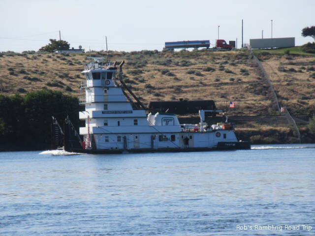
Tugboat heading down the Snake River after delivering a barge up river.
The campground is full for the weekend. Almost everyone is from Washington state with a few Oregon thrown in. I think I’m the only traveler in the park this weekend. My neighbor asked what someone from Florida was doing in this area. It turned into a weird conversation. I don’t think he ever considered that someone from another part of the country might want to visit his home area. Maybe I’m unusual, but this is the type of campground I like. Going a little way out of my way to stay in a nice Corp of Engineers Park on a river is worth it to me.
I was surprised to hear rain on the roof during the night. I’m not sure how long it lasted, but it didn’t sound very heavy. This morning I woke to a partly cloudy day with ever increasing wind. By late afternoon a strong wind was blowing across the river. The high temperature for the day was just over seventy.
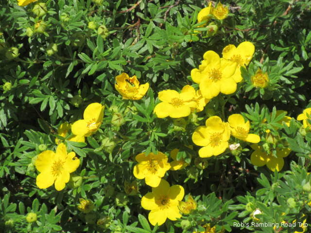
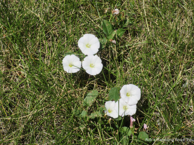
I found a few little wildflower blossoms along the river.
Today’s big activity was a grocery run and a start at exploring the area. The grocery shopping wasn’t the most successful trip I’ve made. The relatively new and large Super Walmart seemed to be out of stock for many of the items I wanted to buy. Despite the rather bad vibe, I managed to get enough food for another week or so.
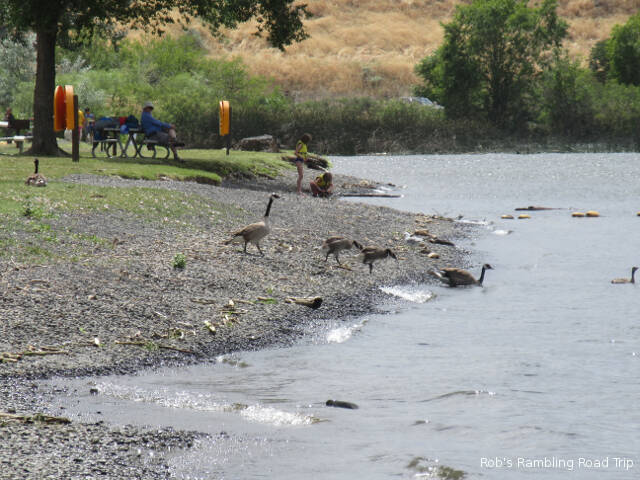
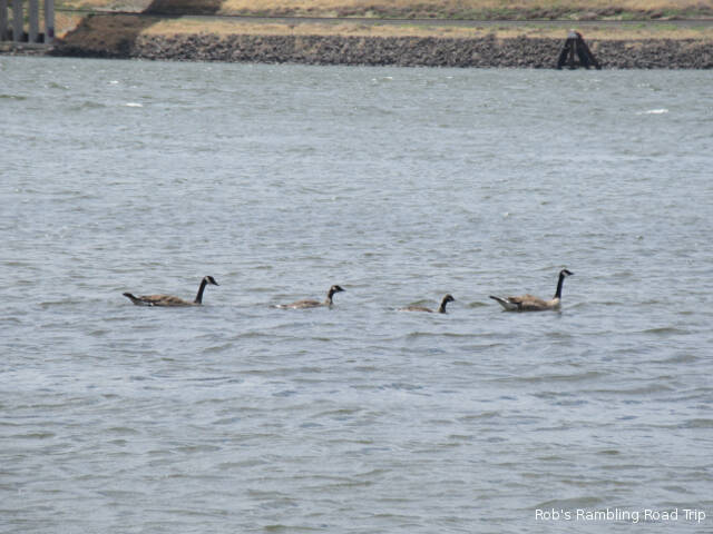
Even the geese use the beach for a little swimming.
I learned a little bit more about the history of the area. After spending last weekend on the historic Oregon Trail, I’m now on the route of the 1804 Lewis and Clark Expedition. The Corp of Discovery came down the Snake River to the Columbia. A state park named for Sacajawea is at the confluence of the rivers not far from here. I hope to visit the park while I’m in the area.
At the campground a lot of turn over happened today. The weekend visitors are starting to arrive. There is a real diversity of equipment present. Many sites have tents, but the RVs range in size up to diesel pushers bigger than my little gas Class A. So far I haven’t seen as many boats as I saw last weekend in Oregon, but the river is definitely the draw. It will be interesting to see what happens over the weekend.
Today’s temperature only made it into the lower half of the eighties. It was a much more comfortable day than the previous two. Late in the day the wind picked up and cooled things down even more. Tomorrow may be cooler.
Bracing against the wind.
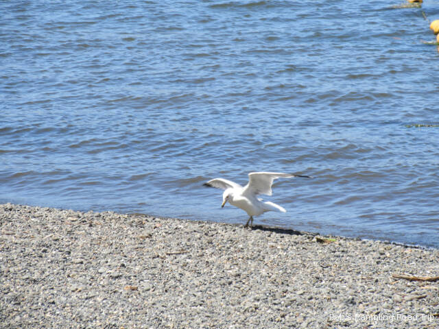
I’m finally acclimated to the Pacific Time zone. Ever since I crossed into this time zone last Friday, I’ve been waking up and getting up early. This morning I didn’t wake up until after 8AM. As a result my day started slowly and my ambition level was low most of the day. During the afternoon I took a walk along the park nature trail. It was a nice walk, but I missed seeing any plants in blossom or any kind of animal life. Listening told me that there were birds and possibly frogs, but I didn’t see any of them. Later in the day I saw one lone seagull along the river. I guess that will have to satisfy my wildlife viewing desire for the day.
This campground doesn’t have water hookups at each site. You are expected to use your own tanks or use water jugs filled from one of the water taps scattered throughout the campground. My campsite is next to one of the taps. It may come in handy if my tank gets low, but right now it’s an annoyance. The two little boys at the next campsite know how to turn it on, but can’t seem to figure out how to turn it off. Most of the time their parents come out to close the faucet and get the kids home. I’ve had to shut it off once. My new neighbors across the street have upped the ante. The grandmother brought her two young grand kids over to the water tap to play. She showed the kids how to fill spray bottles with water. It wasn’t long before the kids were standing under the water faucet getting soaked while she watched from the road ten feet away from the splashing water. This is a desert area. Isn’t water conservation an important concept?
My low level of ambition today kept me from getting out of the campground. I’m starting to run low on supplies. Tomorrow I’ll have to at least make a grocery run, but hopefully I’ll start to form a touring plan for the area. With more than two weeks planned in the area, I’ve been slow getting out and touring.
It was another hot day. The temperature peaked around ninety, but a light wind kept conditions comfortable if you were out of the direct sun. It is not humid. The dry heat warrants a lot of water drinking. The next few days are forecast to be cooler.
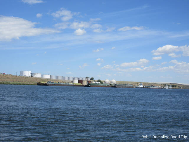
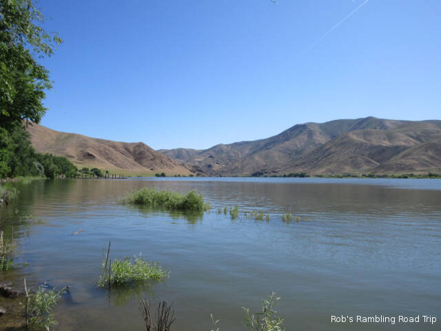
I spent the day getting settled in for my two week stay and exploring Hood Park. The park is an Ary Corp of Engineers facility on the east bank of the Snake River. It is located down stream from the Ice Harbor Lock and Dam and just up stream from the merge with the Columbia River. It is possible for products and trade goods to come all the way up river from the Pacific Ocean or the reverse. There are terminals for grain and fuel on the far bank of the river.
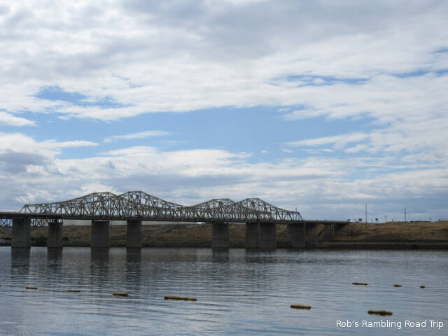
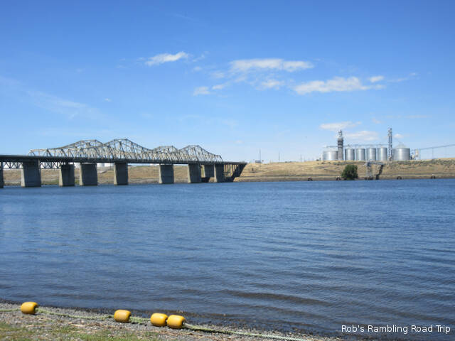
Bridge over the Snake River. A little ways down river the water empties into the Columbia River to continue its voyage to the sea.
In addition to the campground there is a large day use area with a beach on the river and a boat launch area. On this hot day there were a lot of families with kids swimming and playing in the river. A few people were using the picnic area and a half a dozen empty boat trailers were in the parking lot. Later in the day I saw a few boats return to the boat ramp from fishing up river toward the dam. The campground and day use area have plenty of shade trees and lots of green grass, but the park staff needs to work to keep it that way. During the first half of the day a maintenance worker was continuously turning sprinklers on, adjusting there flow for maximum coverage and then turning them off after everything got a good soak. If they had the water pressure to turn them all on at once it would be a real wet show.
Tanks, fuel barges and tugs across the river from Hood Park.
My other activity today was catching up on my internet based reading. After spending the weekend without net access, I had many blogs and news sources to catch up on. I usually spend more than an hour a day reading RV related blogs. Today I spent more than three hours catching up. The other impact of my weekend network isolation is the loss of momentum making reservations for August and September. In the middle of last week I was getting ready to commit to a few more reservations. I need to find that momentum again.
I woke up this morning to strong winds again. Since it was a travel day, I hoped it would calm down quickly like the last two days. When I left the Farewell Bend State Park at 10:30, it was a little better. I would have to contend with the wind all day.
The journey west on Interstate 84 roughly parallels the path of the Oregon trail. The road was very up and down. It eventually climbed about two thousand feet from my weekend base. About half of the elevation was given back on a long winding six percent down grade. Some of the scenery was beautiful, but I really couldn’t enjoy it. I had to watch the road closely and do all of the driving. Cruise control in the mountains isn’t a viable option. The trucks would pass me on the flat sections of the road. I’d slowly pass many of the trucks on the uphill sections when fast moving cars would allow me to get into the passing lane. On the downhill it was a toss up. Some of the truckers just let the rig roll going down hill. I try to keep the speed slow enough that I’m in control without over stressing the brakes. The whole way I was thinking about the difficulty of crossing the area in a wagon pulled by horses or oxen.
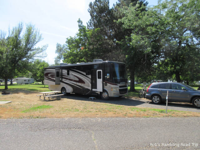
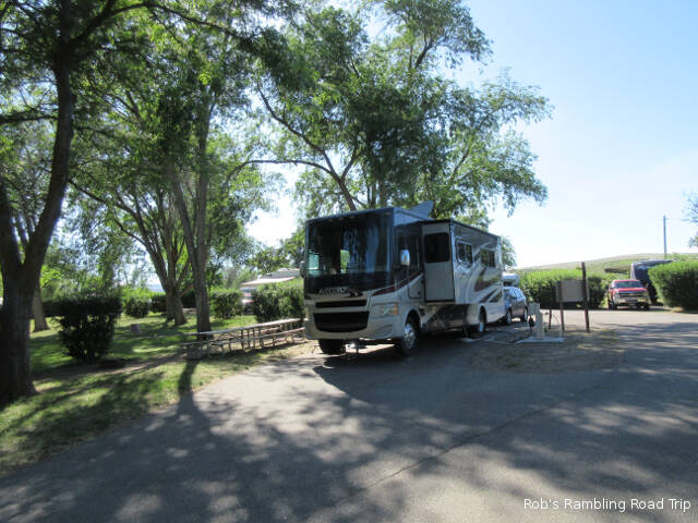
Site 38 at Hood Park Army Corp of Engineers Campground.
I’m at Hood Park on the Snake River just north of its merge with the Columbia River. It is in southern Washington near the tri-cities of Kennewick, Pasco and Richland. The location is a little further north into Washington than I thought. I miss interpreted the scale of the map. What I thought was twelve to fifteen miles turned into forty five. My plan is to range out from here on day trips over the next two to three weeks. We’ll see how well that goes.
I have internet and cell phone again. Before I post this blog entry I will be posting the last three days. Since I’m back dating them, they may not alert subscribers. Here are links to each of them:
Strong winds for a few hours after sunset seem to be a common occurrence in this area. It happened again last night and seems to be happening tonight as I write this blog entry. The wind really stirs up everything and makes a lot of noise, but it also manages to flush any of the lingering heat of the day away. The temperature made it up to about 90 degrees today under a full sunny sky.
Wildflower blossom of the day.
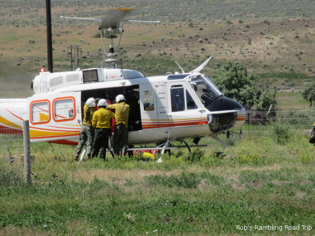
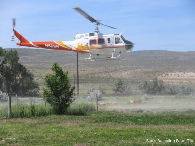
The Price Valley Heli-Rappellers with the Payette National Forest had an exercise going on in the front of the park today. It was kind of hard to figure out what they were doing. They seemed to be practicing loading and unloading the helicopter. I didn’t see any actual repelling from the copter. I just saw several take off and landings by the helicopter with lots of stuff getting loaded and unloaded between trips. It was interesting but noisy.
I watched more boats being launched and recovered from the boat ramp. All of today’s boats were towed by pickup trucks and SUVs. One interesting difference between these boats and the once on the east coast is the majority are made of aluminum. Fiberglass boats are in the minority. Many of the aluminum boats are quite large and have enclosed cabins.
Unloading drill
Time to lift off.
The campground has become quiet. All of the weekend campers and boaters have departed. They started pulling out early this morning and continued until the 1PM checkout time. There weren’t a lot of new arrivals this afternoon. I’ll be leaving tomorrow to travel to the confluence of the Snake and Columbia river on the Oregon Washington State boarder about half way across the state. It is a little over 200 miles from here.
The wind blew hard last night. It helped cool yesterdays 90 degree high temperatures down to comfortable sleeping weather. The only trick was treating the noise of the wind as white noise. Sometime during the night it calmed down, but the wind returned for a while this morning. Eventually it died down again and the temperature of the bright sunny day reached the high eighties.
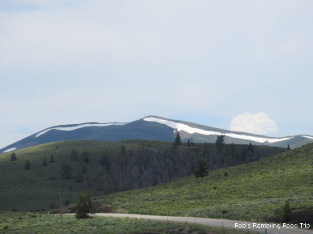
A view of the Brownlee reservoir of the Snake River. The direction of the river’s flow is north out a cut in the mountains on the left of the picture.
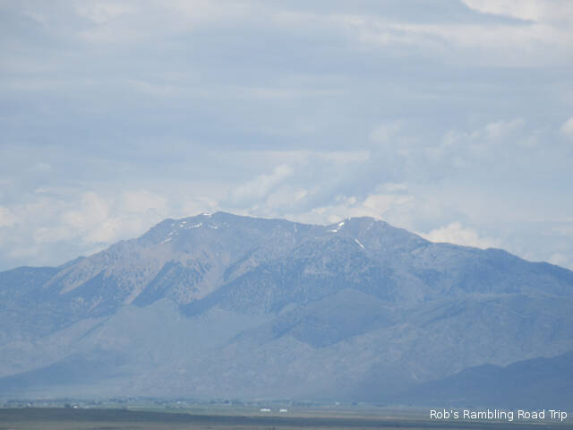
The Farewell Bend State Recreation Area is a little green oasis on the side of the Snake River Brownlee Reservoir. It is surrounded by steeply rolling grass covered hills. I spent the day exploring the park. It has a large day use area with a boat launch in addition to the campground. Many of the visitors are here for the fishing in the reservoir. Walking through the campground it is not surprising to see boats in addition to tents, trailers and motorhomes. One thing I hadn’t seen before, that I think is for freshly caught fish, is small chest freezers sitting beside the power pedestal. I saw two different tent campers that had similar top loading chest freezers on there campsite. One tent camper with a boat also had a small white refrigerator about half the size of the freezer siting beside it.
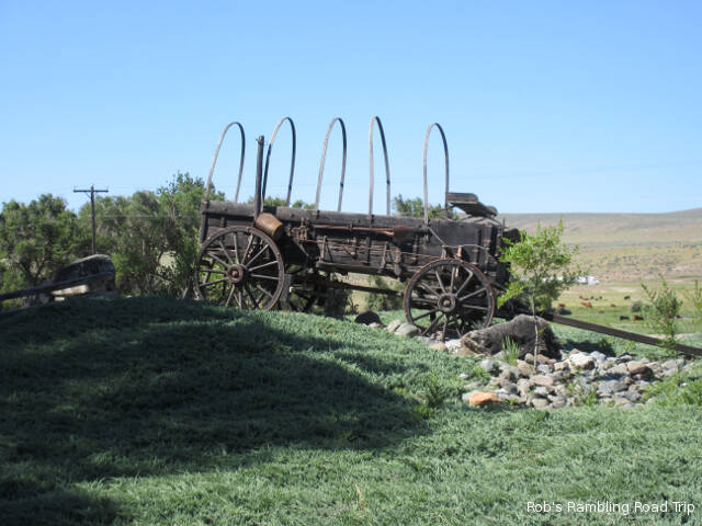
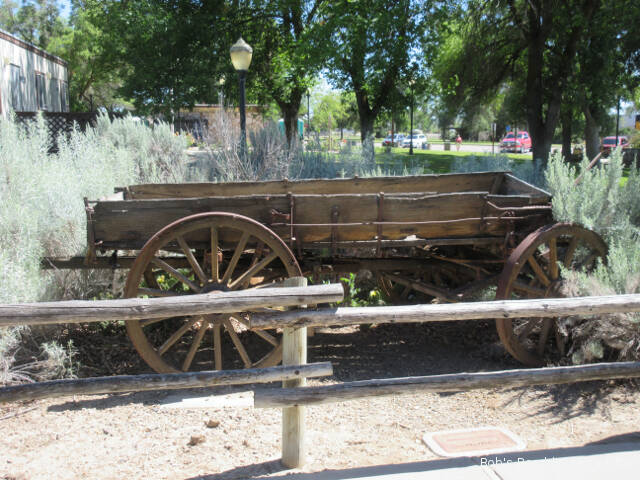
Oregon Trail pioneer wagon at the front of the park.
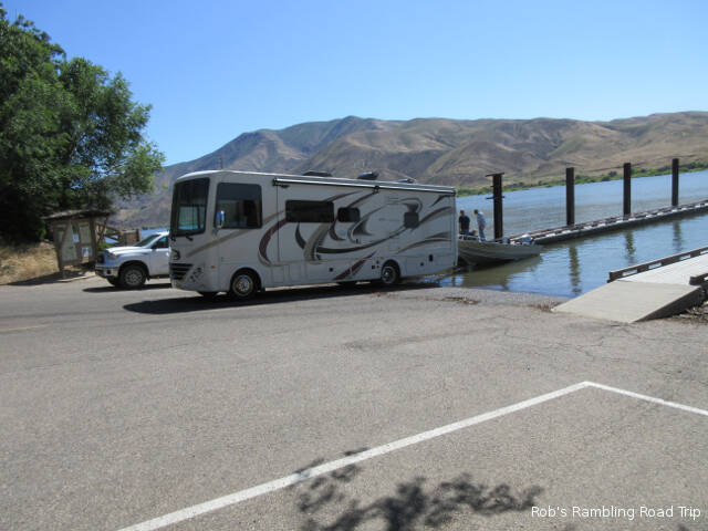
The other surprising thing I saw was a full size class A motorhome launching a boat. They managed to accomplish the task without getting the RV wet, but the motorhome drivetrain sure protested loudly as it pulled the boat out of the water and up the steep ramp. The owners must really want to use their boat to risk a one hundred thousand dollar plus motorhome at the bottom of a boat ramp. I saw another motorhome with a boat heading for the ramp later in the day, but I didn’t watch the “bizzar” act.
You can’t see how great the slope is from this picture. The grade is greater than any road I’d go on.
Reading and watching TV filled out the rest of my day. Not having internet access and no local TV stations to watch the news causes a real change in my routine. I really don’t know what’s going on in the world. I’m still writing this blog every night, but it won’t get published until I arrive at my next destination on Monday.
Today was a long travel day from Arco Idaho to the Farewell Bend State Recreation area near Huntington Oregon. Farewell Bend is about twenty five miles northwest of the state line with Idaho along Interstate 84. Its name is derived from the point where the Oregon trail leaves the Snake River and heads in a more westerly direction.
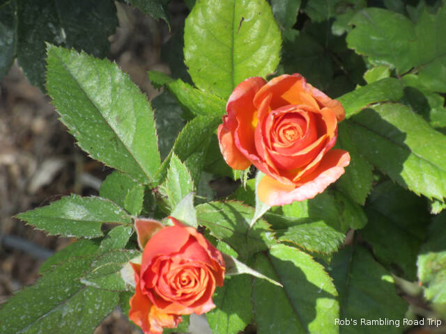
Rose blossom of the day.
My travel day was across many different types of terrain and roads. The first third of the trip was on two lane roads that varied from sixty miles per hour to twenty five through towns. Once I reached Interstate 84 it was just a long haul. I went through desert land, farm land, ranch land and city scape on the journey. The city scape in Boise was fairly easy with three, four and five lanes on the interstate highway.
Old emigrant wagon at the Oregon Welcome Center.
I departed Arco at 10:30 Mountain Daylight time and arrived at my destination just before 4PM Pacific Daylight time. The six and half hour elapsed time includes one stop for gas and an hour long stop at the Oregon Welcome center. Farewell Bend State Park is on the side of the Snake River Brownlee Reservoir. When I arrived there were many empty sites with reservation placards on the sign posts. By six it was completely full of weekend campers. I’ll be here until Monday without cell phone service and no over the air TV. I managed to get a satellite signal through the trees, so I’m not completely without entertainment.
Site 63 at the Farewell Bend State Recreation Area. The sites aren’t very level. My front wheels are off the ground. The leveling jacks have all the weight.
My view of the Brownlee reservoir of the Snake River. The far shore is Idaho.
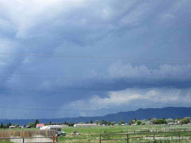
A thunderstorm is overhead this evening as I write this blog entry. The day started sunny and dry. The temperature was in the mid seventies shortly after 3PM when the big black clouds of a thunderstorm made their way slowly over the mountains and down the valley. By 5PM it started to brighten up again, but the temperature had cooled down significantly. All was calm until 9PM, when the current storm started to make its presences known.
On the valley floor surrounded by mountains.
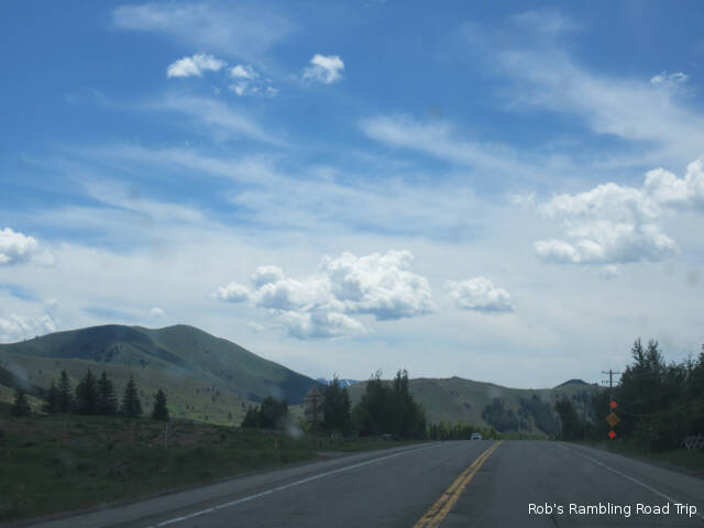
I drove to the Sun Valley Idaho area today. It is over a couple of mountain ridge lines and across wide valleys. I couldn’t help thinking about the pioneers heading for Oregon in the 1830s. There weren’t any roads and only very basic maps. Most of the details were only known to trappers that had hunted the area previously. The rivers, mountains and other hazards make the journey near impossible. Even today when you cross a mountain ridge and drop down to the floor of a wide valley you are surrounded by mountains. The road is the only thing that tells you how to get out of the valley. It looks like a solid wall of mountains in every direction. The wagon train guides would probably know the general direction of a suitable pass to get out of the valley, but scouts would still need to explore ahead to find the best way across the valley. My journey to Sun Valley took around an hour and a half. It would have taken a wagon weeks.
Following the roads and direction signs I crossed the last valley and turned north. The valley gradually got narrower and tourist towns became more frequent. The speed limit dropped to 25mph in every community and the traffic increased. I passed a busy airport with several expensive private jets and a small Delta Airlines jet on the tarmac. This was a sure sign I was approaching an upscale resort area. Traffic continued to increase the further north in the valley I traveled. Eventually I saw green ski runs on one of the mountains to the west. This was my only clue that I’d reached the main area of the valley. Most of the bigger resort areas seemed to be well off to the east and west at the base of the mountains. The traffic didn’t allow me time to see things or figure out where to turn to see more of the area. After traveling several miles north of the center of the action I turned around and returned through the towns. The drive was an interesting overview of the area. If I were staying nearer for a longer period of time, it would be fun to hike some of the trails or ride the bike trail.
Returning to camp looking down into the valley that is home to the town of Arco. The thunder clouds are starting to move in over mountains.
Back at camp, between thunderstorms, I got most of the outside tasks completed for tomorrows travel day. I’m moving on about 275 miles into Oregon. The state park I have reserved for the weekend has a check in time of 4PM and it’s in the next time zone. Check out here is at 11AM, so I’m going to have to kill time somewhere along the way.
Afternoon thunderstorm making its way down the valley.
I have read notes on the internet that the cell service at my destination is not good. I may not be able to update this blog while I’m at my campsite. If that is the case, I will still write a daily entry, but the posts will be delayed until I’m in an area with cell service.