Zion National Park

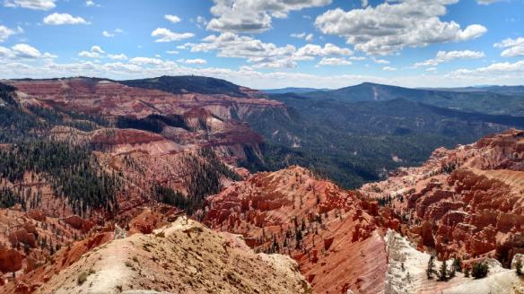
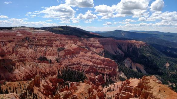
Thursday August 31st 2017

The day started cloudy with a promise of sun to come. I got underway for Zion National Park a little after 9AM. Thirty minutes later, as I was in line at the toll booth, the sun was starting to assert its presence.

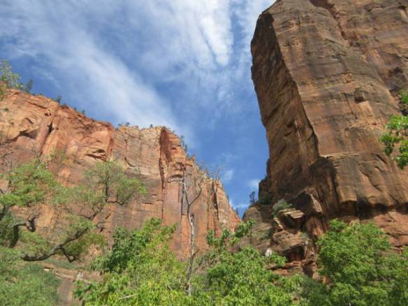
I have been to Zion National Park before on day trips out of Las Vegas. These visits were in November and December when the park shuttle system wasn’t running and ground conditions didn’t allow hiking away from the park roads. Today the shuttles were the only way to tour the park and I had the opportunity to take five short hikes.

I found one of the last few parking places in the visitor center parking area. Once that is full you have to park in the town of Springdale and take the free shuttle into the park. Some of the parking in Springdale is free and some of it is in paid lots. Signs on the way into the area warn that parking in the park between 10AM and 3PM is usually not an option. In addition, there is a warning about the upcoming holiday weekend being a major visitor overload situation. The Zion National Park officials are very concerned with managing the high number of visitors to the park each year. They currently have a proposal out for public comment that would require people to make reservations to visit the park. It would have to be a lot worse than today for me to be in favor of requiring a reservation to visit the park.

I went a little overboard with picture taking this trip. I took around 450 pictures. As always I’ll be uploading the pictures to a Google Photos album when I get a good internet connection. The pictures I’m including in this blog entry are a few of the better ones.

z01

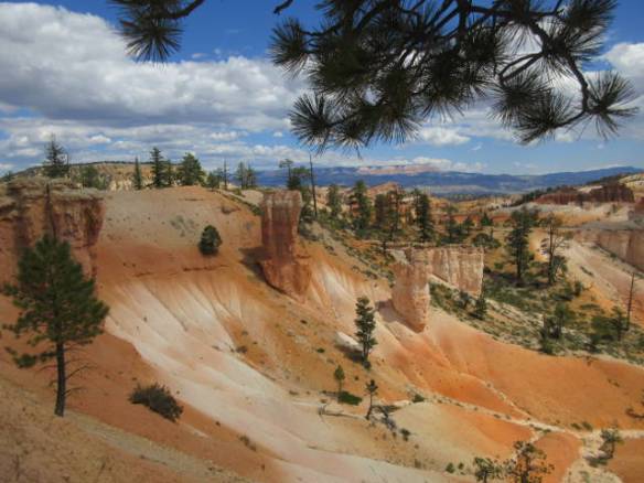
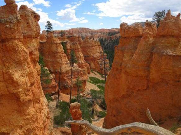
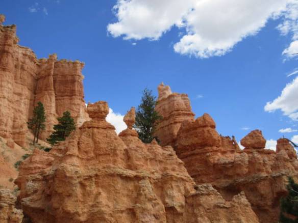
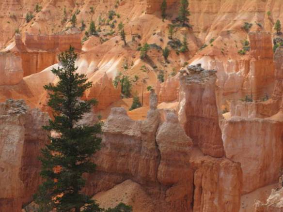
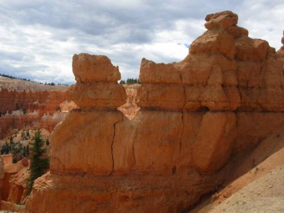
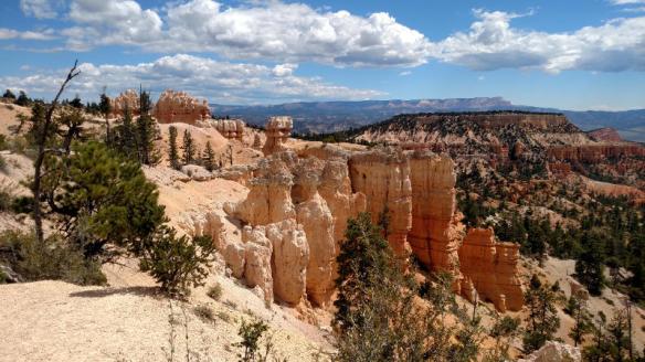
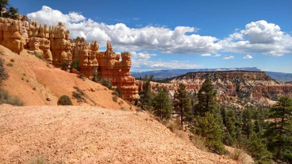
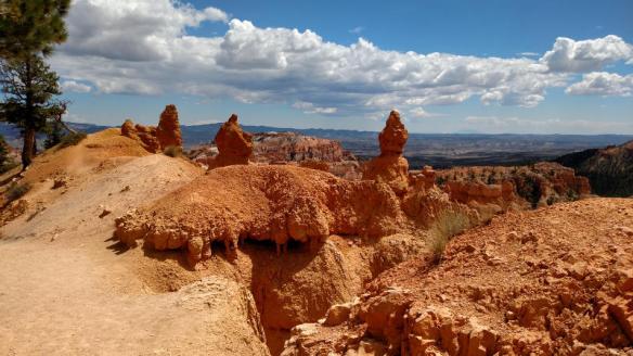
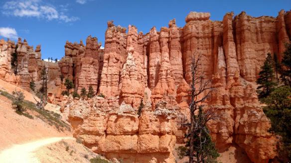
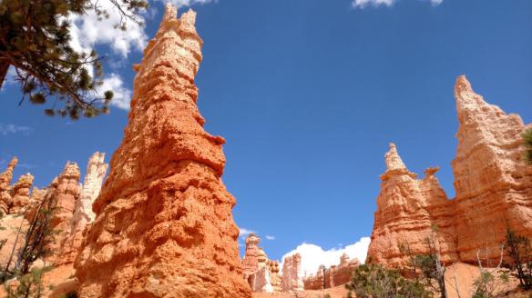
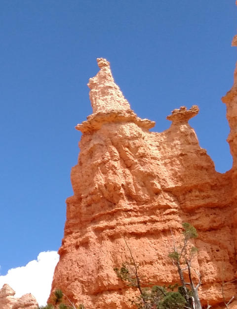
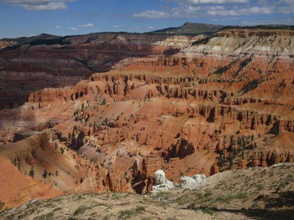
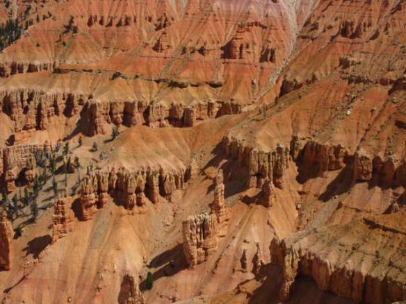
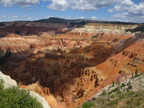
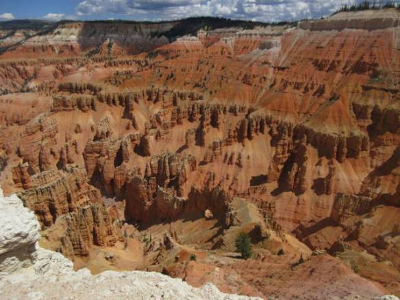
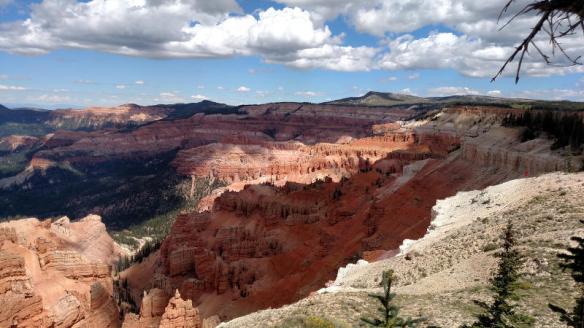
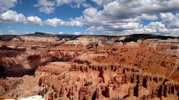
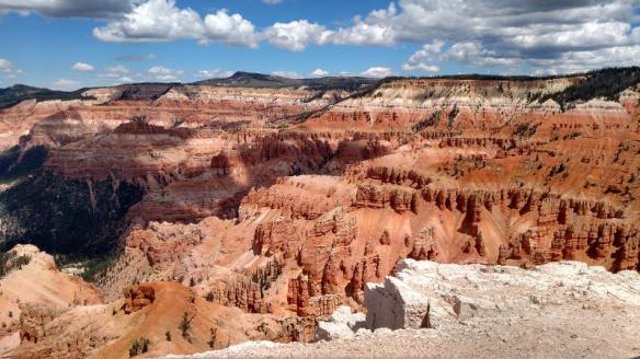
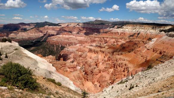
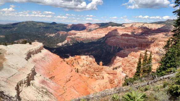
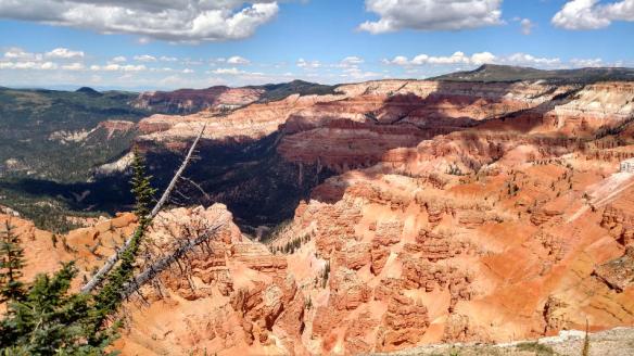
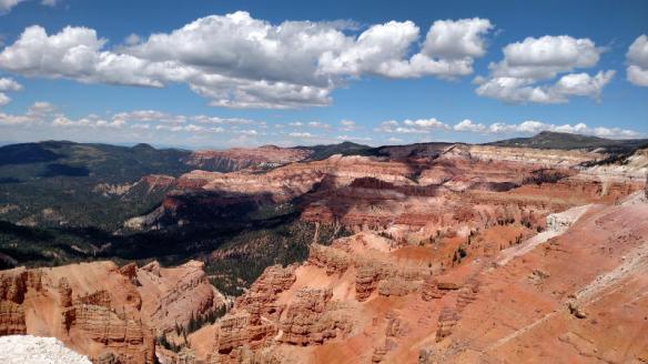
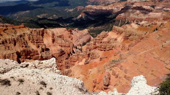
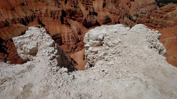
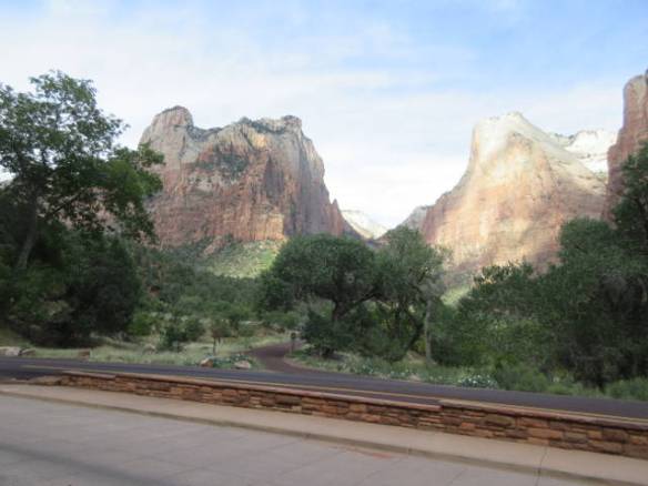
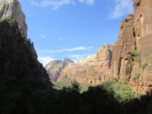
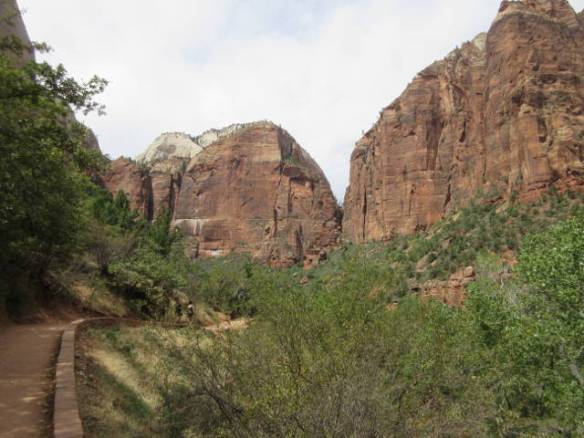
Views from the Court of the Patriarchs

z02

z03

z04

z05

z06

z07

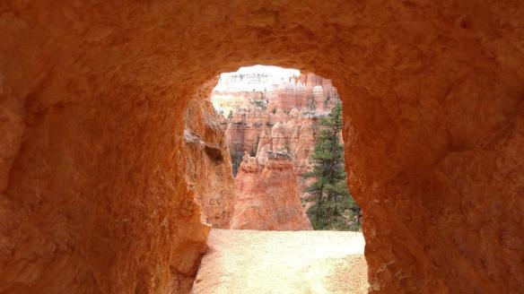
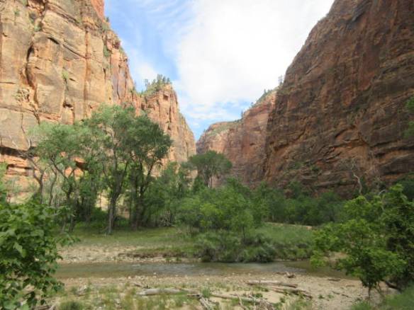
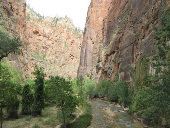
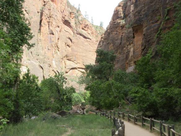
At the end of the Canyon road the River Walk trail follows the Virgin River into a narrow canyon.

z08

Virgin River

z09

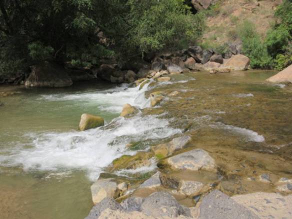
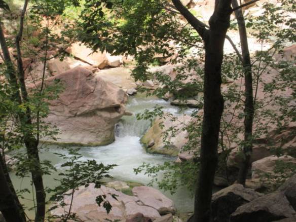
A little water fall on the Virgin River

z10

z11

z12

z13

z14

z15

z16

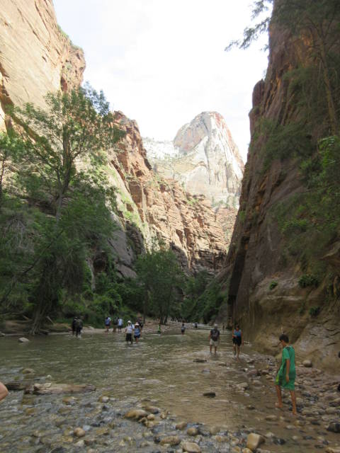
At the end of the defined trail you can continue on in the water of the Virgin River. I didn’t.

z17

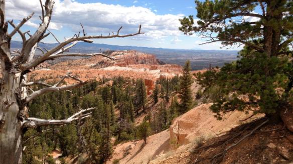
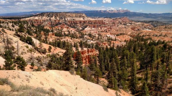
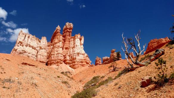
View from the area of the Zion Lodge

z18

z19

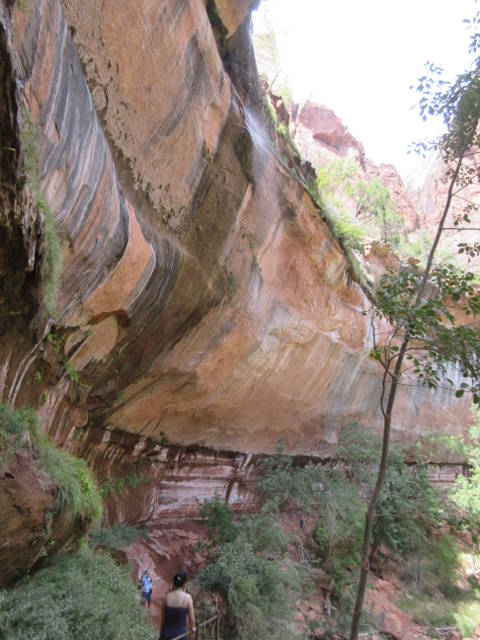
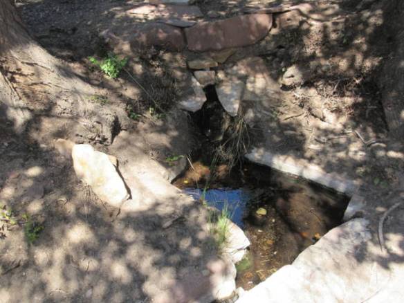
Under the water fall at the Lower Emerald Pool

z20

At a wetter time of year this would be even more impressive.

I got to see a few animals (other than people) today. The ground is covered with squirrels that aren’t in the least bit afraid of people. A deer was content to feed ten feet from the trail while people took pictures and walked by. She was still there when I came back by forty five minutes later. The turkeys I saw were a little more cautious. The were further from the trail and more alert.

a1

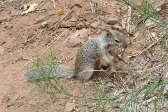
These ground squirrels were everywhere.

a2

This deer was busy eating.

a3

One of a group of six turkeys.

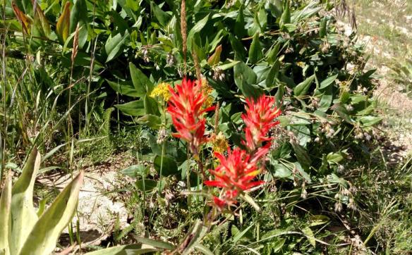
Here are some pictures of the interesting plants I saw today.

fl1

A reminder that this area is a desert.

fl2

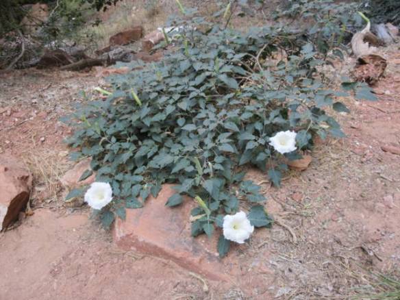
There are many of these Desert Morning Glory bushes.

fl3

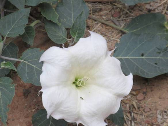
Closeup of a Dessert Morning Glory.

End of Zion National Park blog post.

Winter Planning Issues

Wednesday August 30th 2017

It made it up to 101 degrees before a storm front passed through the area. Around 5:30 this afternoon the wind blew hard and clouds moved across the sky. It didn’t rain and I didn’t hear thunder or see lightning. Checking the weather radar on my phone showed a storm a little distance to the west. By 7PM the sun was back.

Tomorrow is forecast to be the coolest day of the week. I plan to take advantage of the few degrees and visit Zion National Park. Today became an odds and ends day. I did a few chores around the RV and completed a couple of tasks.

wnd1

Canyon wall to the west of the campground. Who says you need to go to National Parks to see interesting cliffs. In a few hundred years this “hole” may be an arch.

One task that I haven’t completed is reservations for the winter months. I’m reconsidering my intent to spend November through mid February in Texas. Some of the areas heavily impacted by Harvey contain things that I want to see. Clearly I have to adjust my travel to allow the hardest hit areas time to recover. San Antonio is still a safe place to visit, but the areas south and east of there are suspect. I’m not sure there’s enough in San Antonio, north and west to support more than a month or so stop.

The simplest solution is to continue as planned to San Antonio, but spend less time there. From San Antonio, I’d need to head straight east through East Texas and Louisiana. I don’t really know what’s in southern Mississippi and Alabama. The other consideration in this scenario is either fully embracing or avoiding Mardi Gras in the middle of February.

A more drastic option is to stay in Arizona through the end of the year or mid January. I’d then need to come back across Texas and Louisiana without a lot of stops. This is basically a reverse of my trip west last winter. If I stayed in Arizona, I’d probably look into Quartzite or Yuma for a longer stay. I’ve been moving every week or two since the beginning of April. A month or two in one location will allow me to catch up on a few things.

The third option is to really start looking out of the box for a travel plan. Should I go west to Southern California? What’s in New Mexico and West Texas? Should I go to the Rio Grande valley in extreme South Texas? About the only option I haven’t put on the table is heading east to Florida this fall. There is so much other country to see in the winter. Florida is a quasi home, but I’d rather keep it as an every other year winter stop.

What all of this comes down to is I have more research to do. Writing this blog entry has helped clarify some of the thoughts and dilemmas I’ve been dealing with while watching the Weather Channel coverage of the flooding. Now I just have to commit to a plan.

Pipe Spring National Monument

Tuesday August 29th 2017

It was another hot day. The temperature topped out around 104 degrees about 5:30 this afternoon. Even with both AC units running full time, the side of the RV toward the sun was uncomfortably hot. The overnight low is forecast to be 75 degrees so one of the AC units will need to be on all night. I much prefer having the windows open.

This morning I went out on my usual first day in a new location exploration drive. It turned into a fifty mile trip into Arizona to visit the Pipe Spring National Monument. It is located in an area known as the Arizona Strip. This section of Arizona north of the Grand Canyon is a section of high desert that is suitable for cattle ranching. The water source at the Pipe Spring was significant to the Native Americans, the Spanish as a stop on the Spanish trail from Santa Fe to California and the Mormon settlers.

ue1

One of the springs that drew people to the area.

ue2

The fort dubbed Winsor castle by explorer John Wesley Powell for the Mormon leader responsible for its construction.

ue3

View of the Inside of the wall in the previous picture.

ue4

Opposite side of the fort.

ue5

The fort is filled with period furniture. I don’t think the two mouse traps on the far left of the picture are period.

ue6

Two chairs with an unusual canned seat.

ue7

A ranch wagon.

ue8

Two Longhorn cattle that live on site to set the historic mood.

ue9

A example of a covered wagon used by travelers that often stopped at the ranch.

The part of the site’s history that is celebrated by the National Monument is the Mormon settlers period. The fort building on the site was ordered built by Brigham Young to protect the church’s cattle ranch at the site from displaced native Americans and to protect Mormon families from the authorities attempting to end polygamy.

The fort is really a ranch house turned inside out. The solid stone walls have gun ports but there is no history that they were actually used. The ranch provided the Mormon community in St. George with butter cheese and cattle until over grazing and drought reduced the viability of the area. It continued to serve as a refuge for plural wives in Mormon families. The fact that Pipe Spring was in Arizona Territory and not Utah Territory or later the state of Utah complicated proving polygamy.

The guided tour of the fort and the ranch conducted by a National Park Service ranger was very informative. The literature and signs alone don’t provide the depth of understanding that the ranger provided about the history. There is also a museum describing the life of the history and life of the Kaibab Indians. The Pipe Spring National Monument is in the middle of the Kaibab Indian Reservation.

I completed my area familiarization drive with a stop at Walmart back in Hurricane UT. Overall I traveled 100 miles and toured a National Monument all to get a few groceries at a Walmart five miles from my campsite.

Travel Day to Hurricane Utah

Monday August 28th 2017

What a difference fifty miles and 2000 feet lower in elevation makes. I moved south on Interstate 15 to the town of Hurricane Utah. This town is northeast of St. George and a good jumping off place for visiting Zion National Park. It is also a lot hotter than Cedar City. It was 106 this afternoon and my campsite doesn’t have any real shade. The campground is located on the gravel hillside leading up to a narrow canyon wall. I’ve had both AC units cranking since I got here.

mnd1

The campground was kind of empty when I arrived at 2PM. It filled up some in the evening, but there were plenty of empty sites. This gravel area is on a gently terraced hill side. Leveling was a bit of a challenge.

This area seems to be having a late summer heat wave. The last couple of weeks were normal to a little below normal for high temperatures. This week, with the exception of maybe one day, is going to be above normal in the temperature department. I’m here until the middle of next week. With the heat, it’s not going to be the best place, but this is a holiday weekend. The selection of available sites in this area for Labor Day weekend was not very plentiful.

mnd2

Site 60 at the St. George/Hurricane KOA.

The narrow canyon the campground shares with interstate 15 also does a number on radio signals. I couldn’t get any over the air TV channels and cell phone service is poor. Surprisingly, the 4G cellular data service seems to be OK for internet. The campground also has WiFi, but I’m not sure how good it is. For the first time in a couple of weeks I have satellite TV. That’s one redeeming value for the lack of shade. I can now get caught up on the HBO Game of Thrones episodes I missed. The campground has cable TV for access to the local channels.

Sunday at Home

Sunday August 27th 2017

Today was another hot one. It got up to high 90s in the late afternoon. Like a car in the sun, a motorhome heats up quickly when the sun hits it. I am currently parked under trees that shade the rig for the first half of the day, but by mid afternoon the sun is coming straight at the font windshield. Even with the front blinds down and the windows open it will get very hot quickly. I need to close the windows and turn the air conditioners on. Luckily it gets down to around 60 overnight, so I can shut the AC off and open the windows back up.

I stayed at home today. There are still a few things in the area that I want to see, but I’ll be back in this area in two or three years. All of the national parks are a draw to the area and Interstate 15 is a main north south route. That’s one of the nice things about this life style. You don’t have to see everything in a hurry, you know you can always come back. Now that I know the terrain a little better and as I gain more experience with the RV in the mountains, I will be able to book campsites nearer some of the national parks. I’ve been very conservative, even skittish in where I’ve driven the motorhome so far.

Tomorrow I’m moving on. It will be a very short repositioning trip of about fifty miles to the St. George Utah area. From there I can explore Zion National Park and other areas of Southwestern Utah, Northwestern Arizona and Eastern Nevada. The short hop is do to the holiday weekend. I reserved the St. George Utah stop before I selected this location in Cedar City for my visit to Bryce Canyon.

sun1

Boneless Pork Chops on the grill.

My big accomplishment for the day was dinner. I grilled a couple of boneless pork chops. One was for dinner today and the other will be cut up with some fried rice for a meal during the week. Other than that I took a short walk around the campground and started preparation for traveling tomorrow.

More Bryce Canyon National Park Pictures

Saturday August 26th 2017

After over a week of normal to below normal temperatures the weather reverted to hot and dry. It was in the low 90s today. I spent the day at home recovering from yesterdays hike in Bryce Canyon National Park. Other than sleeping late, I didn’t have much to recover. My calf muscels ached a little, but not enough to really be uncomfortable. Considering the climbing I did yesterday, I’m not complaining.

I’m including more pictures from Bryce Canyon in this blog post. Yesterday’s pictures were all taken with my cell phone. Today’s pictures came from my Canon PowerShot ELPH 360HS point and shot camera. The advantage of the Canon pictures is the camera zoom. Some of these pictures really bring the hoodoos and other features into close up view.

c01

c02

c03

c04

c05

c06

c07

c08

c09

c10

c11

c12

c13

c14

c15

c16

c17

c18

c19

The cracks in this formation don’t look like they will survive another winter.

End of Bryce Canyon Blog Post

Bryce Canyon National Park

Friday August 25th 2017

Today I drove about 80 miles to visit Bryce Canyon National Park. It is very picturesque drive over the mountains on to the high plateau that Bryce Canyon sites in. I got there shortly before 11am to find that today was a Fee Free Day at the National Parks in celebration of the National Park Service Birthday. Since I bought a year long pass earlier this year this didn’t impact me financially, but it raised some concern about volume of visitors in the park. I don’t think that fear was realized, as I had no problem with parking or crowds.

I took around 400 pictures. Some of the better pictures are included in this blog post. All of them will be uploaded to a Google Photos Album once I get good internet connectivity.

My touring plan for the day was to walk sections of the Rim Trail around the amphitheater. I visited the park once before on an overnight trip from Las Vegas. That trip was in November and snow covered most of the Rim Trail so I was restricted to the observation areas near the parking lots. I started my exploration near the North Campground and walked along the canyon rim to Sunrise Point. That’s where my touring plan went bust. Instead of continuing along the rim to Sunset Point, the sirens song of the Queens Garden down in the canyon called.

b01

First view of Bryce Canyon from the Rim Trail near the North Campground

b02

b03

b04

b05

b06

b07

b08

b09

View of the Queens Garden from the Rim at Sunrise Point

The trail down to the Queens Garden was advertised as eight tens of a mile long and 320 feet of elevation change. For some reason I didn’t thing that sounded too bad. Never mind that 320 feet is a thirty story building. Two hours later I was back at the rim after visiting Queen Victoria on top of a hoodoo near the bottom of the canyon. The walk through the rock formations and hoodoos was magnificent. I didn’t continue my hike along the rim trail. I went back to the car for a late lunch and decided to call it a day.

b10

It doesn’t sound that difficult. Three hundred and twenty feet of elevation is significant.

b11

The trail is wide with lots of switchbacks most of the way.

b12

b13

b14

b15

Soon the fins and hoodoos are above your view instead of below it.

b16

b17

b18

b19

b20

b21

b22

b23

The trail goes through several rock fins.

b24

b25

b26

Queen Victoria on the hoodoo on the right.

b26a

Zoomed in view of Queen Victoria.

b27

Back near the top of the trail and the rim.

I don’t think I’ll return to Bryce Canyon National Park on this visit to Utah, but I’ll be back to see more of park. Hopefully, next time I’ll be able to find a campground closer to the park.

More on Cedar Breaks National Monument

Thursday August 24th 2017

After yesterday’s exploration of Cedar Breaks National Monument, I spent today at home. I’m assuming it was the combination of altitude with the climbing on the 2 plus miles I hiked yesterday that really wiped me out. I slept very well last night. Unlike the day after my first hike in Arches National Park I feel fine today. I don’t have any of the muscle aches I had after that excursion. The pictures in this blog are from Cedar Breaks National Monument.

cbr01

Cedar Breaks Amphitheater from the main viewing area.

cbr02

Real log cabin used as the visitors center.

cbr03

cbr04

cbr05

Close up of some of the hoodoos.

cbr06

There are many of these squirrels.

cbr07

cbr08

cbr09

cbr10

A couple of the nearly 2000 year old Bristle Cone pine trees.

cbr11

cbr12

I really enjoyed Cedar Breaks National Monument. There isn’t a lot variety to see in the park. Other than viewing the rock formations in the amphitheater, there is a hike to an alpine pond that I didn’t take. I suspect there are larger animals like deer to be seen at the right time. It would be nice to see the amphitheater at sunrise or sunset. I’m staying a little too far away to make that practical. There is a campground in the park, but it doesn’t have sites that would accommodate my rig. I really can’t see driving up there with my RV anyway. The road is very steep for more than 10 miles as it winds through a canyon and up the side of the mountain.

The view with snow on the ground would also be interesting, but not easy to see. The park is open in the winter, but the road is closed from mid October to May. Signs indicate that there are a series of groomed snowmobile trails. With over ten feet of snow in the average winter it can’t be a very enjoyable experience.

Tomorrow I hope to get an early start. Bryce Canyon National Park is about 80 miles away. I’ll take a lunch and plenty of water to spend the day in the land of hoodoos.

Cedar Breaks National Monument

Wednesday August 23rd 2017

I drove 20 miles and climbed five thousand feet to visit Cedar Breaks National Monument. Simply stated Cedar Breaks is a half mile deep hole in the ground filled with red and white stone formations. It is filled with fascinating cliffs, windows, arches and hoodoos.

I took about two hundred and fifty pictures. Taking pictures was a way of keeping my pace slow as a hiked the trails. It is very easy to over do it at ten thousand feet. I walked around one section of the amphitheater to Spectra Point. Not only is the view from the point spectacular, it is also home to a grove of Bristle-cone pines. Some of the trees in the grove are almost two thousand years old. A group of similar bristle-cone pines in Nevada are the oldest trees on the planet at around 5000 years old.

The hike is labeled as “Moderate”, but it has a lot of altitude changes. The actual Spectra Point is lower than the start of the trail, but to get there you need to climb to a much higher elevation. It was a 2 mile total out and back hike. The trail continued another mile to the Ramparts Overlook, but I chose not to push my ability to hike at altitude.

The remainder of this blog entry contains some of the pictures I took today. I will put all of the pictures in my Google Photos album when I get better internet access. Upload speeds at this campground are almost non-existent.

cb01

Cedar Breaks is a half mile deep bowl in the grown known as an amphitheater.

cb02

cb03

cb04

cb05

Bristle-cone pine trees

cb06

Bristle-cone pines overlooking the amphitheater.

cb07

cb08

The trail continues around the amphitheater and down onto the white rock area known as Spectra Point

cb09

cb10

cb11

Some of many wildflowers along the path

cb12

cb13

cb14

The ground drops straight down through the opening in the white limestone rock.

cb15

Field of yellow wildflowers along the road at the visitors center.

cb16

cb17

cb18

cb19

cb20

End of Cedar Breaks National Monument entry.

Travel to Cedar City UT

Tuesday August 22nd 2017

It was raining lightly as I packed up to move this morning. The intermittent rain continued most of the way to my destination in Cedar City Utah. With only a little over one hundred miles to travel, I managed to time my departure right at the 11AM checkout time. The traffic was light on the first part of the trip, but it got heavy once I turned south on Interstate 15. I made two stops along the way to time my arrival after the specified checkin time. One stop was for gas and another was at a rest area for a bite to eat.

The gas stop was a little surprising. The cost of gas was $2.89 a gallon for 85 octane gas. I’m still getting used to Regular grade gas only having 85 octane in the mountain areas of this country. The oil companies have determined that the lower octane is all that’s required to prevent the engines from knocking at altitude. To get an octane level closer to the 87 I’m used to, I would have had to pay an additional 20 cents a gallon for 88 octane.

The surprising thing was the $2.89 a gallon price. The last gas I purchased in Richfield UT for the car was $2.69 a gallon. I expected the price to be cheaper in the more heavily traveled area of I-15 so I waited to buy gas. What my miscalculation resulted in is having to pay more for more gas. I put in a little more than 48 gallons of gas for around one hundred and thirty seven dollars. If I’d bought gas at the start of the trip in Richfield UT, I’d have only put in about 38 gallons at twenty cents a gallon less. One way or another I had to buy gas today. I don’t like to let the 75 gallon tank get below a quarter full.

The kicker to the gas saga is that the gas price at the exit for my destination in Cedar City was $2.59 a gallon, but I don’t know if I could have gotten in an out of the station. It is always a trade off of cost vs. convenience. I don’t mind paying a little more for easy access to the gas pumps. In this case, I had scoped out the station I bought gas at in Google Maps satellite view before departing this morning.

td1

Site D2 at the Cedar City KOA. Once again I get nice shade, but no satellite visibility.

I’m staying at the Cedar City KOA for the next 6 nights. From here I can tour the Cedar Breaks National Monument and Bryce Canyon National Park. Cedar Breaks is at the top of mountains to the east of the city and Bryce is about 80 miles away over the same mountains. This location is a compromise resulting from not being able to find a reservation at a closer location.