Moving on to West Yellowstone MT

Wednesday May 31st 2017

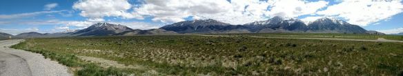
After a week in Arco ID, today was moving day. I finished packing up and was on the road for West Yellowstone MT around ten this morning. I departed the Snake River plain for the mountains just it time to avoid the hot weather. Some of the areas on the plain were expected to have temperatures in the 90s. It topped out in the high 70s in West Yellowstone.

wsd1

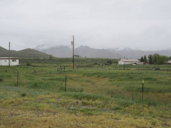
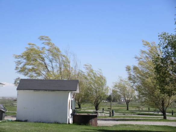
Site 4 at the Yellowstone Park Mountainside KOA in West Yellowstone MT. This evening I saw a large deer like animal, but bigger, on the hillside. By the time I got the binoculars it was gone.

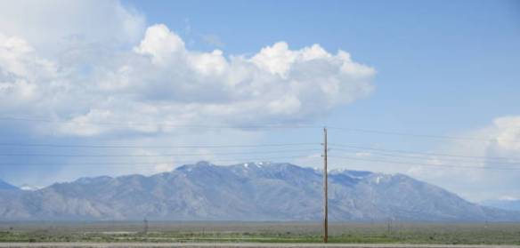
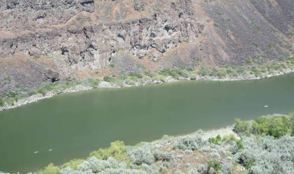
I had around 180 miles to travel. My route seemed simple it was following US 20 all the way to West Yellowstone. I always review the route on Google Maps ahead of time. If it is particularly complicated I will program the RVs GPS, but for simple routing it is more annoying than helpful. Today I should have had the GPS program. In Idaho Falls US 20 gets onto Interstate 15 north for one exit. I knew this routing fact from my Google Maps review. What I didn’t realize was that the exits were so close that traffic following US 20 don’t even merge in with the northbound traffic. The on ramp turns into the off ramp provided you stay in the right lane. I saw an opening and merged into the I-15 northbound traffic, only to see my exit pass by. The next exit I could use to reverse direction was a long way away. Luckily I knew there was another east west route further north that I could take east to rejoin US20. I took Idaho 33 from I-15 over to US 20. Overall it was a twenty or thirty mile detour.

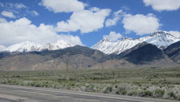
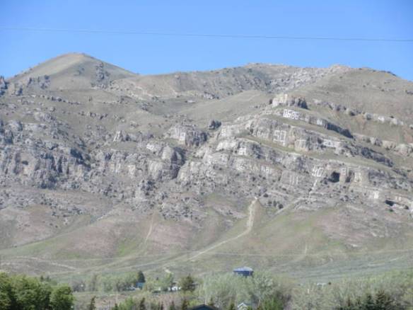
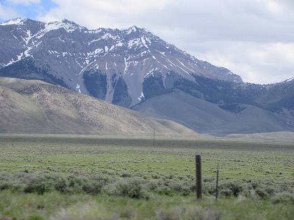
Overall it wasn’t a difficult drive. The worst climb was on US20 northeast of Ashton ID. The road climbs fairly steeply in the Caribou-Targhee National Forest. It then flattens out at altitude passing through grass lands and some of the Henry Fork of the Snake River head waters. After about 20 miles it starts a gradual climb over the continental divide into Montana. I am staying at the Yellowstone Park Moutainside KOA only a short ways down from the top of Targhee Pass.

I arrived at my destination shortly after 1PM. After getting setup and having a quick lunch, I drove the seven miles into West Yellowstone. This is very much a tourist town, but that’s what I’m here for. I found the bigger of the two grocery stores in town. It is more like a combination of a convenience store, liqueur store and deli with some hardware thrown in for good measure. Luckily, all I needed was fresh bread for sandwiches. The prices were what you’d expect at an isolated mountain tourist town.

Tomorrow I’ll head into Yellowstone to see what I can see.

Another Visit to Craters of the Moon

Tuesday May 30th 2017

This morning was very calm and sunny. It was the type of morning that leads to a beautiful warm day. It was sunny all day with the temperature topping out around 80.

Today was the wrap up day for my stay in Arco ID. I went back up to the Craters of the Moon National Monument to see some of the things that the busy holiday weekend made difficult to get near. Specifically, I got to check out the displays and movie in the visitors center. On Saturday it was four rows deep around every exhibit. Today it was possible to spend as much time as I wanted at each exhibit.

tud2

View from the top of the Inferno Cone. The parking lot can be seen below.

My next stop was the Inferno Cone. The parking lot for this 164 foot high pile of cinders was full on Saturday. Today I was the only one there when I started up the cone. The walk up is along a path that has from an eight percent to 28 percent grade. I needed to pause a couple of times on the way up to catch my breath. This is one of the first times I’ve actually felt the effects of the altitude. It was a little over six thousand feet at the base of the cone. The view from the top of the cone was worth the climb. In one direction you can see the snow capped mountains. In the other directions you can see other cinder cones and buttes rising out of the Snake River Plain.

tud1

View to the Southeast from the top of the Inferno Cone.

I also stopped at a couple of other viewing areas that were full on Saturday. They weren’t that different from the stops I was able to visit. I had considered going into one of the lava caves, but only one was open today. I was warned off at the visitors center when I inquired about a cave entrance permit that the cave would be very busy. That cave area proved to be the only area of the park that was crowded. I don’t feel like I missed anything by not going into a dark hole in the ground. I much prefer caves with colorful limestone or gypsum formations.

After my visit to the Craters of the Moon National Monument I returned to my RV home. I started preparations for tomorrows move to West Yellowstone MT. It is around 180 miles with the last few over the continental divide. My research says I will only encounter 3 percent grades, but I’m still learning about all of these mountain passes.

EBR-1

Monday May 29th 2017 (Memorial Day)

It was a beautiful sunny day in the mid 70s. The holiday weekend campers started leaving the park early. My neighbors were gone by the time I got up. Other weekend residents left throughout the morning. By noon the park was almost deserted with only about 6 or 7 rigs remaining. Tonight another 8 to 10 RVs have arrived.

mem1

I drove east from Arco this afternoon to visit the Experimental Breeder Reactor (EBR-1) Museum on the grounds of the Idaho National Laboratory (INL). This learning reactor from the 1950s is in the middle of nowhere. The INL is more than 28 miles across on route US 20 and probably twice that from north to south. It is located on open land with grass and sagebrush with a butte here and there. Each of the Lab complexes dedicated to nuclear science and technology is well back from the road and miles away from other Lab complexes. The EBR-1 location is right in the middle of the INL land.

mem2

Reactor wall signed by the scientists and engineers present on December 20th 1951.

I arrived just in time to join a tour that was starting. The young lady leading the tour had her hands full answering the questions of a handful of kids. She did a good job of informing the adults and answering things like why consoles were painted gray to the kids. The tour lasted about an hour. It provided a good overview of the historical significance of the reactor. EBR-1 demonstrated the first peaceful use of atomic fission on December 20, 1951. The reactor powered a string of light bulbs. The next day it provided the power needs of the building.

mem3

Two nuclear powered experimental jet engines.

mem4

This black bird (crow?) was making a lot of noise to guard the jet engines.

After the tour I was able to wander around the exhibits and check out additional areas that were not part of the tour. This included a set experimental nuclear powered jet engines outside on the grounds. They were part of research to develop a nuclear powered bomber. The program was terminated in the early 1960s by President Kennedy. Given the size of the two devices on display, the plane would have been huge.

mem5

Looking from the EBR-1 site across the Snake River Plan toward the mountains. There is nothing for ten or more miles.

I liked the tour of EBR-1. The museum provides and interesting historical perspective to the use of nuclear power. There is also an element of education on the dangers associated with today’s nuclear reactors and along with an opinion that it could be much safer if the research at EBR-1 and its successor EBR-II was allowed to continue.

More area touring

Sunday May 28th 2017

The good weather has returned. It was mostly sunny all day and the temperature reached the mid to high 70s. Each day this week is forecast to get warmer. The down side is the warmth with melt the snow in the mountains faster than the ground can absorb the water. There are flooding concerns in the area.

sud1

Warm days ahead threaten to melt the snow on the mountains too fast. Flood warnings are in place in the valley.

I watched the start of the Indy 500 on TV this morning. The pre-race pageantry is fun to watch. How often do you get to hear someone sing “Back Home Again in Indiana”? The start of the race is almost anticlimactic after the opening ceremonies. After watching 30 laps or so, I got in left to see some more of the area.

Today’s goal was to find the King Mountain Glider Park in the town of Moore. This town of about 170 people is about twenty minutes northwest of Arco. I wanted to watch some folks hang gliding or soaring. While I found the correct area, there was any action going on. I can only guess that the conditions were not right.

I drove around for another hour or so before returning to my RV home. I fought a runny nose and watery eyes all day. It is probably a reaction to some pollen. The early return allowed me to catch the end of the Indy 500 on TV. It included a spectacular crash. Thankfully no one was hurt, but let’s face it that’s why most of us watch. We want to see the crashes.

The campground has been busy this weekend. Memorial day weekend is a family camping weekend. There are many families here in ever kind of equipment from single person tents to big Fifth wheel trailers. They gather around smoky campfires and cook marshmallows. One group of multiple families was even singing around their campfire last night. It’s good to see them enjoying the camping experience.

Craters of the Moon National Monument

Saturday May 27th 2017

It was a dry and partly cloudy day in the 60s perfect weather for visiting the Craters of the Moon National Monument and Preserve. The only down side was the holiday weekend crowds.

sat01

Part of the crater wall broken loose in the North Crater area.

sat02

Lava formations beside the trail in the north crater.

sat03

sat04

Flacking lava with rust colored interior layers.

sat05

Craters of the Moon is a large area of lava that spewed from the a series of fissures known as the great rift. The last eruption is thought to have occurred about 2000 years ago with more possible in the future. It is just one of a series of volcanic feature that stretch from Yellowstone in northwest Wyoming across the Snake River plain of southern Idaho into southeastern Oregon. The Yellowstone end is the most active and the Oregon end is the oldest most dormant.

sat06

One of may dead trees in the Devils Orchard part of the park. The dead trees are apparently the impact of man, but I didn’t understand how.

sat07

sat08

Path up to the top of a spatter cone which is like a miniture volcano.

sat09

Crater area of the spatter cone.

sat10

Snow at the bottom of a spatter cone crater.

The park consists of 750,000 acres of land south and east of US routes 20, 26, and 93. A paved loop road navigates the lava around a small portion of the park. Turn outs along the road and dedicated parking areas provide access to paved trails through the lava. The holiday weekend made it difficult to impossible to find parking in some of the smaller parking lots. There are plenty of helpful display signs to describe the lava formations. Unfortunately, there are also many display signs that preach ecology and the catastrophe it would be to damage what you are looking at. It was probably intended to be educational, but I got the impression that the sign author didn’t want you to be able to see what nature has made available.

sat11

Mountains across the broken lava.

sat12

sat13

Wild flowers on growing in the lava.

Scattered through out the lava beds are trees, bushes and ground flowers that grow in the dirt that accumulates in the cracks and crevices of the lava. I heard some birds, but the only animal life I saw was a chipmunk.

sat14

sat15

sat16

Indian Paintbrush

sat17

Closeup from a field of white, purple and lava color.

Rain Rain Go Away

Friday May 26th 2017

Last night the weather forecast was for rain early in the morning and with a chance of thunderstorms in the late afternoon if the sun broke through. That was a little off. It was foggy and rainy until about 3PM. An hour or two later the sun broke through and it started to warm up from the mid 40s into the 50s. Since the sun doesn’t set until around 9PM, it’s still possible that thunderstorms develop, but I doubt there will be enough warming.

frd1

View to the east this morning.

frd3

Same view to the east this evening.

When I heard the forecast I figured I’d do some more driving around the area today. I have the other direction from Arco toward Idaho Falls to check out. The conditions this morning did not support such an endeavor. Visibility was down to next to nothing. It never really rained hard just steady.

frd2

Rain drops in a puddle. It was a steady but light rain.

I spent most of the day watching TV and listening to the radio. The TV reception is not the best in this area. The Idaho Falls ABC station and its sub channels can be received 90 percent of the time. The PBS channel and subs seem to come in all the time. There is also a CBS channel that can be received occasionally. My satellite TV is equally problematic. An annoying tree branch can interrupt the signal when the wind blows the wrong way. Between all of these sources I watched some out of my normal programming today.

Tomorrow is forecast to be sunny and warmer. I’ll be able to get out and see some of the things I came to this area to see. My blog entry tomorrow night should be more informative than tonight’s random discussions of the weather and my TV view habits. I’d rather write about the weather than skip a night writing the blog. Recording something about each day is about the only structure I have.

Touring Northwest of Arco ID

Thursday May 25th 2017

I have developed a habit of touring the area on my first day at a new location. That is exactly what I did today. I drove north from Arco ID about 75 miles to the town of Challis ID and back.

trd1

Picture of Numbers Hill in Arco ID. Each high school class since 1920 has painted their year on the side of the hill.

One of the big features in Arco is a rock hill called Numbers Hill. Since 1920 each graduating class at the local high school has painted their graduating year on a rock overlooking the town. This is one of those classic small town traditions. I can just imagine each class picking out their spot on the hill and figuring out how to paint in that location.

trd2

US 93 heading northwest from Arco ID.

trd4

Panorama of part of the Little Lost River Range. Mt Borah is 2nd from the right.

trd3

Mt Borah on the left.

The first twenty five or so miles heading northwest are in a broad valley with large tracts of cultivated land. The Little Lost River Range of mountains makes up the north side of the valley all the way. After the town of Mackay the terrain changes. The road gains some altitude and passes by the Mackay reservoir. The land use changes to cattle ranching in this area. The mountain peeks get higher with more snow as the road continues northwest. Idaho’s highest peak, Mt Borah at 12,662 feet, is in this area. The road passes over the Willow Creek Summit at 7,180 feet before dropping back toward the town of Challis.

One of Idaho’s favorite road signs seems to be “Game Crossing” warnings. They don’t warn about specific species just “Game”. Most of the animals I saw were cattle behind the fences that lined both sides of the road. Any Game that was going to cross the road would have to deal with the cattle fences. I saw one group of light brown and white deer sized animals that I think were Pronghorns. My uncertainty comes from the Internet implying there were very few in Idaho. This herd was on the inside of the cattle fence trying to find a way to the road area. Later I saw a single deer on the road side of a cattle fence trying to find a way out of the road area. Traveling at sixty five miles an hour it wasn’t possible to snap a picture. I was passed them before the idea occurred to me.

trd5

Cloudy gray skies replaced the blue sky over the mountains.

I hadn’t planned on turning around at Challis and returning on the same route, but the option was a long way around through the mountains. The deciding factor was the weather. The blue sky was rapidly getting filled with gray clouds. Thunderstorms were in the forecast as a possibility. I took the safe approached and returned the way I came. The alternative was about one hundred and fifty miles longer mostly through the mountains.

Wind, Wind and More Wind

Wednesday May 24th

The wind comes sweeping down the plain. Except, this isn’t Oklahoma. The wind really blew today on the Snake River Plain of Idaho. Thankfully I only had 100 miles to travel.

I knew it was going to be windy today, but the strength exceeded any forecast I heard. The sustained wind speeds were recorded at 30mph at some locations along my route. Gusts in the area were recorded at 60mph. A portion of Interstate 15 to my east was closed do to dust and several trailer trucks were in the ditch along area routes. I made it safely to Arco Idaho but I doubt I one of two hands off the steering wheel more than a couple of times.

wdd2

Wind blowing the trees here at the campground this afternoon. A number of branches were blown down.

I was traveling on narrow two lain US highways. In addition to the steady wind and the gusts I had to deal with oncoming trucks. The additional suction caused by the passing trucks drew the RV toward the middle of the road into the wind. I had to be careful not to over correct or disaster would strike. My new location is to the northeast of Twin falls. I traveled on roads going North, Northeast and East to get to Arco. The wind was out of the west, maybe a little southwest. The north bound segments of travel were the worst. As I slanted more east the wind almost became a help. The tail wind may have saved gas, but it still required attention to the gusts.

wdd1

Site B10 at the Craters of the Moon Arco KOA.

I crossed over a mountain pass at more than 6000 feet near the Craters of the Moon National Monument and Preserve. Arco is at 5300 feet about 2000 feet higher than my stay in Twin Falls. This town is a little bigger than the farm towns I passed trough getting here. It has the industry associated with the Idaho National Laboratory located a few mile to the east. The National Monument and the Experimental Breeder Reactor Museum at the Laboratory are two of the reasons I stopped in this town.

Travel Prep – Grocery Shopping

Tuesday May 23rd 2017

Today started in the 50s and ended in the 80s. Tomorrow is supposed to be in the low 70s and windy. Wouldn’t you know it tomorrow is a travel day for me. I don’t have a long way to go. I’ll be traveling on US highways rather than the Interstates, so the wind should be more manageable.

I spent today getting ready for travel. In addition to the normal prep work I had to stock up on groceries. My next two stops are in mountain towns that don’t have major grocery chains. I need to get enough food for two weeks. All I plan to need during the that time will be items like bread and maybe milk.

tud1

View to the west down stream on the Snake River from the Perrine Bridge. The whit specs in the river are rocks that were not visible last week.

Shopping for two weeks is not something I have a lot of experience with. During my working years I usually stopped for groceries on my way home every couple of nights. Since I’ve been living in my RV home I’ve made an effort to only shop for groceries once a week. Stores are not as nearby or convenient as they were when I lived in a house on a foundation. The idea of buying food for two weeks drove me into planning mode. I actually made a grocery list with some pre-planning of what I would cook and what leftovers I might have over the next couple of weeks. This is unprecedented for me.

There is a fairly new Walmart Super center in Twin Falls that got my shopping business. I have replenished my can goods and stocked up on breakfast cereal. The refrigerator has beef, pork and chicken that needs to be divided and frozen. I have a gallon of Orange Juice, 2 quarts of milk and a dozen eggs. I also bought the makings for two pizzas and two weeks of sandwiches. When you add in the TV dinners already in the freezer and other prepackaged stuff in the cabinets I should be fine for the duration. A meal or two in a restaurant isn’t outside the realm of possibility either.

This was the biggest grocery bill I can remember having, but I think the prices in this area are pretty good. Many of the items that I buy at Walmart regularly are a few cents cheaper here. I suspect that some of the other things I bought were more expensive but they didn’t standout. The other observation was that they charge a six percent tax on everything.

The stores in different areas put the focus on different things. For example, this Walmart seem to have a smaller selection of packaged cookies than I’m used to. Another surprise was the brand of bread I’ve come to expect. From the eastern seaboard across the south and in Nevada, I’ve been buying Natures Own bread. I came to believe it was a national brand that Walmart had a contract with. It wasn’t on the shelves at this Walmart. A brand from Oregon dominated the selections.

tud2

Snake River below the Perrine Bridge. The white area on the banks were not visible last week.

When I was out for groceries I stopped at the Perrine bridge to watch the BASE jumpers one more time. I saw one jumper and one drone helicopter operator at the bridge. What stood out is how much lower the water level was today. There is three or four feet of white rock showing on the sides of the river near the bridge. Down stream rocks are visible in the middle of the flow that weren’t showing last week. When they said they were limiting the flow to supply the irrigation canals they weren’t kidding.

Balanced Rock

Monday May 22nd 2017

I made it out to Balanced Rock today. Armed with Google directions I set out to find the elusive natural attraction. Saturday I went west from Twin Falls on US 30 looking for a road to the south leading to Balanced Rock park. I never found a road sign to provide some direction. Google’s primary directions take me south of Twin Falls on US 93 then west on a local road. These directions proved successful.

mnd6

Balanced Rock

There was a small regular road sign on highway 93 that directed me onto the west bound road. In indicated that Balanced Rock was twenty miles down the relatively narrow farm road. The road was straight for almost the entire distance. The road went up and down over rises so you could never see very far ahead, but it didn’t turn left or right. The sides of the road were lined with fields in various stages of planting. Some were hard packed dry dirt, some had been turned over in preparation for planting, still others were lush green with growing crops. I’ve decided that some of the fields may be a crop in the onion family, but for the most part I’m just guessing. Every time trees appear ahead a farm house and barn complex comes into view. The question I have to ask is which came first, the trees or the buildings. It could be either. Trees are usually located with water, but so are people.

mnd1

Salmon Falls Creek in the Balanced Rock Park

mnd2

Salmon Falls Creek looking down stream in Balanced Rock Park

I kept track of the mileage. Around 19 miles into my westward trek, the speed limit dropped from 60 to 35 and the road turned to the right. Suddenly the road twisted, turned and dropped into a big whole in the ground. The road bottomed out in the Salmon Falls Creek Canyon. Balanced Rock Park was on the left after crossing a bridge over the creek. It is a nice county park between the creek and the rock wall of the canyon.

mnd3

High canyon walls in the Balanced Rock Park.

mnd4

Spires without balanced rocks along the top of the canyon walls at Balanced Rock Park

The park has picnic tables and bathroom facilities. The water in the creek is running high, but green grass and shade trees are prevalent in the park. I parked the car and got out to look for the Balanced Rock. I studied the tops of the rock walls on both sides of the canyon. There were several spires that could support a balanced rock, but nothing that looked like the pictures I’d seen.

It is nice park that provides shade and natures symphony. In addition to the sound of the creek, which looked more like a small river today, birds, nesting in the rock ledges, were keeping a steady stream of calls and wing flutters as they moved around. Unfortunately, I still hadn’t found the Balanced Rock.

mnd5

Balanced Rock nestled in with other bolder formations on top of ridge alongside the road on the west side of the canyon.

As I was leaving the park I read the park entrance sign more closely. A faded arrow indicated that the Balanced Rock was a mile further out the road I came in on. I drove out of the canyon on the west side of the creek and near the top was a pull out to view the Balanced Rock. Other than a picnic table under a roof there was nothing notable about the pull out, but up on the top of a rock wall on the south side of the road was THE Balanced Rock. It is interesting, but the park in the canyon below was more impressive (IMHO).

mnd7

Looking back east across the top of the canyon formed by the Salmon Falls Creek. The flat land to the east contains all of the farmlands I passed through to get to the Balanced Rock.

After taking a few pictures of the rock and the surrounding area I continued on the road to the west. It started turning south and eventually intersected US 30. There were no signs on route 30 to direct one to the rock. I’d been by the intersection on Saturday, but there is no way I would have turned off US 30 at that location even if I had a GPS telling me that was the way. The road just looked too sketchy. The road in from US 90, though long, was enjoyable and much better than the road from US 30.