Travel Day to West Wendover NV

Friday June 30th 2017

I got up this morning to a windy day. Just what I didn’t want on a travel day. I had 180 miles to travel from Twin Falls Idaho to West Wendover Nevada. I got on the road at ten.

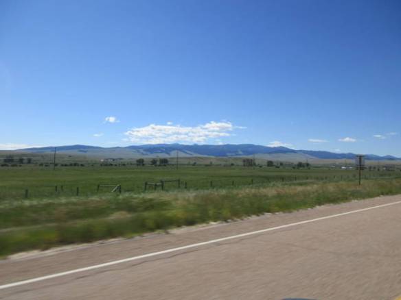
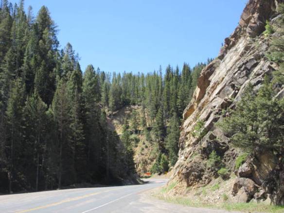
Most of my travel was south on US 93 from Twin Falls to Interstate 80 in Wells NV. I came north on this road in May and found it to be a challenge. It wasn’t any better today. So far on this Rambling Road Trip, it is the most challenging major road I’ve traveled on. The Idaho section isn’t bad, but in Nevada it is a two lane road that climbs over a couple of six thousand plus feet peaks with six percent grades. Add to that challenge, no real shoulders with twenty to fifty feet drop offs on both the sides of the road and it gets scarier. Top it all off with gusting cross winds through open areas and you have a white knuckle concentration activity.

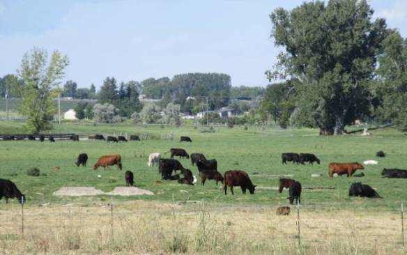
The northeast Nevada area must be a big grazing area for deer or elk. The road signs for crossings could represent either animal.  Route 93 has large sections with double high fences,  underpasses and bridges designed just for the animals to safely cross the highway. On the section of Interstate 80 I drove across they were building two new bridge crossings. The engineers are not concerned with the weight of traffic crossing the bridge so they put up a corrugated metal tube like a Quonset hut and cover it with dirt. I’m just not sure how you convince the animals to use the bridges.

id1

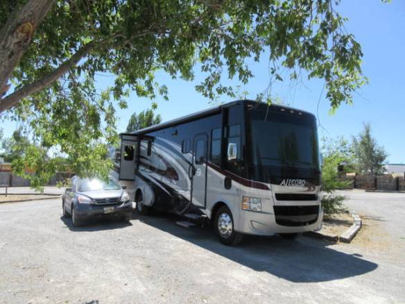
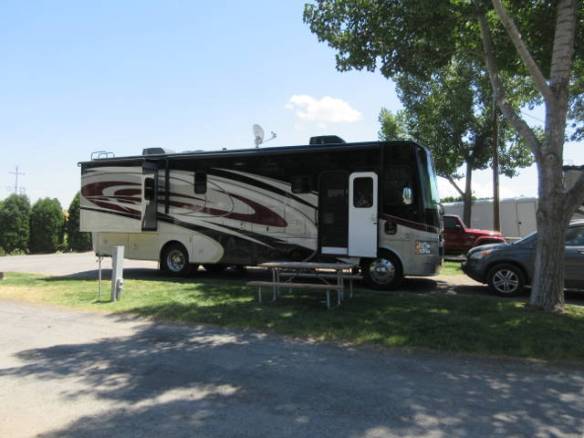
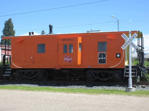
Site B-12 at the Wendover KOA. It is a gravel lot with scattered trees a block off the main drag and a block from the train tracks.

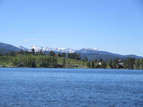
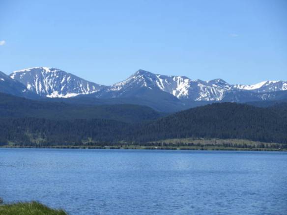
I arrived at West Wendover NV around 1:30. It is located near the bottom of the western slop of a mountain that flattens out into the salt flats of western Utah. The town is the only Nevada community officially in the Mountain time zone. All of its commerce and media outlets are associated with Utah. The town of Wendover is in Utah and starts as soon as the casinos stop. I’ll be here until the 12th of the month.

Finding a Home for the Holiday

Thursday June 29th 2017

Today’s mission was to find a place to stay for the holiday week. This morning I drove out to the county fairgrounds. Like many fairgrounds, they have RV hookups for use by attendees to the various events held at the fairgrounds and they rent the sites out when not needed for events. The problem is there’s not a lot of information about the fairgrounds and they don’t take reservations.

ur7

Pseudo wildflowers planted around the campground.

I found a nice grassy area with hookups for RVs at the fairgrounds. What I didn’t find were people using the facility. There were a handful of RVs scattered around but I didn’t see any people. The fairgrounds itself was fairly busy. It looked like a day camp was using part of the grounds and the stables had activity. For no apparent reason, I had an uncomfortable feeling about the place. I was concerned about the physical security and to a certain extent personal safety. I decided to move on to option two.

I’ll head south tomorrow over the mountains into Nevada. I’ve made reservations for the next ten days on the Nevada Utah boarder. I can use that as a base to explore northeastern Nevada, the salt flats of Utah and the Golden Spike region in Utah to the northeast of my base camp. I also made reservations in the Provo Utah area for a few days before moving to the reservations I already had in Salt Lake City. Between all of these reservations, I am now booked until the end of July. I need to work on August and September.

ur1

View to the west from the Perrine Bridge.

ur2

View to the east from the Perrine Bridge.

On my way back from the fairgrounds I stopped at the Perrine Memorial Bridge over the Snake River to see the BASE jumpers. I wasn’t disappointed. I got to see two people jump together and the scenery in the canyon was even more vibrant than when I was here in May. The green colors were deeper and the browns were darker.

ur3

Two BASE jumpers (on right) and an observer on the bridge ready to jump.

ur4

Kayaks in the river below the bridge.

ur5

Jumpers on the way down. They are over the middle of the river, but my angle makes it look like they are in the rocks.

ur6

Jumpers on the ground near the target.

The weather today was positively beautiful. It topped out in the mid 80s and the storms stayed north of here. Tomorrow in this area will be more of the same. Across the mountains to the south it will be a few degrees warmer, but dryer. Independence day in this area is forecast to be over 100 degrees. In Nevada there will be several days around 100 degrees. That’s the down side to the move.

ur8

Cattle across route 93 from my campsite. They sure make a lot of noise at night.

Back in Twin Falls

Wednesday June 28th 2017

Last night was warm and I kept several windows open. Mother nature didn’t like it, she sent a shower trough around 5am. I ran around closing most of the windows, before trying to get back to sleep. I didn’t get to sleep long. My neighbors made enough noise to wake me as they prepared to depart. I was up by 7:30am.

This was a short travel day for me. I had around 120 miles to travel from Pocatello to Twin Falls. My plan was to leave at the checkout time of eleven so I would get to Twin Falls a little after 1PM. The early start to the day combined with the fact that I hadn’t completely unpacked conspired against the plan. I was ready to depart shortly after 9am. I took a slow walk around the campground to kill time, but I was on the road by 9:30.

Checking in before the prescribed check-in time is usually possible, but checking in before the official checkout time isn’t going to work. In this case checkout at the Twin Falls campground was noon. I needed to kill an hour or so on the journey west. I spent that hour in a rest area with the Snake River in front of me and a windmill farm on the hillside behind me. It was good to see an enterprising utility company had taken advantage of the high wind area that the road signs warned about.

end1

Site 22 at the Jerome / Twin Falls KOA.

With a slow twenty minute stop to fill the gas tank, I managed to check into the Twin Falls KOA a little after 1PM. This is the same campground I stayed in during the month of May. In fact, I’m at the same campsite. I came back to this area in the hope of finding a place to stay for the July 4th holiday. This campground and the other formal campgrounds are booked solid. I hope to stay at the County Fairgrounds which has sites available on a first come first serve basis. Tomorrow I’ll check that possibility out. If not, I will continue south into Nevada on Friday. I know of a couple of places on Interstate 80 that currently have plenty of sites, but there is less to do in the area.

Once again I allowed the holiday to sneak up on me. I know I need to book ahead of time for holiday weekends, but figuring out where to book is more complicated. The holiday always seems to be weeks away, then suddenly, it’s next week. As I’ve said before, the need to book sites ahead is one of the more annoying aspects of this lifestyle.

Slow Day in Pocatello

Tuesday June 27th 2017

Thunderstorms were all around the area last night, but we only got wind here. Today has been a sunny warm day in the mid to high 80s. Overall it was a few degrees more comfortable than yesterday.

tud1

Pasture land (and an ugly power line) beside the RV park.

I didn’t do anything spectacular today. I made a run to the grocery store for a few luxury items like cookies and did some driving around to get a general feel for the area. One interesting highway interchange stood out. The route 91 bridge over Interstate 86 swaps the lanes over the bridge to avoid left hand turns across traffic to get onto the Interstate. So the northbound lane moves from the right of the southbound lane before the bridge at an X style interchange and then back to the right at an X style interchange after the bridge. All of this so the traffic getting on the Interstate never has to have a traffic light for a left hand turn across the on-coming traffic. I just don’t know what the traffic engineers were trying to accomplish. Perhaps it was because there were two actual bridges rather than one wide bridge.

This afternoon at the campground I was able to catch up on my laundry. I had quite a bit to get washed. Since I’ve been wearing a lot of cool weather clothes, I have been able to go deep into my supply of clean clothes without being in danger of running out. However, I was running out of space to keep the dirty clothes. I didn’t make the time while I was at Glacier NP and the facility at Deer Lodge didn’t impress. This park has six washers and dryers at a reasonable per load cost in a nice clean room.

The afternoon campground entertainment got started late today. Watching the arriving travelers come into the park is the entertainment I’m talking about. Tonight a trailer arrived at the site next to me. It pulled in and the co-pilot got out and looked at the position. The next thing I knew they were backing out of the site and repositioning closer to the utilities. After another conversation between the pilot and co-pilot they backed up the trailer ten feet or so. The co-pilot went inside the trailer while the pilot stood outside looking at the trailer. When the co-pilot came back out they reposition the rig again. All I can think is they weren’t satisfied with how level the rig was. It looked fine to me. After another couple of minutes in the trailer by the co-pilot. They switched sites. The procedure was repeated on a site across the street. Once they finally got setup I came to the conclusion they were new at this. Their water hose and electric cable looked like they hadn’t been out of the box for long.

Tomorrow is a travel day. I’ll be going a little over a hundred miles west to Twin Falls ID. I’ll be staying a couple of nights at the same park I was in at the middle of May. This will be another short stay of two nights before I move on.

Travel Day to Pocatello Idaho

Monday June 26th 2017

I got packed and ready to leave by 9:30 this morning. The forecast called for hot weather with the possibility of thunderstorms late in the day along my route. I’ve been in areas with high temperatures no greater than 80 since early May. Yesterday’s mid 80s and today’s 90s are a big change.

My drive today was on Interstate highways all the way. I started going east on Interstate 90, then south on Interstate 15. Overall I traveled 280 miles in a little under five hours. With the exception of two areas of construction and a few areas of unfavorable wind, it was an easy drive. The two passes over the Continental Divide were inconsequential. If it wasn’t for the sign a few miles south of Butte, I wouldn’t have known I was crossing the divide at 5900 feet. The second crossing at the Montana-Idaho line was even less remarkable. The road traveled through high plans cattle land most of the way through Montana. In Idaho the road steadily lost altitude until it opened up onto the Snake River Plain.

mod1

Site 35 at the Pocatello KOA.

I’m in Pocatello Idaho for the next two nights. A line of thunderstorms is headed this way from the southwest. Tomorrow has a similar forecast, but the daily high temperature isn’t supposed to be as high. I don’t have any specific plans for tomorrow. I’ll make a run to the grocery store, but will probably just relax most of the day. On Wednesday I’ll move west to Twin Falls for another couple of nights.

Grant-Kohrs Ranch National Historic Site

Sunday June 25th 2017

The sun was bright and the wind was no where to be found today. It got hot and I chose an outdoor activity. I toured the Grant-Kohrs Ranch National Historic Site. It is located in Deer Lodge MT where I’m staying.

und1

Grant-Kohrs ranch house

The ranch began in the late 1850s as an open range ranch to supply the nearby mining towns with beef. The cattle industry grew with the arrival of railroads to transport the product to the population centers on the coasts. The open range combined and intermixed herds from as far away as Texas with the herds on the high plains of Montana.

und2

Ranch lands with the mountains in the background.

und3

Ranch wagon

und4

One of several horses on the ranch.

The peak of Open Range ranching came in the late 1880s. Foreign investment allowed the herds to get bigger and the railroads were able to deliver the product to ever greater markets. A very bad winter of 1886-1887 caused major losses and many ranches went out of business. The establishment of homesteads with barbed wire fences finished the open ranges. Ranching continued in a more controlled fashion that allowed stockpiled feed to support the herd over bad winters.

und5

Fenced in area with cattle.

und6
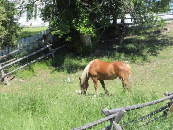
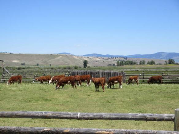
The Grant-Kohrs ranch became a national history landmark in 1960 and a National Historic site managed by the National Park Service in 1972. It provides exhibits and presentations about ranch life from the 1860s through the middle of the 20th century. They have horses and cattle on the property which heightens the experience. I really got a sense for what life might have been like on the ranch.

und7

Chuck Wagon exhibit.

This is my last day in Deer Lodge. I’m moving south into Idaho tomorrow. It will be a long travel day and I need to cross the Continental Divide twice on Interstate 15 going south. I used to think the Divide was relatively straight north south across the continent. It actually follows a real winding path after getting north of Colorado.

Old Montana Prison

Saturday June 24th 2017

Today I went to the Old Prison Museums on Main Street in Deer Lodge Montana. This is a complex of museums centered around the Old Montana Prison. The additional museums are the Montana Auto Museum, Yesterday’s Playthings, Frontier Montana, WWII Exhibit, Cottonwood City and the Powell County Museum. I concentrated on the Old Prison and Auto Museum today. I may go back and see some of the others tomorrow.

atd1

Outside prison wall and guard tower.

The old prison started life as an attempt to tame the “wild west” in 1871. It was built as a territorial prison that transition to the state when Montana became a state in 1889. It continued to operate as a prison until 1979, when a new prison site four miles west of town opened. During its life as a prison it had two major riots. One in 1908 and another in 1959. During each riot lives were lost.

atd2

Cell block building inside the outer wall.

atd3

Four levels of cells.

atd4

Example of a cell. I’m not sure I believe the wood wardrobe is really part of a real cell.

The museum is full of contrasts. The cell blocks and confinement areas tell the story of a harsh uncomfortable life. The seasonal temperature extremes added to the discomfort the prisoners had to live with. On the flip side an area of the museum was dedicated to “prison life”. It focused on inmate athletics, participation in blood drives, Toys for Tots and graduating high school via GEDs. There was a family with young children on the self guided tour with me. The kids were more impressed with the positive prison life display than the cell blocks. I heard the father remind the kids several times that they didn’t want to go to prison to be able to do the things described.

I had to laugh at my own confusion. I couldn’t figure out what the 1935 building called the Tag/Hospital was all about. I got the hospital part but what was the significance of the word “Tag”. I finally found a description that identified the Tag Plant as a facility for making license plates. I’d like to think if it wasn’t in the same building as the hospital I wouldn’t have been confused, but “tag” isn’t my first choice of vocabulary for the identification placed on a motor vehicle.

atd5

Some of the early cars.

atd6

1931 Ford Model A, 1928 Chevrolet Roadster and 1920 Desoto Deluxe

atd7

s1955, 56 and 57 Chevrolet Bel Airs

Next to the Old Prison Museum is the Montana Auto Museum. It contains around 150 automobiles arranged in chronological order. The first vehicle was an 1880 Ladies Sporting Cart and the most recent a 1978 Corvette Limited Edition. I really enjoyed walking through the collection.

atd8

Electric Engine used on the Milwaukee Road railroad through the Montana and Idaho mountains.

atd9

Caboose

Outside the museum some of the rolling stock of the old Milwaukee Road railroad is on display. Included in the display is a big electric engine. It was interesting to learn that they ran electric engines between Harlowton, MT and Avery, ID from 1917 to 1974.

Scenic Loop Drive

Friday June 23rd 2017

It got down into the low 40s overnight, but was around 60 and climbing by 9AM. It was a beautiful clear day that topped out in the low 70s. Today was a check out the area day.

I drove the Pintler Veterans Memorial Scenic Highway. This is a loop from Drummond MT on Interstate 90 to Anaconda MT near Butte on Interstate 90. I didn’t keep track of how far I traveled, but I was gone for a little over three hours with several brief stops. The road goes out through the Flint Creek Valley by the historic mining town of Philipsburg MT then up into the Beaverhead Deerlodge National Forest.

fid1

View out the car window of the ranch land in the Flint Creek valley.

fid2

Road hugging the cliff as it climbs the mountain. The Flint Creek is below.

fid3

Road continues up the mountain through a narrow cut.

The creek valley is all ranch land. I saw hundreds of cattle, a few horses, lots of sheep and a some goats on the domesticated side of things. For wild animals, I had one deer cross the highway in front of me. The doe actually looked both ways before running across the road and jumping the fence on the far side. I spotted her far enough away that I had slowed way down from the 70mph speed limit by the time I was within a 100 feet from her.

The road follows the creek up into the mountains and Georgetown Lake and Silver Lake, before gradually winding its way down into the large community of Anaconda MT. This is another town that owes its existence to the mining industry. It was the site of a major smelting works that was finally closed down around 1980. Followed by a period of cleanup lead by the Environmental Protection Agency.

fid4

Georgetown Lake with the Anaconda Range in the background. The Anaconda Range makes up the Continental Divide in this area.

fid5

fid6

I enjoyed the drive on the loop road. In some ways it is a microcosm of Montana. The drive includes ranch land, mountains, mountain lakes, and plenty of mining history. Philipsburg deserves a dedicated visit for people interested in historic towns; today I wasn’t. At the right time of day, I think there would be more wildlife to view along the scenic loop as well.

When I got back to the RV park this afternoon, my rig was one of two rigs in the park. By seven this evening, the park was almost full just like last night. A clear indicator that this park catches many travelers going between Glacier and Yellowstone National Parks.

Travel to Deer Lodge MT

Thursday June 22nd 2017

Last night I was having Internet problems. The campground’s WiFi was doing great until Tuesday morning when the provider tried to perform an upgrade. I needed to switch to my 4G wireless connection to post Tuesday’s blog. It wasn’t very fast, but it got the job done. Last night the 4G network wasn’t worth a dime. I suspect to many people were fighting for the same tower.

I got last night’s blog posted this morning before I finished packing and got on the road. This afternoon, at my new location, I also managed to upload the pictures from East Glacier National Park that I took on Tuesday. They can be viewed in my Google Photos shared album called Glacier National Park June 20 2017. Click on the link to view the photos. This album includes a couple more photos of the Mama Grizzly and her cub as well as views of the terrain on the east side of the park.

I was packed and on the road by ten this morning. My route was basically a backtrack on the path I took to get to West Glacier. The only difference was I took a bypass around the community of Kalispell. It was a little longer but less congestion. I didn’t like the roads any better this week than I did last week. There are many unexpected dips and bumps that can create a real porpoise affect.

thd1

Site 13 at the Deer Lodge KOA.

After about five hours on the road I arrived at the Deer Lodge KOA in Deer Lodge MT. This community is on Interstate 90 about forty miles west of Butte. I will be here until Monday. There is a big museum complex on the site of the old Montana Prison that I want to visit.


Last Day in the Glacier NP Area

Wednesday June 21st 2017

This was my last full day in the Glacier National Park area. It was a sunny day with fairly strong winds late in the day. My activities today were a real mixed bag.

wed1
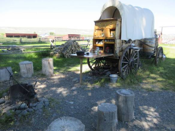
I started the day with a grocery store expedition. I drove thirty miles into Kalispell MT to the Walmart Supercenter. I passed one grocery store about 20 miles into my expedition, but other than that there are only general store and convenience store type places. Overall it took two and a half hours to get what I needed to restock the refrigerator and food storage cabinets. It was a needed task since there isn’t much commerce at my next stop in Deer Lodge MT for the weekend.

wed2Later in the day I made a run into Glacier National Park to see if by dumb luck the Going to the Sun Road was open. When I entered the park the message board that had previously announced the road was closed had been turned off, so it was looking positive. Another positive sign was the traffic heading up the road. It was very heavy. As I approached the Avalanche visitor area were the road had been closed, I didn’t see any signs announcing the road was closed. Unfortunately, it was still closed. My guess is it will open tomorrow or Friday. The web site tracking the progress has shown the two snow removal crews having met at Logan Pass for the last two days.

wed3On my way back out of Glacier NP the “Oil Life” indicator in my car came on. This happens when the sensors think there is only fifteen percent life left in the car’s oil. It was at thirty percent when I checked a week or so ago. I had passed a Jiffy Lube on my way for groceries this morning, so I headed fifteen miles down the road for an oil change. This place wasn’t into changing oil in a jiffy. It took more than half an hour even though they started right away.

The pictures in tonight’s blog are all from various plantings in the campground. It seems like someone is always tending the flower beds and hanging plants.