Preparing to Leave Las Cruces

Wednesday January 31st 2018

Today was my last day in Las Cruces NM. I spent it at home doing odd chores and getting ready to travel in the morning. The lack of exciting action means the topics for tonight’s blog entry are limited.

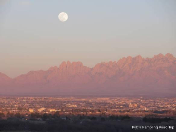
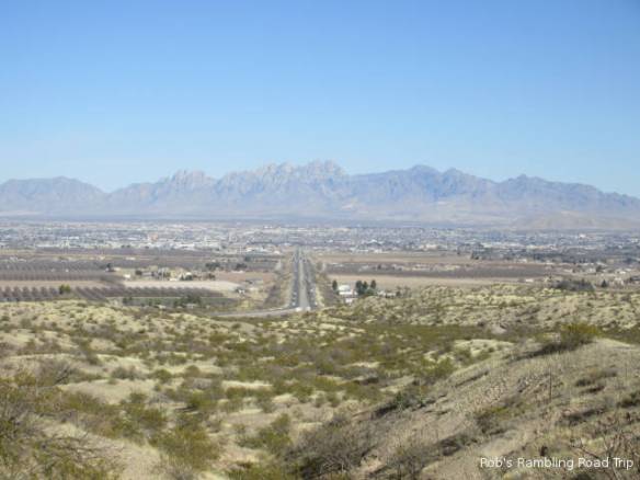
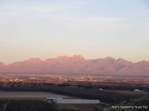
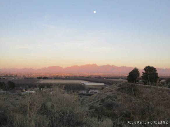
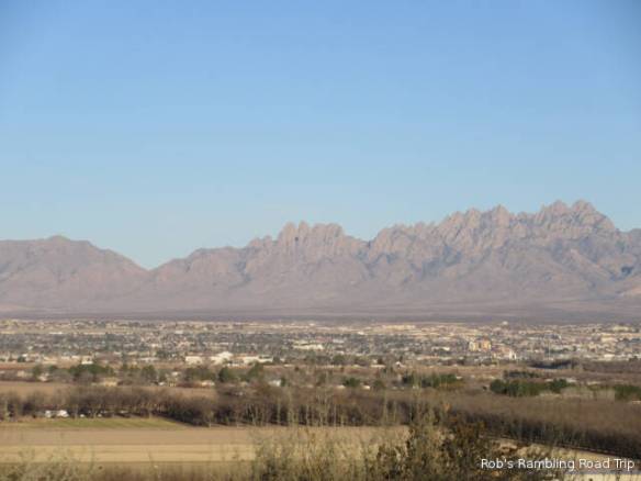
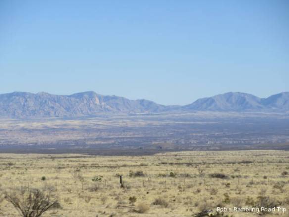
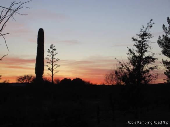
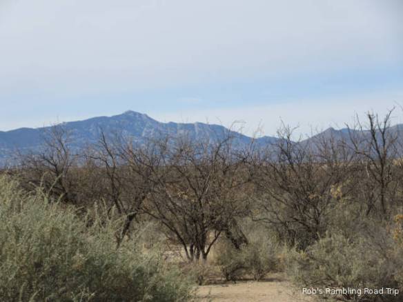
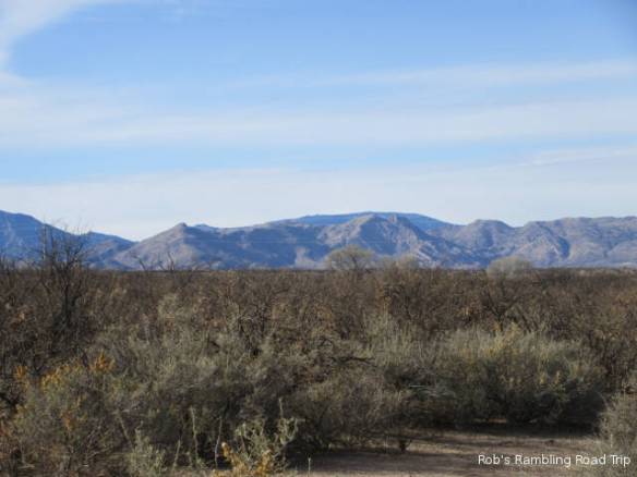
Let’s start with the weather. It has warmed up a little more every day I’ve been here. Today’s high temperature was in the low 70s which is above the norm by a few degrees. There was very little wind so a haze settled in the valley over the city most of the day. Even with the haze the view from this campground is incredible.

r3t2018-01-31_18-511

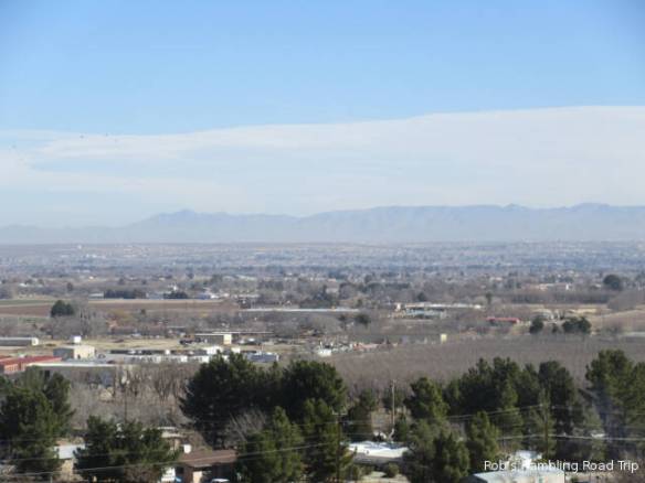
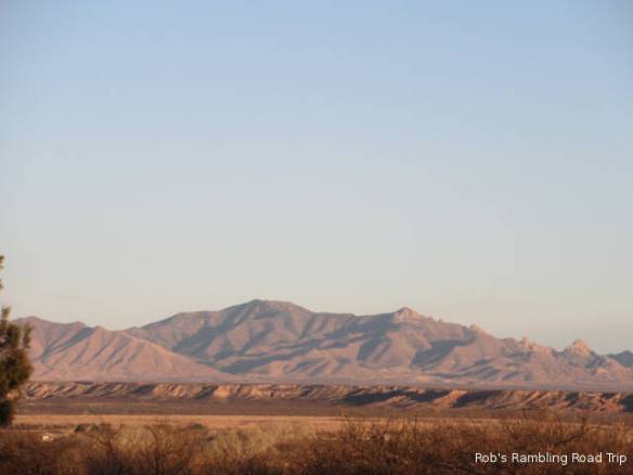
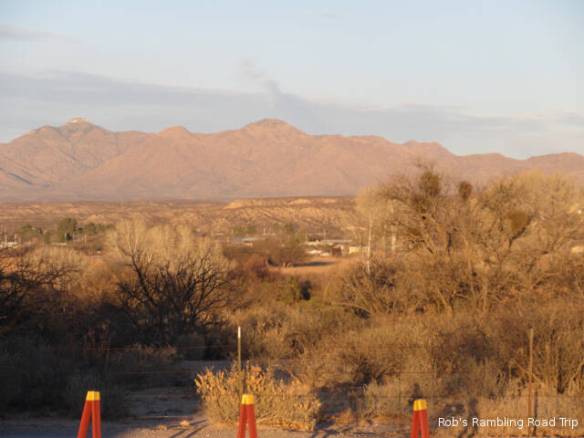
The view of Las Cruces was covered by haze this morning.

One of the chores I accomplished today was the laundry. This facility had older equipment in good condition, but I was able to get the laundry done quicker than usual. The machines were commercial grade. The washing machines had a higher capacity and the dryers had hotter settings in addition to high capacity. The laundry even seemed clean when I was done. Sometimes I’m not sure I actually washed anything when I put the stuff away.

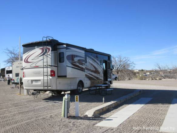
This RV park is full tonight. It has been close the last couple of nights, but just about empty during the day. Around two in the afternoon it starts filling up. Tonight I saw a number of RVs turned away. They were mostly big rigs that needed extra space.

Tomorrow I continue my trip east. I don’t have reservations for the night. I’ll probably stop at Van Horn TX about two hundred miles away assuming I by-pass El Paso to the north. I understand the city can be a nightmare going through on I-10. It didn’t give me any problems westbound last year, but why chance it. The next option after Van Horn is seventy to one hundred miles further down the road. I have a reservation for Friday night in Kerrville, TX. To get there I have to travel close to six hundred miles over two days. That’s a little more per day than I’ve been doing lately, but easily accomplished.

White Sands National Monument

Tuesday January 30th 2018

I drove northeast on US Highway 70 to the White Sands National Monument. The first twenty five to thirty miles is across the city of Las Cruces and its valley. The mountains that look close from the RV park are a long way away. After crossing the mountain pass at fifty one hundred feet the road crosses the White Sands Missile Range for the next thirty five to forty miles. The White Sands National Monument is on the far east side of the Missile Range closer to the town of Alamongordo NM.

r3t2018-01-30_20-541

Edge of the white sand dunes.

r3t2018-01-30_20-542

r3t2018-01-30_20-543

The White Sands National Monument is the biggest area of Gypsum sand dunes in the world. It is formed from the gypsum left from ancient oceans that covered the area. A regular southwest wind keeps the dunes forming and shifting. The area retains water on the surface during wet times of the year and inches below the surface during drier times. Today, during one of the drier times, wet gypsum sand could be seen in some areas of the road surface.

I started my visit with the orientation movie at the visitors center. It talked about the formation of the dunes, the wildlife that inhabit the area and the experiences of man with the dunes from the Mescalero Apache to the Spanish and Anglo settlers. This movie rated high on my approval scale. It stuck with facts and information as opposed to pushing an agenda.

r3t2018-01-30_20-544

White Gypsum sand. Some was soft and loose other areas were hard packed.

r3t2018-01-30_20-547

r3t2018-01-30_20-548

r3t2018-01-30_20-546

Animal track on the side of the dune.

From the visitors center I drove the scenic drive, stopping at the information signs and at the Dune Life Nature trail. The Dune Life Nature trail is about a mile through an area of the dunes near the edge of the dune field. It has more vegetation than the areas at the center of the dune field. I didn’t hike the Alkall Flat Trail in the middle of the dune field. It was just to much white sand that reminded me of cold wet snow.

The Dune Life Nature trail was very interesting. It had just enough vegetation to break up the white. There were many signs of animal life but I didn’t see any ground creatures. There were some birds in the distance. On the edges of the dunes it was easy to see tracks in the sand of different animals.

r3t2018-01-30_20-5411

Packed Gypsum sand road. I passed the road grader maintaining the surface twice. Now I have to get it off my car.

The scenic drive is paved for the first four miles. It then transitions to packed gypsum sand. They are constantly running a road grader to keep the drifting sand under control and the wet areas packed down. There wasn’t a lot of traffic today. It was easy to avoid soft or wet areas on the road. On busy days it might be more of a challenge.

The White Sands National Monument was interesting. I would certainly visit again if I’m in the area or passing by. I don’t think I’d drive seventy miles from the west side of Las Cruces again.

This evening back at camp I watched the sunset in the west and the moon rise over the mountains to the east of Las Cruces as the sunset.

r3t2018-01-30_20-549

Sunset to the west.

r3t2018-01-30_20-5412

Moon rise over Las Cruces to the east.

r3t2018-01-30_20-5410

Starting to Checkout Las Cruces NM

Monday January 29th 2018

This is the start of my third year of daily blogging. In January of 2016, I committed to writing this blog everyday. My goal in writing the blog was multifaceted.

  • First I wanted to document my travels. I think I’ve been successful with that goal. There are some days that I don’t do anything interesting beyond living in the RV that make the blog entry less than scintillating, but overall it is an accurate reflection of my life in the RV.
  • My second goal was to keep friends and family informed about my travels. I’m not very good at initiating conversations so I tend to rely on this relatively passive method of communications. Once I started automatically cross positing the blog to Facebook this goal has been more successful.
  • My third objective was to give back to the RV community. I read many blogs on full time RVing before starting out. This is my small contribution to that information base. While I’ve written a lot of good information, I haven’t publicized the blog on various RV forums so I don’t have as many followers as I could.
  • My last goal was to have a communications forum to take the place of a virtual water cooler conversation. In other words I wanted a soap box. I haven’t chosen to use the blog for this purpose very often. Instead, I found that the very fact of having to write a daily blog causes me to think about what I’m doing, why I”m doing it and how I’d describe the day. In may ways the blog gets me out of my chair and out the door seeing and doing things I might otherwise not do. Even if I don’t take selfies of every event.

I’m going to give myself a B+ and plan to continue to write a blog entry every night.

r3t2018-01-29_19-072

Roadrunner statue made from recycled materials at the scenic view on Interstate 10. Las Cruces is in the valley behind the statue.

The weather got down into the high twenties last night but rebounded into the low sixties today. I spent most of the time in camp doing various chores. This afternoon I found a gas station to fill up the SUV and did a tour of the local area. This RV park is located on a hill northwest of Las Cruces with great views of the area. The city is in a valley with the Rio Grande river passing through. The river has a very wide cut to flow in, but the water in the cut today isn’t much more than your average creek. It is mostly gravel bars. There is a good deal of agriculture in the valley so I image water is diverted for irrigation. In a couple of months when the spring run off starts the river should be more to look at.

r3t2018-01-29_19-071

Looking toward downtown Las Cruces.

r3t2018-01-29_19-074

Sun setting on the mountains to the east of Las Cruses.

r3t2018-01-29_19-073

The almost full moon over Las Cruces.

The White Sands National Monument is about 70 miles to the northeast of here. I’m thinking about driving there tomorrow or Wednesday. I move on eastward Thursday.


Travel Day to Las Cruces NM

Sunday January 28th 2018

It was another frustrating night with power outages throughout the night. The relays for my power transfer switch is located in the basement storage under my bedroom. Every time the power goes out and comes back on the relay trips with a loud bang. When I am trying to get to sleep and getting ready to wake up the bang can really get your attention. If it happened after I got to sleep, I didn’t here it.

r3t2018-01-28_17-171

Site 67 at the Las Cruces KOA.

I departed Benson AZ shortly before 10AM this morning. My first stop was at the gas station to put one credit card swipe worth of gas in my RV home. I didn’t want to fill the tank with expensive Arizona gas, but I needed enough to get to New Mexico. New Mexico gas prices are twenty or more cents cheaper per gallon. As it turns out one card swipe got bought one hundred dollars worth of gas. That was plenty to make it all the way to Las Cruces. Often the pump will kick out at fifty or seventy five dollars. I didn’t swipe my card again for the last fifteen to twenty gallons.

It was an uneventful trip out of Arizona and across southern New Mexico. The wind gusts were a problem at times, but the wind was not bad enough to cause dust storms which close the road. I passed many ominous warning signs about dust storms and what to do if you are in one. Leaving Arizona there are a couple of moderate climbs. Once in New Mexico the terrain is wide open with more gradual but long climbs.

A little after noon about halfway across southern New Mexico I crossed the Continental Divide. This is the first time since June that I’ve been east of the Divide. I went back and forth across the divide in Idaho and Montana during June. I passed west of Divide for the first time in the Motorhome at the end of February last year. My return to the east is now firmly underway.

r3t2018-01-28_17-172

City of Las Cruces and mountians to the east.


Getting Ready to Leave Benson AZ

Saturday January 27th 2018

Today was my last full day in Benson AZ for this trip. I will visit the area again on future trips. I’m not getting out of here any too soon. The power problems I described in yesterday’s blog entry continued all night and have already started again tonight. There is just too much power demand for the RV parks electric system. The owners are aware of the issue, but until it’s fixed it is a royal pain. There are many other RV parks in the area that will probably get my business on my next visit to the area.

r3t2018-01-27_18-421

The last sunset I will see in Benson AZ for this trip.

The other reason to get moving soon is the wind forecast. Each of the next few days has a higher wind forecast than the previous day. Tomorrow should be alright for my drive out of Arizona and across New Mexico to Las Cruses. I have about two hundred and twenty five miles to go. With any luck, I’ll be off the road by the time the wind really gets strong. I’ll stay in Las Cruses until Thursday, before continuing my eastward trek.

I got many of the outside travel prep tasks done this afternoon. In addition to the normal tasks of storing the grill and loading the bicycle onto the car, I disconnected the water hose and the sewer hose. In the morning the hoses will be very stiff if not frozen. I can easily function on my water tank and holding tanks overnight. The only outside tasks left for the morning are hooking up the car for towing and stowing the electric cord.

Most of the rest of the day I just relaxed by reading, watching TV and walking around the RV park. For dinner I prepared a big batch of American Chopped Suey. The leftovers will be good for a couple of more meals even if I pig out on one of them.

The power just went off for the third time since I started this blog entry an hour ago. You’d think people would get a clue and use less power after the first outage.

Touring South of Benson

Friday January 26th 2018

On some days I don’t have a clue what day it is until I sit down and write this blog entry. Today was one of those days. The power went out in the campground near bed time last night. After turning off everything that would draw down my batteries unnecessarily, I went to bed. Unfortunately, I didn’t get to sleep right away. I was thinking about the power outage and it was a little early. It all boils down to I didn’t get enough sleep last night.

Management fixed the power problem in about a half an hour, but it went out again during the night. The campground had more occupants last night than previous nights I’ve been here. My guess is there were some high current demands that overloaded the circuits. This is an older campground that was designed with sites to have 30amp circuits. In the last few years it has had some of the service upgraded to 50amps on select sites. The power that feeds the campground may need to be upgraded. As I was completing this blog entry, the power has gone out twice. They must have a more serious problem than overloaded circuits.

r3t2018-01-26_18-241

Neglected historical marker for Fort Huachuca. The actual active fort can’t be seen from the road. It serves as a better memorial than the marker.

Today’s temperature was in the mid sixties with a ten to fifteen mile per hour wind out of the north. Generally, it was very nice day. I took a site seeing drive south form Benson on the west side of the San Pedro valley. I went as far as the city of Sierra Vista. Along the way I stopped at the Historic Marker for the original Fort Huachuca. This was one of the forts established in the late nineteenth century to protect the miners, settlers and travelers to the southwest from the Apache Indians and Mexican insurgents. Fort Huachuca is unique among the forts. It is still a functioning Army Post today.

r3t2018-01-26_18-242

Mountains to the west of the valley, (Picture taken while driving)

r3t2018-01-26_18-243

The haze across the valley to the east. Can you imagine a cavalry patrol out there one hundred and thirty years ago?

This area is loaded with history.  I need to study up on the expansion of  settlers into the southwest.  The  conflicts with the native Americans have some memorable names like Geronimo attached to the legends.  It would be nice to come back to the area with some of the background needed to appreciate the historic sites.   Even without that knowledge it is easy to imagine cavalry patrols out in the valleys.

On the return I passed through another Boarder Patrol check point. There was another one just outside Tombstone on Tuesday. These are permanent structures not temporary ones. This one had more people on duty including a dog or two. I’m not sure if there focus is on people, drugs or what. All I experience is a glance inside the car and a pass through.

r3t2018-01-26_18-244

Slow Day at Home

Thursday January 25th 2018

After a couple of days of being a tourist I stayed at home today. It was a beautiful day in the desert. The temperature was in the low seventies with a light wind most of the day. It wasn’t even as cold overnight when compared to the last few days.

I spent time today working on my itinerary. My calendar is now full of blue and red appointments through the beginning of June. Blue appointments are confirmed reservations and red appointments are tentative plans. The calendar is mostly blue confirmed reservations through the first week in April. I locked in the first week in February for San Antonio Texas and the Presidents Holiday weekend in the Pensacola Florida area. There are five open single night stops left in February to lock in. I’ll make those reservations closer to the actual night in case I need to move slower or faster.

The unconfirmed plans start in April. The plan is to stay in Florida until the third week of the month. Then I’ll move through Georgia to the Chattanooga TN area for a few nights. From there I’ll move on to Nashville for a few more nights. Each of these stops have some tourist type things to do. After Nashville I’ll move across Kentucky to northern Indiana for a couple of weeks. It is still early to make reservations at many of the places in the north. The next confirmed reservation starts Memorial Day weekend in the middle of Missouri for the Escapees Escapade.

I don’t know where I’m going from the middle of Missouri. If I go north I can visit the Dakotas, Minnesota, Wisconsin and Michigan starting with the upper peninsular. Turning south opens up Arkansas, Tennessee, Kentucky and West Virginia. All of my options end in the northeast. I want to return to New England for September and October. The winter of 2018-19 will be in Florida. I’ve already got two weeks reserved in a State Park during December. I need to make other reservations as the eleven month reservation window in the state parks opens up. The amount of planning and reservations associated with my approach to this lifestyle continues to frustrate and amaze me.

r3t2018-01-25_16-391

One braut too many cooking in the smoke.

One good thing about staying home was having the time to grill a good meal. I made good use of my new grill to prepare some potatoes, onions and brauts. I slice the potatoes and onions and cook them sealed in foil with fake butter. The combination went well with the brauts. My only problem was I cooked one braut too many. They come in packages of five so I either have to cook 3 and freeze 2 or the opposite.

r3t2018-01-25_17-482

Tonight’s sunset was very colorful.

This afternoon I watched the campground fill up. Most days it empties out by the 11am checkout time and starts to fill up around two. Most people only stay from one to three nights. Tonight there seems to be more people here than any of the other nights I’ve been here. I check out on Sunday.

r3t2018-01-25_17-481

Lone saguaro cactus in the sunset.

Wandering to the East of Benson AZ

Wednesday January 24th 2018

I don’t seem to have the magic decipher ring for the weather forecasts around here. I thought last night was going to be in the mid to high thirties so I wasn’t worried about the water pipes freezing. This morning the water hose to the RV was frozen. It wasn’t a big problem. I used the internal water tank and pump until the hose thawed. It got into the low seventies this afternoon and the heavy wind that I thought was in the forecast wasn’t very strong.

Early this afternoon I headed out to the east on the Interstate. When I arrived in Arizona last March 1st I passed through and area on Interstate 10 called Texas Canyon. It is located to the east of Benson in the Dragoon Mountains. I wanted to stop at the rest area on the highway and checkout the views. Last year, driving the motorhome, there wasn’t any room in the rest area. Since the same thing might happen on my east bound journey, I decided to drive out to the rest area in the car.

r3t2018-01-24_17-511

View to the southwest from Texas Canyon.

r3t2018-01-24_17-512

Granite rocks in Texas Canyon. Do you see a rock Dolphin ?

The canyon is more of a high pass through the mountains. It is at about five thousand feet. My location here in Benson is around 3500 feet. The interstate climbs to the higher elevation over about fifteen miles. The distant view from the rest area is interesting but far more impressive are all the granite boulders in the canyon that surround the rest areas on both sides of the highway. Many of them have eroded into very interesting shapes.

r3t2018-01-24_17-513

Some off the Rock formations in the Chiricahua National Monument.

r3t2018-01-24_17-514

Mountain peak through the forest.

From Texas Canyon I continued east toward Wilcox AZ. The signs announcing the Chiricahua National Monument drew me south from Wilcox like a Siren’s song. It turned out to be a bit longer drive than I anticipated. The terrain in this area is more high plains than desert. It’s cattle country. The road twists and turns while going up and down in rapid succession. Luckily I met very few oncoming cars because you didn’t see them until they were right in front of you.

The Chiricahua National Monument is in the Chiricahua mountains on the east side of the plain that separates the Chiricahua Mountains from the Dragoon Mountains to the west. It contains forest lands and rock formations resulting from erosion of volcanic ash. Since this wasn’t a planned visit, I got to the monument too late in the day to really explore the park. It would have been nice to hike some of the trails. All I really did was tour the visitors center and drive around some. A planned visit in the future is warranted.

r3t2018-01-24_17-515

Mexican Jay ?

Today was a day for the birds. I mean I saw a lot of birds today. Driving across the plains approaching the National Monument I saw several hawks circling and diving. In the park I was entertained by medium sized blue birds that I think are Mexican Jays. They seemed to rule the parking lot at the visitors center. Leaving the park, a Road Runner crossed the road in front of me. This is the first road runner I have actually seen running across a road. Later on my way home I saw a group of Sandhill Cranes in what I think was a Pecan grove.


Tombstone Arizona

Tuesday January 23rd 2018

Despite forecasts to the contrary it was even colder last night than the previous night. It was thirty three inside the RV when I woke around 5AM. Once I turned on the heat it was fine until the sun took over the heating. Today’s high temperature was about eight to ten degrees warmer than yesterday.

r3t2018-01-23_18-181

Woman walking a dog down the middle of the blocked off sections of Allen Street in Tombstone AZ.  The O.K. Corral is at the far end of the blocked off section of street. 

r3t2018-01-23_18-182

Old hotel.

Today was a tourist day more me in Tombstone AZ. The historic mining town is located about twenty five miles south of Benson. I arrived in town shortly before noon and found a parking place after wandering around a bit. Following the signs for parking only lead me to resident restricted spots. It was only moderately busy. I’d hate to find a place to park on a busy day.

r3t2018-01-23_18-183

The Earps in front of the O.K. Corral attraction hyping the gunfight show.

r3t2018-01-23_18-184

Sign on the front of a building that seems appropriate regardless of the century.

r3t2018-01-23_18-185

Stage coach tour. I don’t think these horses would have been used for a real stage coach.

Like many other towns in the west that were established as mining towns, Tombstone survives today as a tourist attraction. It has the added advantage that the 1880s newspapers and later Hollywood movies sensationalized a gunfight that lasted no more than a minute or two near the OK Corral. A three block area of Allen Street has been closed to traffic and left to appear like it did in the late 1800s. Stores, restaurants and tourist attractions line both sides of the street.

Today I focused on the shops on the main street and the gunfight show at the OK Corral. There are other tourist draws in town. A tour of an old Silver Mine, a mockup of Old Tombstone used as a movie set and the old territorial court house are other attractions looking for your money. I’ll leave those for another visit either this week or on future visit to the area.

r3t2018-01-23_18-186

One of the old wagons on display at the O.K. Corral.   

r3t2018-01-23_18-187

Gunfight stage area of the O.K. Corral.

r3t2018-01-23_18-188

The Earps and Doc Holliday confronting the cowboys.

The OK Corral show includes a diorama and movie narrated by Vincent Price that tells the story of Tombstone including the gun fight. It starts with the discovery of silver and ends with the ground water flooding that closed the mines early in the twentieth century. Surprisingly the presentation on the gunfight was balanced. The Clantons and their fellow cowboys were described as mostly outlaws and probably stage coach robbers. The Earps and Doc Holliday were deputized officers of the law, but may have been more instigators than peace officers. It wasn’t described and depicted as purely good vs. evil. The actual gunfight re-enactment was anticlimactic. It’s what got you their, but everything else was more interesting.

I spent about three hours in Tombstone before returning home to Benson. I enjoyed the tour of the town. I didn’t buy anything other than informative entertainment. The shops selling western tourist merchandise and general souvenirs were only interesting for a walk through or two. There are plenty of other options for future visits.


Getting Acquainted with Benson AZ

Monday January 22nd 2018

It was cold overnight. I found ice when I went to reconnect the water hose to the RV this morning. My guess is it was in the twenties. The inside of the RV was only in the forties with the furnace set low. I raised the furnace set point around 6:30 in the morning so it was comfortable when I got up a couple of hours later. The big front windshield remains the source of the greatest heat loss in the motorhome. It also works the other way to raise the temperature of the RV when the sun is on the front. The inside was in the eighties this afternoon with the sun on the front. The outside high for the day was in the mid fifties, but it was dead calm all day.

r3t2018-01-22_18-501

Desert all the way to the mountain ridge

r3t2018-01-22_18-502

More desert to the mountains.

I spent the day getting familiar with the RV park and the community of Benson Arizona. The RV park shows signs of age with evidence that efforts are underway to improve the facility. The laundry facility looks usable, but the equipment is old and makes me wonder if I can/should stretch things out until my next stop. The area surrounding the park is open desert land going on for miles in the direction away from town. In the distance are mountains that frame the area.

r3t2018-01-22_18-503

Distant mountain ridge at sunset.

The town of Benson developed as a rail depot on the Southern Pacific Railroad in 1880. A stage coach station in the area preceded the railroad by thirty years. It was the railroad station and freight depot that served the thriving town of Tombstone twenty five miles south and the mining communities in the whole area. Today it is a stop on AmTrak’s Sunset Limited from Los Angeles to New Orleans.

r3t2018-01-22_18-504

Another view of the mountains at sunset.

I drove around town and found the Safeway Supermarket and the Walmart. A quick stop in Walmart for bread and water was quite a confusion. This Walmart was obviously converted from something else. The layout was unique. On my tour of town I bought gas for the car so I can get going in the morning without worrying about filling the tank. I plan to head down to the tourist draw of Tombstone tomorrow.