Wind and Dust

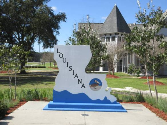
Tuesday February 28th 2017

When I got up this morning it was cloudy in the 50s and calm. Yesterday’s wind was gone. The overnight sprinkle of rain was not to be seen; gone leaving no evidence it ever happened. I wasn’t fooled. Checking the online forecasts turned up an alert from the National Weather Service. High winds and dust storms were forecast for this area and the area I was traveling into.

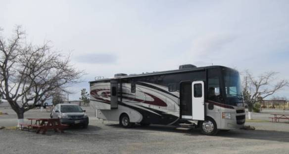
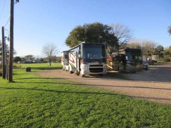
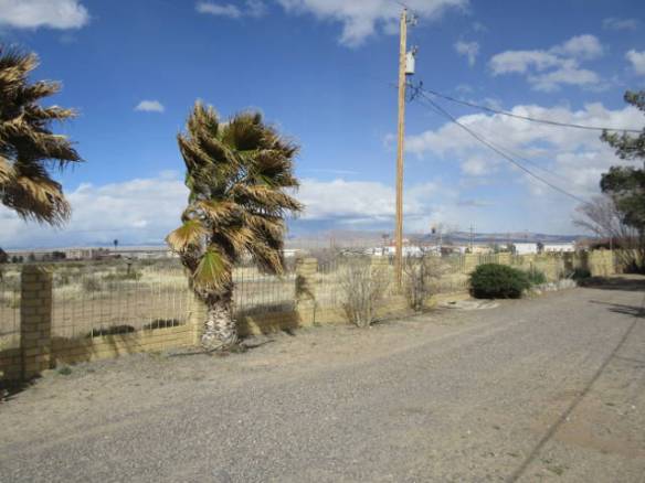
At 8:30, as others were getting on the road, I went up to the office and extended my stay for another night. I didn’t need to travel today. There was no reason to take the risk. Not being familiar with the area or the weather patterns, I had to take the warnings seriously. About 9:30 this morning, right when I’d be on the road, the sky darkened, the wind picked up and visibility went way down. The sky was brown with wind blown dust. I made the right decision to stay put for the day. Tomorrow has a much better forecast.

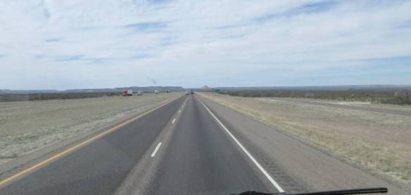
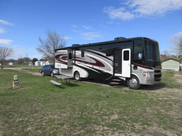
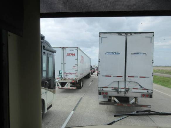
Most of the other overnight visitors to this campground did hit the road. I think only two others remained all day. The TV news reported the Interstate in the direction I was traveling was closed periodically for wind and dust. I wouldn’t have been a happy camper if I’d gotten caught in one of those closures. To add more grief to the mess, after covering everything with a fine coat of dirt, it rained briefly. Now all of my windows and outside surfaces are covered in quarter inch pools of dried mud.

td1

The came out but the wind kept blowing.

Throughout the day the windstorms came in waves. It blew continuously all day, but every now and then it would pickup and blow harder for half an hour or more. Around 3:30, the clouds broke apart so the sun brightened the area, but the wind continued. The outside temperature never got much above 60. Inside I had the electric heater or the fireplace on to keep in toasty warm.

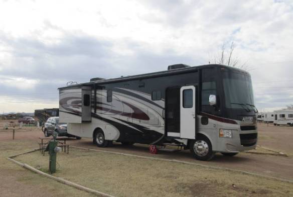
Tomorrow, I’ll get on the road early for the remaining 200 miles of my cross country journey. After six straight days of driving, I needed today off from driving. I knew I shouldn’t group lots of long driving days together, but I did it anyway. Hopefully, next time I think about one of these major relocation I’ll listen to my own advice.

A New State Visited

Monday February 27th 2017

I timed my departure from Van Horn TX to arrive in El Paso TX, about 120 miles west, after the rush hour. Leaving at 10AM central time was perfect for an arrival in El Paso around 11AM Mountain time. The time zone change was only a few miles west of Van Horn as you climbed out of the valley.

The road wasn’t bad getting into El Paso. The hardest part of the journey was the climb out of the valley west of Van Horn. It seemed to be the longest climb I’ve made during this cross country trip. It starts to get congested and commercial long before you reach El Paso proper. This was a big change after all the miles since I last saw big box stores in the San Antonio area. Traffic was heavy but it kept moving through the entire city. The only down side was construction on the west side of the city.

Shortly after passing through the city Texas comes to an end and New Mexico starts. Traffic made it difficult to stop at the welcome center, so I continued on north toward Las Cruces where Interstate 10 resumes its westward direction. New Mexico is the first new state for me on this journey. Louisiana and Texas were new with an RV. I had been to both on business or vacation in the past.

The westward trip started with a stop at a Boarder Patrol Checkpoint. I was just waved through, but the backup was 20 cars or so. While waiting in line, I wonder if they would need to come into my home to look for aliens. Next up on the trip west were ominous warning signs about dust storms. “Exercise Extreme Caution Dust storm area”, “Do not stop in travel lanes”, “Zero visibility” were all on successive signs. At the same time I’m reading these signs I notice the wind is picking up. I made it through the warned areas without any incidents.

md1

Site 29 at the Lordsburg KOA

Most of the way across the state so far has been pretty flat, high desert type terrain. At one point I passed across the continental divide. The sign indicated the elevation was 4500 feet and change. It may be the lowest crossing by an Interstate road. The elevation in Lordsburg, where I am tonight, is 4230 ft. Tucson, the next major city on my trip west, is 2388 ft. I think the flat level road is over. Two thousand feet over one hundred and fifty miles isn’t huge, but it’s a drop.

md2

More interesting desert plants.

After about five hours of travel, I’m at the KOA in Lordsburg NM about 200 miles from my destination for the month of February. I may stay here an additional night. The wind forecast for tomorrow is 30 mph with gusts to 60 mph. If that’s still the forecast in the morning I will extend here.

Windy End of Day

Sunday February 26th 2017

I got started at 9:15 this morning in drizzly rain. It didn’t require more than a very intermittent windshield wiper pass, but it made things messy. After about an hour the sun broke through for the rest of the day. The temperature made it into the low 70s.

The road was pretty good. It became monotonous after I got west of the Texas hill country. The road climbed over a ridge then traversed the flat then up the next ridge only to repeat the cycle again and again. I was one of the slowest vehicles on the road. The speed limit is 80mph, but I maintained my natural speed. Without paying significant attention to speed I seem to settle in at 64 miles per hour. Cars, trucks and other RVs went by me all day. I only had to pass a few trucks and an RV or two.

sud4

Posted speed limit of 80

sud1

Climbing out of the valley.

sud2

Road cut through white rock. In the distance it resembles dirty snow.

sud3

Crossing the flat ground between the ridges.

The last one hundred miles or so were the worst miles of the day. I meet up with a strong wind out of the west. That means I was driving right into it. My first indicator was the need to add gas and the transmission down shifted to maintain speed. About that time I noticed the tall grass along the side of the highway was almost blown flat by the wind. There weren’t any trees with leaves to provide a better indicator. I was soon making many steering adjustments as the force of the wind varied and the direction moved off the front corner and back.

The wind made me use gas faster than expected. I stopped early for gas when it got below a quarter tank. At the gas station, I almost had to hold on to keep from blowing away. The TV news this evening reported steady winds around 20mph with gusts in the 30s. Tomorrow is only supposed to have winds in the teens.

sud5

Site F-10 at the Van Horn RV Park

sud6

Cactus replace hedges, evergreens and flowering bushes in this region of the country.

I arrived at the Van Horn RV Park after six and half hours and 370 miles. Van Horn TX is about 120 miles east of El Paso. The time zone transition to mountain time is between here and there so I’ll need to take that into account tomorrow. I want to pass through the city after the rush hour. My goal is a shorter travel day to around Deming New Mexico.

Shorter Travel Day

Saturday February 25th 2017

Yesterday afternoon the temperature was in the mid 80s, this morning it was around 50 and this afternoon the temperature is topped out at around 60. The sun is shining brightly but the weather pattern sure changed. I also change my travel pattern. After 3 days of hard driving for 5 to 7 hours I slowed down today.

I got on the road at 9:30 this morning from my starting point about 100 miles east of San Antonio. I chose to take one of the loop roads around the city to the north. Mileage wise it was a little shorter than the route through the center of the city. I also suspect the road surface was better than I-10. The down side is that it started off with a few traffic lights before it transitioned into a limited access highway. It also had more traffic than I had anticipated.

Once I was around San Antonio and back on I-10, I was solidly in Texas’s hill country. The road went up and down continuously. After several months in the flat country this was quite a change. When I’m driving in this kind of terrain I have a bigger problem with the trailer trucks. I can maintain speed going up hill better than many trucks, but they go faster on the flats. If I pass them going up the hill, they usually pass me before the next hill. On the other hand if I don’t pass them I loose momentum and struggle up the hill. So it is hopscotch time.

My research indicated that the campground choices along this section of I-10 were widely scattered. That meant I need to stop short or travel longer to find a place to stop overnight. When I started the journey this morning I was prepared to go the distance if necessary, but I was more inclined to stop early. I needed a break from the long days on the road. Full campgrounds or a perfect travel day (what ever that is) were the things that would cause me to go the distance.

sad1

Site 39 at the Kerrville KOA

Just before 1PM I found an available site at the Kerrville KOA. It was advertised as the last site by the check in clerk. I think that meant the last site she thought I could fit on, but I’m not complaining. I get to relax for the afternoon. I’m still on track for my March 1st reservation in Eloy Arizona with a night to spare if necessary.

This campground is in a valley with a stream running through it. If heavy rain was scheduled I’d be a little concerned. I crossed a bridge that becomes a ford during heavy rain to get here. The depth gauge beside the road measured up to 3 feet above the road surface. The campground would be flooded if the water over the road was that high.

Complicated Travel Day

Friday February 24th 2017

It was a great weather day with highs in the low 80s. To bad my travel day didn’t go as well. I am safely in Schulenburg Tx, about 100 miles west of Houston, after seven and a half hours on the road.

I got started a little before nine thirty this morning. The travel through western Louisiana was pretty good. The road passed through a lot of intentionally flooded fields. My guess is they were growing rice. The only obstacle to a smooth trip out of Louisiana was the city of Lake Charles. I took the interstate through the city rather than the longer beltway. The traffic wasn’t bad, but the road was horrible.

frd1

Texas Welcome Center

I arrived at the Texas Welcome center around 11AM. It is a very nice facility with a board walk into the Blue Elbow Swamp. I took a quick walk out into the swamp, but didn’t see any wildlife so cut the walk short and got back on the road. When I stopped for gas a little later I was reminded of Texas’s rather unique exit configurations. They make heavy use of frontage roads that parallel the highway. Exits are often between two cross roads requiring you to travel parallel to the highway on the frontage road to get to the intersection. I think it uses less land, but requires more driving.

frd2

Sitting in traffic for an hour and a half.

My plan was to pass through Houston in the early afternoon before the afternoon rush started. The highway gods didn’t like that idea. Sixty miles east of the Houston area the Interstate was blocked by and accident. Not being familiar with the area I had little choice but wait it out. Some cars and a few trailer trucks took off cross country on a gravel road through the fields. Without a navigator and not being able to backup while towing the car, it wasn’t worth the risk to me.
I waited for over an hour and a half before I got by the area of the wreck. It looked like a tandem trailer and a trash hauler were involved in the accident.

The delay found me going through the middle of Houston at the start of rush hour on a Friday afternoon. In my trip planning I had looked at options to go around Houston. The problem is many, if not all, of the roads around Houston are toll roads that require a special transponder to pay the toll. The traffic through the city was heavy. It only came to a crawl a couple of times. It was a very tense drive.

frd3

Site 49 at the Schulenburg RV Park

frd4

This duck is my neighbor.

Once I was clear of the city I started looking for a place to stay for the night. I stopped at the first rest area and made a few calls. I’m at the Schulenburg RV Park in Schulenburg TX. It is about 100 miles west of Houston and about the same east of San Antonio. Tomorrow is another travel day.

West of the Mississippi

Thursday February 23rd 2017

It’s official as of 2:30PM I am west of the Mississippi River. The travel day began in Milton Florida around 9:30AM and ended at 3:30PM in Lafayette Louisiana. I stopped for gas in Alabama and at the Louisiana Welcome center. Other than that it was steady driving.

thr1

Crossing a marsh in Mississippi. Taken through the front windshield.

Most of the travel was in new territory. I had only been as far west on Interstate 10 as the outskirts of Mobile. The first new experience was a rather steep tunnel under the Mobile River. It very long but went down then up into the downtown region very quickly. Once I cleared the Mobile metro area it was uncongested travel into Mississippi. There was one long elevated area across a marsh that was a harbinger of things to come in Louisiana.

thr2

Louisiana Welcome Center

The Louisiana Welcome center was large and modern. It didn’t have free Orange Juice like Florida, but instead had coffee. I guess they want alert drivers leaving the welcome center. At the welcome center stop, I made the decision to head for the Lafayette or Lake Charles area if I got there early enough. Little did I know the worst part of the days travel was yet to come.

thr3

Long narrow bridges west of the Mississippi River on Interstate 10. Picture taken through the dirty front windshield.

thr4

View of East bound lane of the long bridge.

I avoided New Orleans on Interstate 10 by taking Interstate 12 northwest to Baton Rouge where it rejoins Interstate 10 to cross the Mississippi river. The Interstate 12 root may be shorter and it is certainly easier by avoiding downtown New Orleans. Shortly after I cross the river the road started to get interesting. For about 20 miles an elevated highway traverses a swamp. The road is basically two parallel bridges carrying two lanes in each direction. Occasionally you encounter a higher bridge to cross a levee, not a canal or river. It’s just the opposite of a dry land road. Of course there were two different vehicles broken down on this stretch of highway. It really slowed things down.

The road surface on the long bridge wasn’t too bad, but soon after the bridge ended the road got terrible. The concrete road sections used to pave the highway were all curved. The joints at about 10 foot intervals were all higher than the center of the sections. The RV developed a real rough porpoise like ride. I still have more of this rough road surface to travel in the morning.

thr5

Site 2 at the Lafayette KOA

thr6

View out the front of my Motorhome.

thr7

My neighbors

I am at the Lafayette LA KOA tonight. It is an older, but nice, park on the south side of the Interstate. My site looks out on a small pond with several families of ducks. The only indicator that I am now west of the Mississippi is the TV station call signs. They all begin with a “K” instead of a “W”.

Traveling up and down Florida’s Hills

Wednesday February 22nd 2017

I was on the road about 10:20 this morning. The first stop was one exit in the wrong direction to fill the motorhome’s gas tank. The extra few miles were worth the cost savings on fuel. Once I was back in Florida gas was ten cents more per gallon than in Georgia. More important than the cost was the good access. The station I bought gas at had two dedicated RV lanes with plenty of entry and exit room.

The big issue today was the weather. It didn’t rain overnight as forecast. Instead it held off until mid day then the sky opened up. While I was negotiating Interstate 10 around Tallahassee at the lunch hour Mother Nature decided to dump on us. Visibility was not good all the way around the city. I found a Rest Area on the far side of town to take a half hour break during which the rain let up some. I continued the drive in light rain for the next hour before it cleared up to partly cloudy.

Interstate 10 in this part of the state proves that Florida does have hills. The road goes up and down enough that using cruise control is right on the edge of practical. Quick transitions from up to down to up don’t allow the cruise control computer to maintain the RVs momentum. Once it starts to bog down it has to down shift, add throttle and up the RPMs. Driving it without the Cruise Control takes more attention, but I can anticipate the need for fuel and differ the down shifts until they are really needed.

wnd1

Site D-19 at the Gulf Pines KOA in Milton FL.

Tonight I’m at the KOA in Milton Fl. It is located east of Pensacola about 35 miles from Alabama. I stayed here back in early October. Tomorrow I’ll move on west through Alabama and Mississippi into Louisiana. I need to find a campground in the Lafayette or Lake Charles area.

Map Reading 101

Tuesday February 21st 2017

It was a cloudy day today. The temperature was slow to rise from the high 50s, but it topped out in the upper 70s this afternoon. It wasn’t a very eventful day so tonight’s blog is kind of random.

My focus today was finishing up all of my errands so I can move on west tomorrow. I drove back to the Jacksonville area to complete the tasks. It turned out to be around 100 miles. Not terrible, but certainly a greater distance than I thought. I drove there on the Interstates and came back cross country through several small Florida towns. I watch my speed carefully in the towns. A couple of the towns in north Florida have a reputation for speed traps.

tud1

Another picture of the Spanish Moss in the trees.

Some of my surprise over actual distances is caused by the online programs I use. Paper maps and atlases are very good at giving you the big picture. If you examine the maps scale at good guess at the distance is right before your eyes. With online maps like Google Maps, very often you are zoomed in to a small portion of the region. Changing the zoom allows you to see more territory but doesn’t necessarily provide a sense of the changing distances. The other oddity is orientation north is not always up. This fact when combined with the fact that all turns are not right angles can get you disoriented when the online map is zoomed in. For example, I am much further west than I thought. Turning right off of Interstate 10 onto Interstate 75 was not a turn from west to north. It was a turn from west to northwest. A paper map makes that clear.

I have a four year old paper Rand McNally Road Atlas that usually stays in the draw. I pulled it out over the last few days to look at aspects of my trip west. The paper maps definitely help me see the big picture better. I need to get a new edition. The roads probably haven’t changed that much but this copy is getting a little dog eared on the edges. When I enter a new state, I usually stop at the welcome center for a map. They aren’t the most detailed, but provide another view.

This evening I’ve started the packing for tomorrows travel day. I hope to get on the road around 10AM. I have a time zone boundary to cross tomorrow. I’ll pickup an hour when I enter Central Time.

Presidents Day

Monday February 20th 2017

The temperature got into the 80s today. It was a very nice Presidents Day Holiday. I just can’t figure out what kind of a holiday this is.

I would categorize this as a declining holiday. At one time everybody but retail sales people had the day off. All of the business ran Washington’s Birthday or Presidents Day Sales. People flocked to the car dealerships to see what new car discounts were available. Furniture and appliance stores advertised elaborate sales. I haven’t seen any car advertisements on the TV and the dealerships I drove by didn’t have balloons, banners or other get out the customers paraphernalia. I did see a furniture store with a message board describing a weekend sale.

The fact that fewer people have the holiday off work seems to be the driver. Government offices, schools, most banks and some financial related business still have the day off. Manufacturing, Industrial, Computer and similar industries don’t have the day off. I recall losing the day as a holiday in the 1990s. It makes a long run from New Years Day to Memorial Day without a planned day off.

mnd1

Empty sites at the campground this morning.

As I mentioned in yesterday’s blog this campground seemed to empty out yesterday. Several campers that didn’t leave yesterday left early this morning. At mid day the transient part of the campground had only a handful of residents. This evening much of it filled up with travelers.

One of the things I tried to do today was get a hair cut. I’ve never particularly liked this task and on the road it is even more of a pain. The last couple of times I’ve used a chain franchise. The similarity of the chains stores provides a measure of comfort, if not assurance of quality. This time there were no chain franchise in the immediate area so I tried a place suggested by the campground staff. It wasn’t open today. That’s probably what feed some of my rant about the holiday.

So I drove fifty some odd miles to the nearest chain hair cut joint. It had two people working two people waiting for cuts and a promise of getting to me in two and a half hours. The chain hair cut joints have joined the smart phone age. People are booking times using an app. I’ll try again another day. At least it was a nice drive.

Suwannee River

Sunday February 19th 2017

It was a beautiful day today. The temperature returned to the mid 70s and the sun shined through scattered clouds all day. I went out to explore the area.

Based on the road signs the big attraction in the area is the Suwannee River. The river was made popular in the Steven Foster song “Old Folks at Home”. The song was written in 1851 and has been the state song of Florida since 1935. The song and the mythos surrounding it have been a big driver of tourism to Florida over the years.

snd2

Local Resident

I find it interesting that Steven Foster never visited Florida. All he knew about the river was its name. At one point while writing the lyrics the Pee Dee River in South Carolina was considered. Wouldn’t that have made a great song.

The areas of the river that I sampled were interesting but not remarkable. The river was fifty to one hundred feet wide and slow moving. Trees with Spanish moss overhung the banks. It resembled a lazy river and could under the right situation be very picturesque. A canoe or kayak paddle done the stream might be fun, but I didn’t see an outfitters so I may be way off base on that idea.

snd1

Odd mix of Flowers in planter at campground.

Back at the campground things really emptied out today. This runs against the idea that the holiday weekend was driving the lack of availability I’ve been encountering. Late in the day travelers have taken many of the open sites, but the campground still has many openings tonight. Several of the new arrivals are from the other end of the Interstate in Michigan. They probably left home Friday to get here tonight. I was thinking of Michigan because there is a billboard on the north bound side of the highway advertising a Christmas Wonderland in Michigan. They really want to get people thinking about it early. Around a thousand miles early.