For the first time since I arrived on the Oregon coast the weather was just about perfect. There was full sun all day. The clouds remained out to sea and well inland. The temperature peaked just above seventy with just a light breeze.
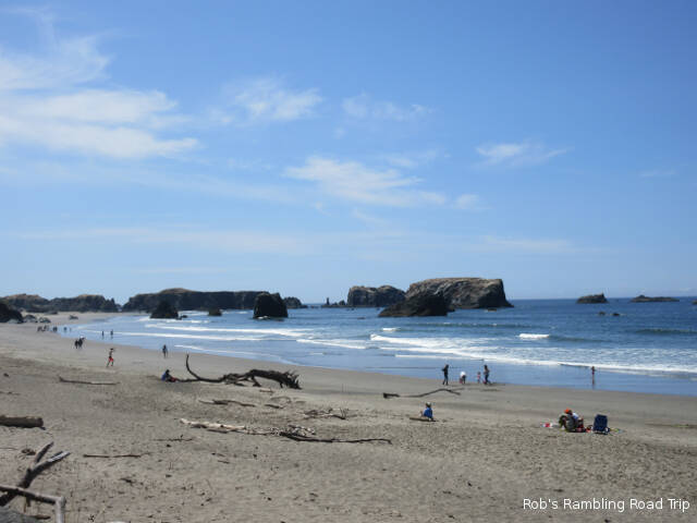
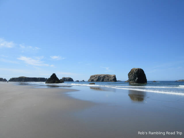
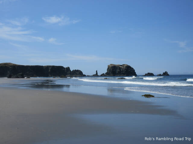
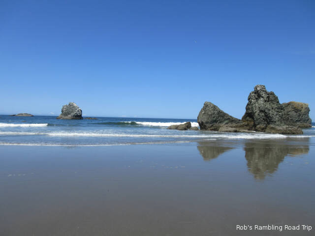
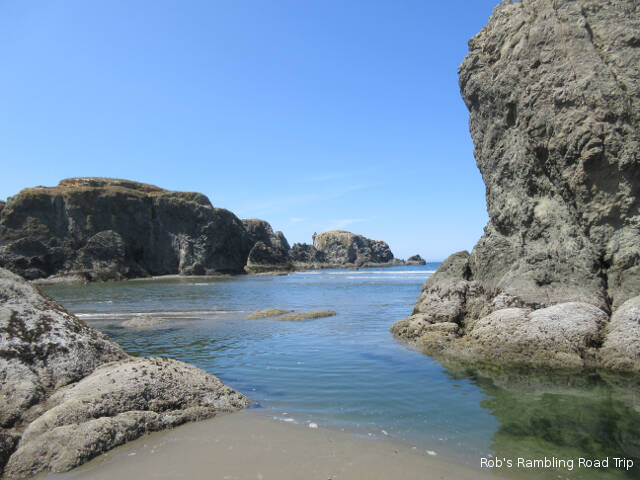
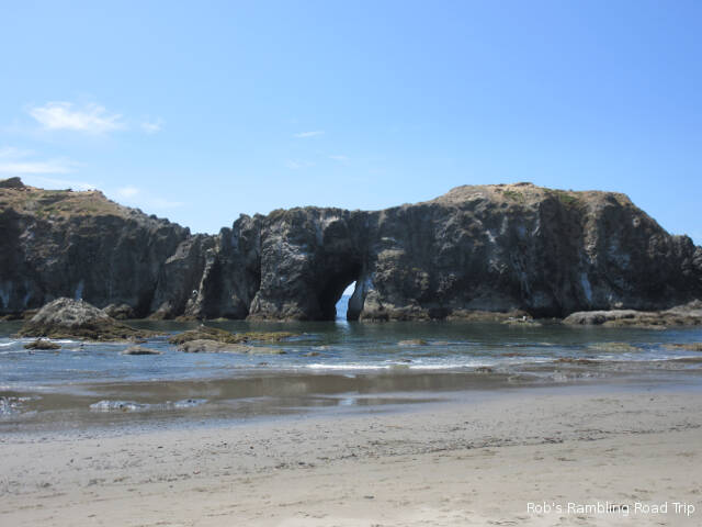
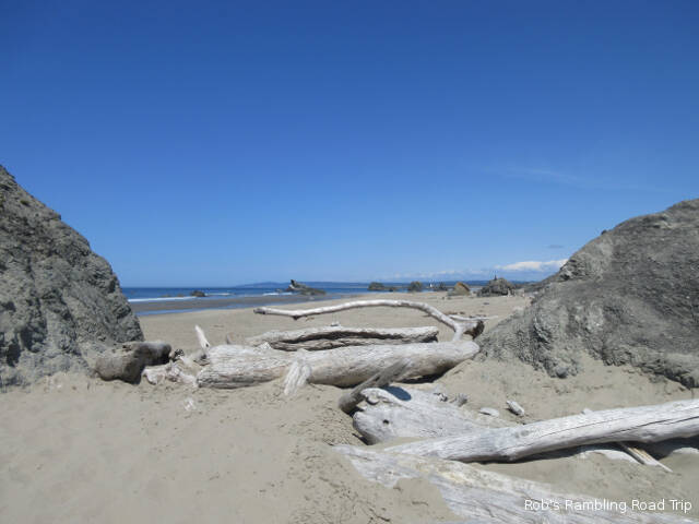
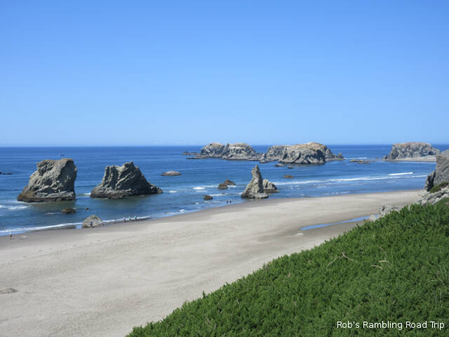
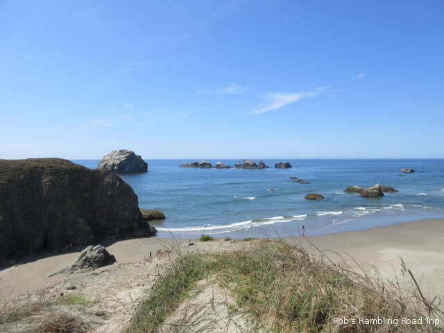
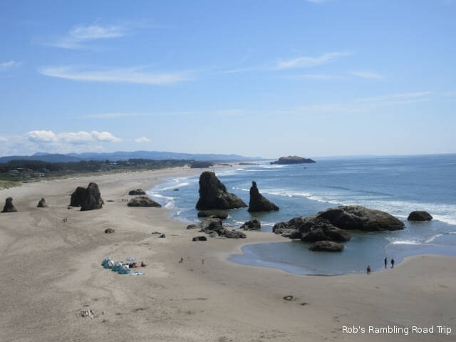
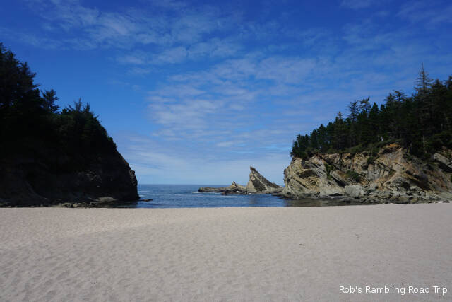
I took advantage of the great weather to take a walk on the beach. The beach I chose was in Bandon, Oregon about 30 miles south of Coos Bay. There are number of named rock formations along the coast in this area. I read the names and looked at the rocks, but the association didn’t click with me. The tide was near low allowing plenty of room to walk. The tidal pools in this area weren’t very interesting. I didn’t see any marine life in the pools. The remainder of this blog post are some of the pictures I took today.
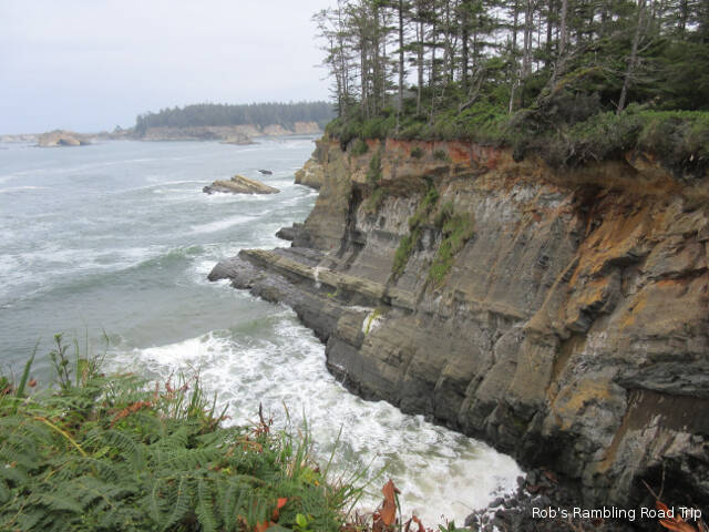
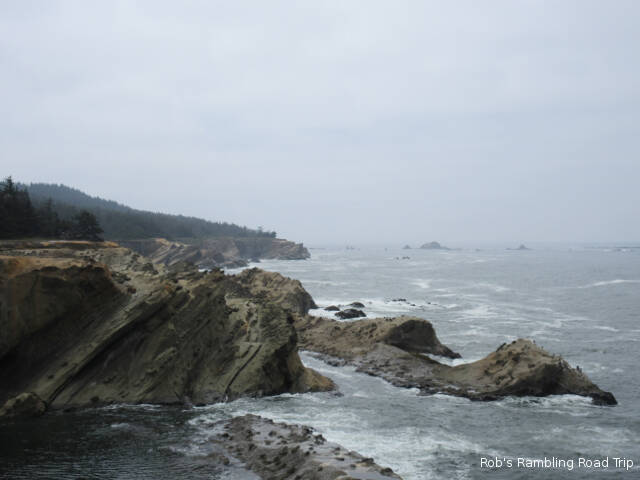
The cliffs are about fifty feet high in this area.
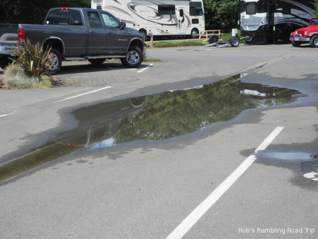
Rain has been in the forecast for the last three days. This morning it finally happened. For about an hour there was a steady moderate rain. By afternoon it was back to mostly sunny in this area, but there were plenty of clouds off to the east.
Evidence of the morning rain storm. This puddle hung around most of the afternoon.
As I’ve commented before it is very hard to understand the weather forecasts in unfamiliar areas. The forecasters give out the facts, but they are tempered with an understanding of the norm for the area. When you don’t know what the normal weather pattern is all about, you don’t know how to interpret the forecast. I don’t know if this mornings rain was above or below the norm for the area. It wasn’t much of a rain storm by most of my experience, but if rain isn’t common this time of year it could have been an exceptional event.
In this area of Oregon another issue with the TV weather forecasts is the coverage. The TV stations have very wide viewing areas use multiple transmitters. Most of the stations in the Coos Bay area have there primary studio located in Eugene Oregon. It is located at the southern end of Willamette valley. They provide four different forecasts in each broadcast. There different forecasts for the coast, the valley between the coastal range and the Cascade mountains, the area on the east side of the Cascades and the passes in the Cascades. They are all very different. The valley area got thunder storms yesterday, which sounded like it was rare this time of year. The bottom line is I still over react to the forecasts.
Blue sky overhead, but lots of clouds off to the east.
I spent the day around my RV home. I took a couple of walks around the park looking for any action in Coos Bay. The same barge with two tugs that I saw yesterday was back today. It must be some kind of training exercise. Once again today the towing tug disconnected in favor of the tug pushing the barge. The only other event of the day was cooking a couple of Brats on the grill for lunch. It was a lazy, but enjoyable day.
I heard two slightly different weather forecasts for the day. One called for a cloudy day and the other called for a chance of rain. Both forecasts were a little bit right and a lot wrong. The day started cloudy as usual, but during the middle of the day it was only partly cloudy. The sun was in and out most of the afternoon. Around the supper hour it clouded over fully and a few rain drops fell on the roof of my RV home. It was over in less than five minutes. The moon is out tonight.
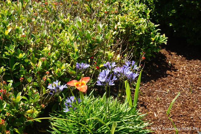
Blossom of the day
Assuming it was going to be a messy day, I planned to get my grocery shopping done today. About the same time as the sun was making an appearance, I headed out for Walmart. As I’ve mentioned before, I go to Walmart for the familiarity of the layout of the store and the availability of the products I’m used to buying. Most Walmarts follow one of a few layouts, but there are still plenty of differences. Today’s big difference, or annoyance, was the bagging at the checkout. Usually I wonder about the merits of putting only one or two items in each plastic bag. It seems to be very wasteful. Today the cashier really filled the bags. She seemed to base all of her packing decisions on size not type. Meat, dairy, produce and bread all got put in the same bag if there was room. You’d think they were trying to save bags, but after filling the bag they’d double up the bag to handle the weight. A quick glance at one of the other checkouts looks like it’s the way the cashiers are trained at this store. I wonder if they use less plastic?
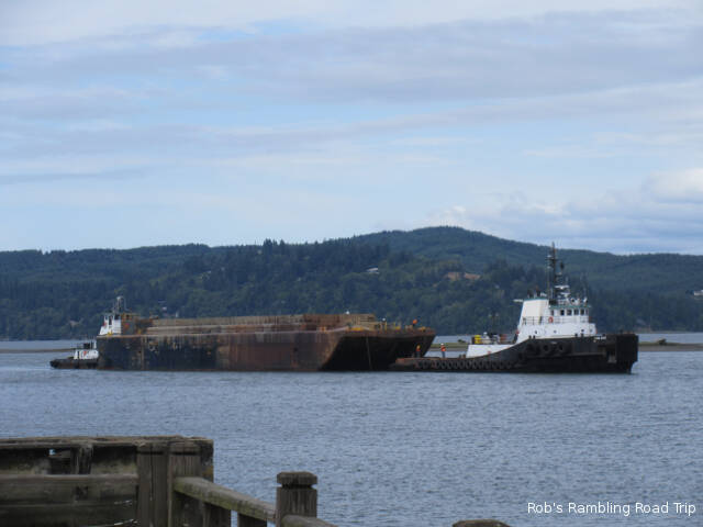
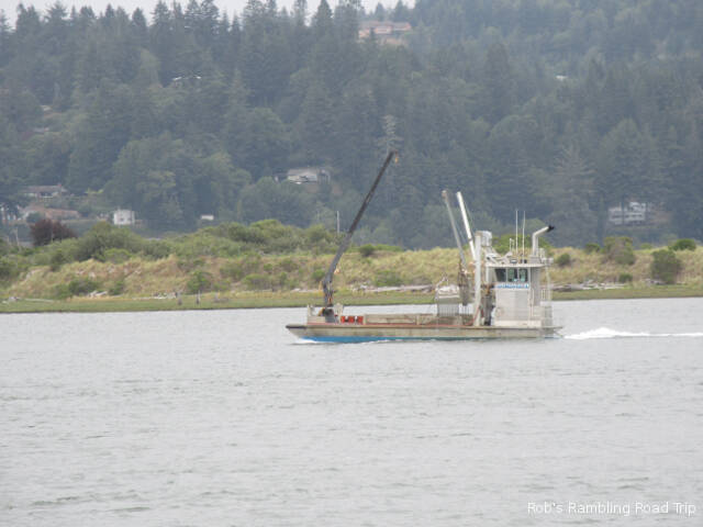
Back at the RV park this afternoon I watched the activity out in the bay. There hasn’t been much going on in the bay while I’ve been here, but today a barge was moving up river. In front of the park a hand off was being made between two tug boats. The tug that toad the barge into the bay and up river was getting disconnected. A new tug had taken over pushing the barge from the rear. Seeing workers in hard hats walking on the barge while underway was unusual.
A barge with two tugs heading up river in the bay.
The sun didn’t get the message that the forecast called for a cloudy dreary day. Shortly after noon the sun broke through the clouds and warmed the air up to around seventy degrees. To take advantage of the bright sunny afternoon, I headed over to the coast.
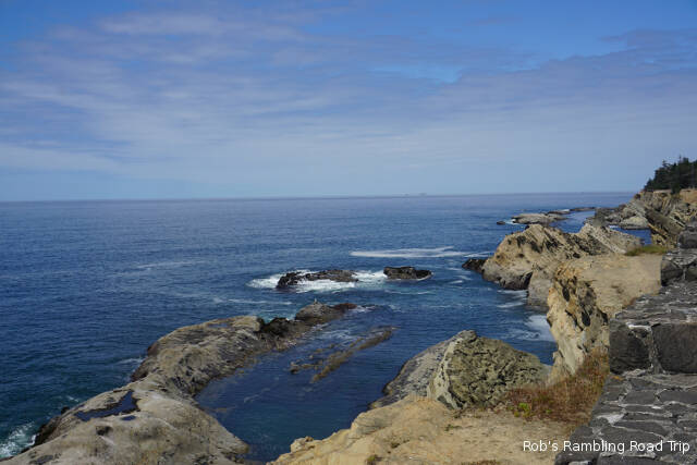
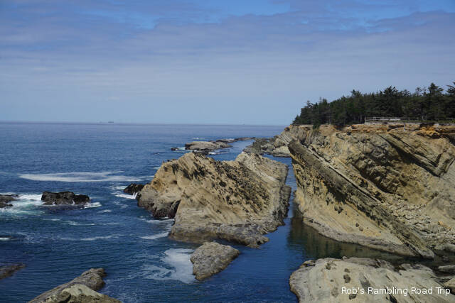
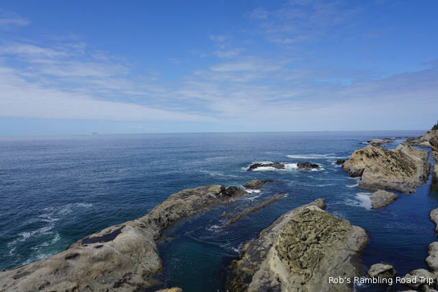
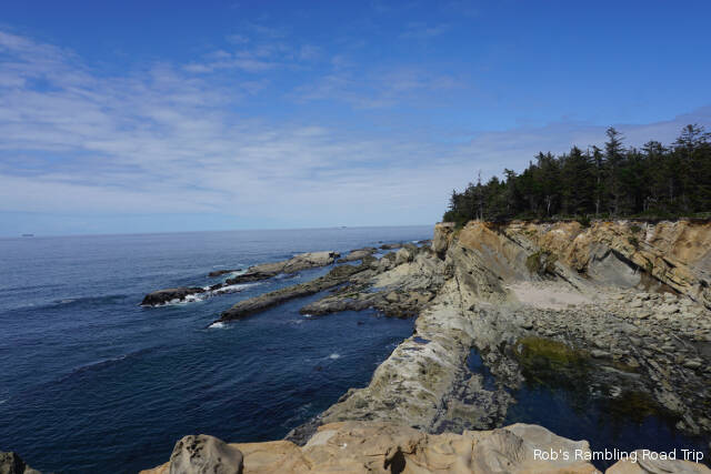
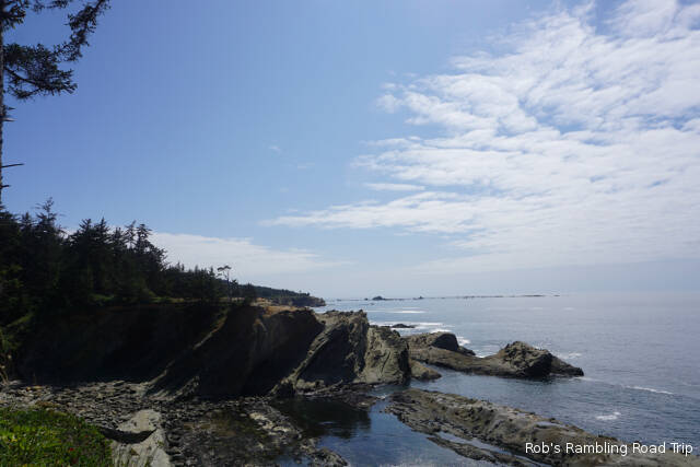
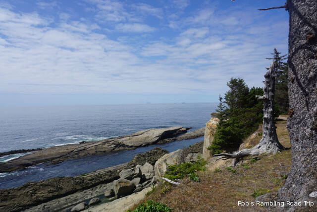
There are three state parks on the road out to Cape Arago. I stopped at the first park, Sunset Beach State Park, on Sunday. Today I drove to the end of the road at Cape Arago State Park. It had some nice views into the ocean and to the south along the coast. I imagine it would be a good place to see whales, but not today. The real scenic cliffs and rock formations is along the coast between Sunset Beach State Park and Cape Arago.
The state park between Sunset Beach and Cape Arago is Shore Acres State park. It is an only home site complete with Botanical Gardens and incredible views of the Pacific from a rocky point. I got some exercise, saw some nice stuff and saved a few bucks for parking by hiking in along the coast from the Sunset Beach State Park area.
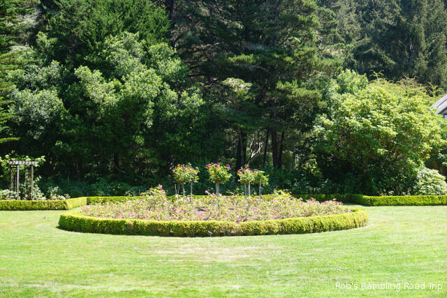
I took over 200 pictures this afternoon. I’m going to let some of them tell my story starting with the botanical gardens at Shore Acres State Park.
Botanical Garden at Shore Acres State Park
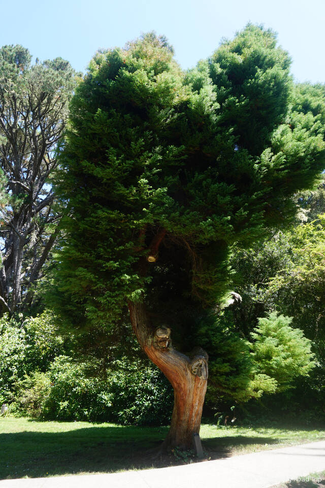
Japanese Plume Cedar
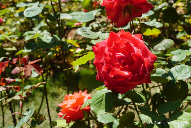
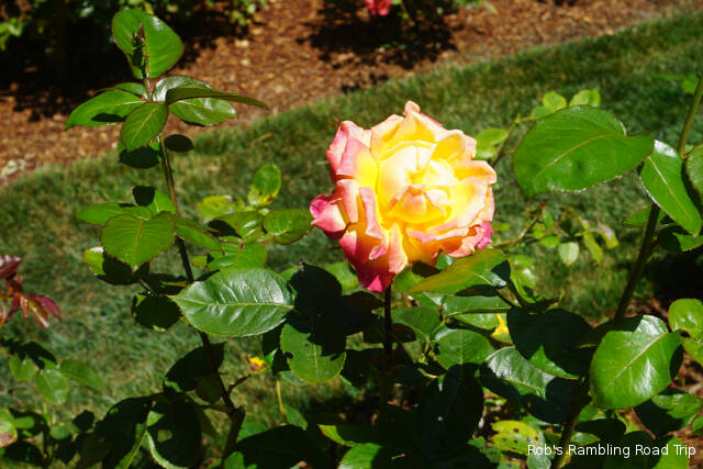
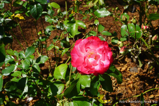
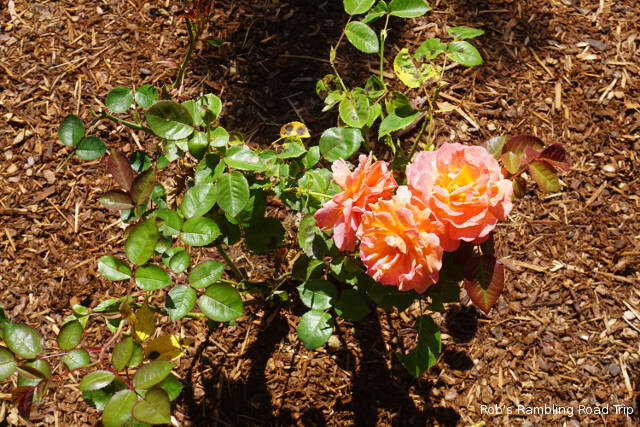
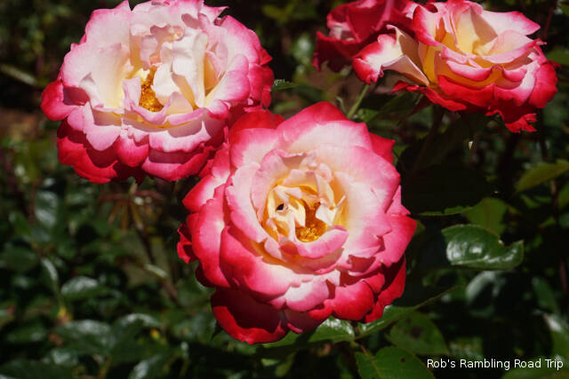
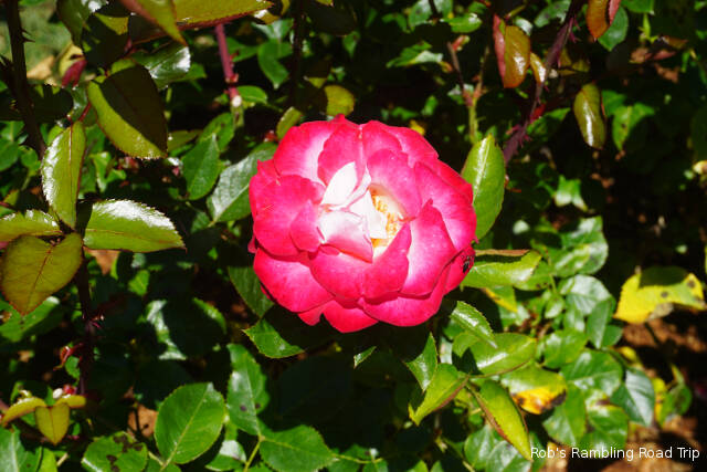
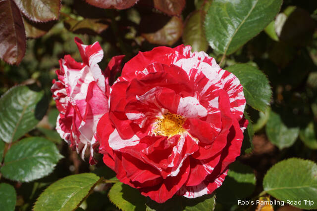
Blossoms from a large rose garden at the back of the Botanical Garden
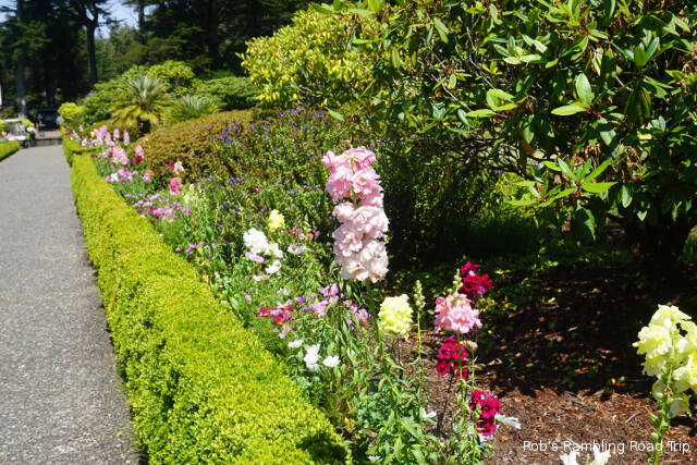
Flower lined formal walkways
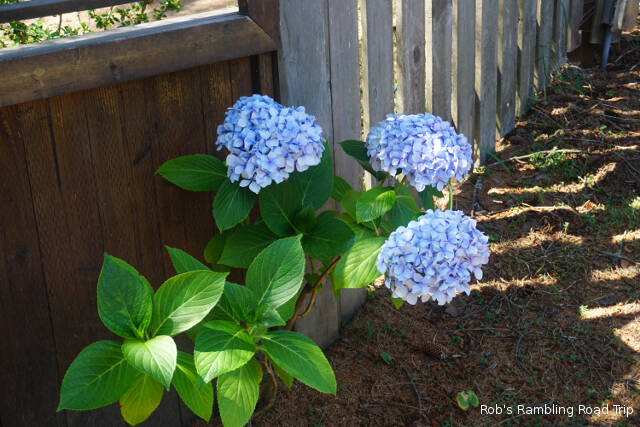
Random plantings along the fence line.
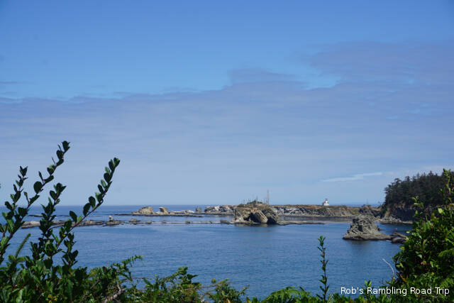
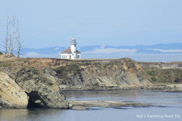
View of Cape Arago Lighthouse near the mouth of Coos Bay
Cropped closeup of the Cape Arago Lighthouse
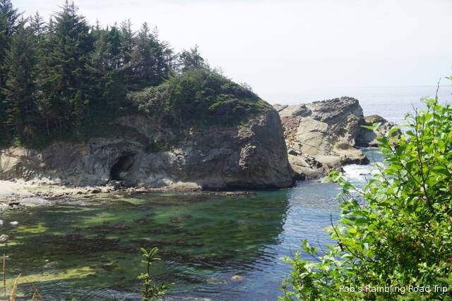
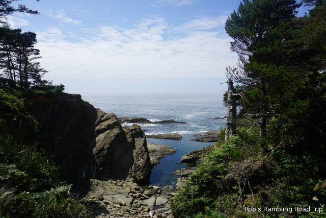
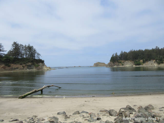
The incoming tidal water was very clear in this sheltered cut in the rock cliffs.
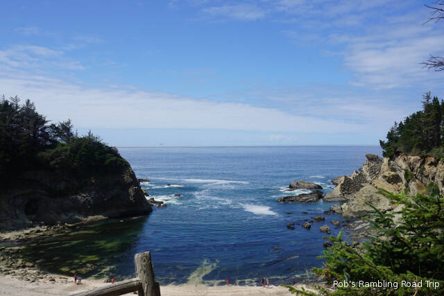
Simpson beach below the Shore Acres State Park site of the old Simpson mansion.
I watched the sea lions try to get from the water onto the rocks. They need the help of a good wave.
She pretended I wasn’t there while watching me all the time.
I pretended she wasn’t there while snapping pictures from fifteen feet away. A hiker from the other direction finally spooked here.
Today’s weather was similar to Tuesday. It was very cloudy and cool all day. With the exception of a little drizzle just before dawn, it never rained, but looked like it could at any minute. The trend is forecast to continue tomorrow.
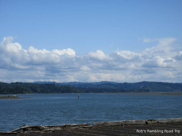
Coos Bay shipping channel in the background is advertised as 35 feet deep at low tide.
Late this morning I drove into downtown Coos Bay to check out the weekly farmers market. The market takes over several blocks of Central Avenue every Wednesday from 9AM-2PM. There was a good mix of farm products, crafts and food vendors. There were several well stocked produce stands most of which looked to be locally grown. Other stands had lots of blue berries and strawberries with peaches and apples thrown in to widen the selection. I always expect to see a strange thing or two at a farmers market. Today’s oddity was at a stand selling grass feed beef. They were also advertising rabbit meat.
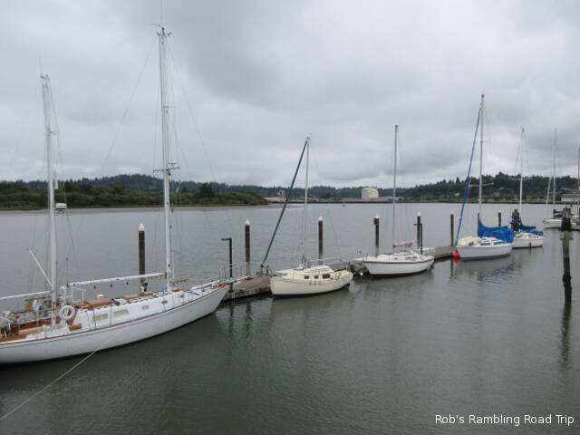
Sailboats at the Coos Bay marina.
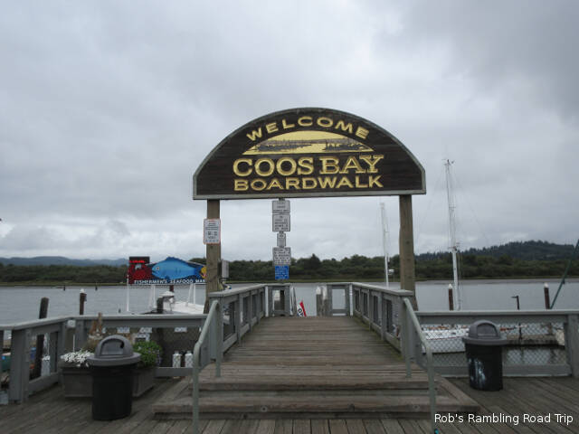
While I was downtown I toured the waterfront boardwalk and learned a little bit of the towns history. The town has only been called Coos Bay since 1944. It was originally incorporated as Marshfield in 1874. The community is the largest population center on the Oregon coast. The primary industry in the area centers around the natural harbor of the bay and the pine forests inland. Ship building and shipping are primary industries. From the 1940s to the 1970s Coos Bay was the worlds largest lumber shipping port and is still a major player today.
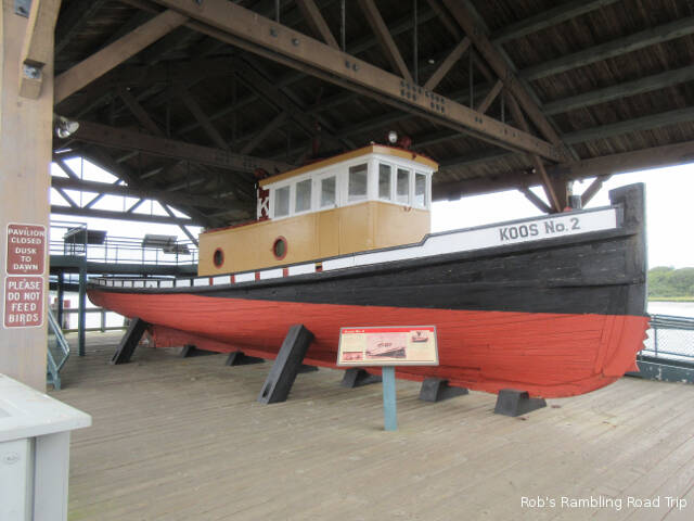
Coos Bay tugboat used in the early 1900s.
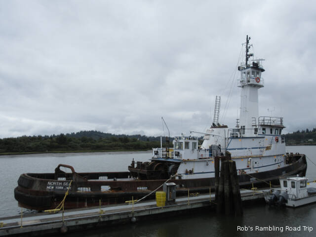
The boardwalk has exhibits and historical placards along its length. In the water beside the boardwalk is a marina area. Most of the boats tied up are sailboats that look like they have been there for a while. The boats are all buttoned up for protection from the elements. There are also a couple of odd boats tied up at the outside bulkhead. The one that stands out the most was a large ocean going tug with a New York registry. It seems to be a long way from home and is currently being painted.
Tugboat from New York, NY tied up at the bulkhead just north of the marina. The smokestacks are covered in plastic and a ladder is on the far side to support painting. What’s it doing in Oregon?
It was gray day with a high temperature in the mid sixties. I had the feeling it was going to rain at any minute, but that wasn’t in the forecast. This is just a normal coastal condition along this part of the shore. Sunshine is not in the forecast until the weekend.
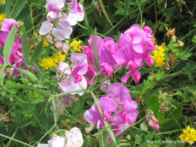
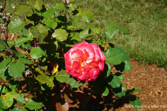
Blossom of the day
Getting motivated to leave my RV home this morning was difficult. Just before noon I headed north along US 101. Just north of Coos Bay the Oregon coast seems to change from rocky cliffs to sand dunes. I drove about thirty miles north to the next major river crossing. The Umpqua River meets the ocean in the Winchester Bay Salmon Harbor area.
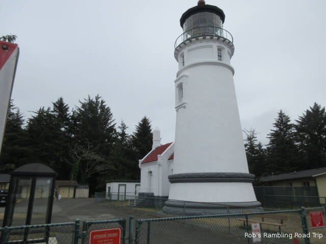
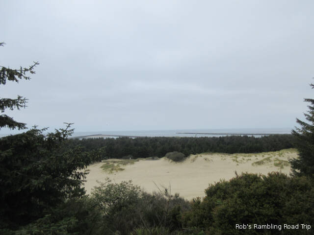
Umpqua River LighthouseView of the Umpqua River Inlet from the lighthouse.
I visited the Umpqua River Lighthouse that overlooks the inlet from 100 feet above on top of a hill a good distance back from the coast. The area between the lighthouse and the coast is filled with sand dune and pine trees. It was very different from the area south of Coos Bay. Later in the year the hill the lighthouse is on becomes a major whale watching area. Today it was hard enough to see the end of the inlet jetties, so any random whale would be very hard to spot. Most whales are spotted between November and January from the observation area.
Fishing vessel in Coos Bay in front of the RV Park. The bay is home to several Oyster farms. I think this is one of the boats used to support that activity.
The overnight clouds never departed today. They lifted up enough that visibility at ground level was fine, but the sun wasn’t able to heat the air very much. The high temperature was well under seventy. Tomorrow is forecast to continue the deteriorating weather trend.
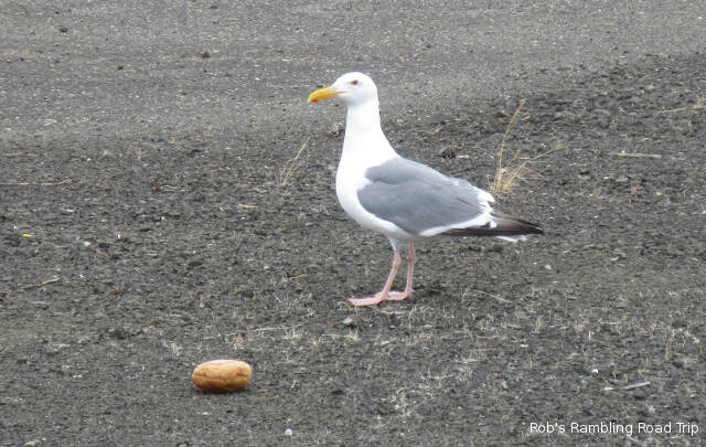
A regal pose for a common bird.
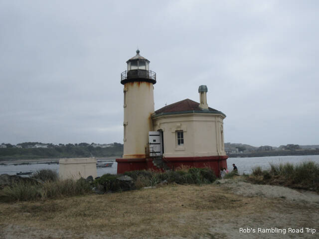
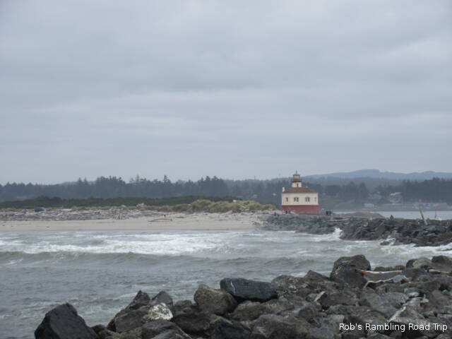
I watched the tide go out in Coos Bay waiting for the sun to break through the clouds. Shortly before noon, as the tide reached full low, I gave up the wait and headed out for the day. I didn’t have any real plan other than see more of the Oregon coast. I ended up south of my RV home at the Bullard Beach State Park. In addition to the beach the park contains the Coquille River Lighthouse. It is one of many lighthouses along the coast that used to be a primary aid to navigation. This light house like most of the others has been replaced by technology and other more modern aids to navigation.
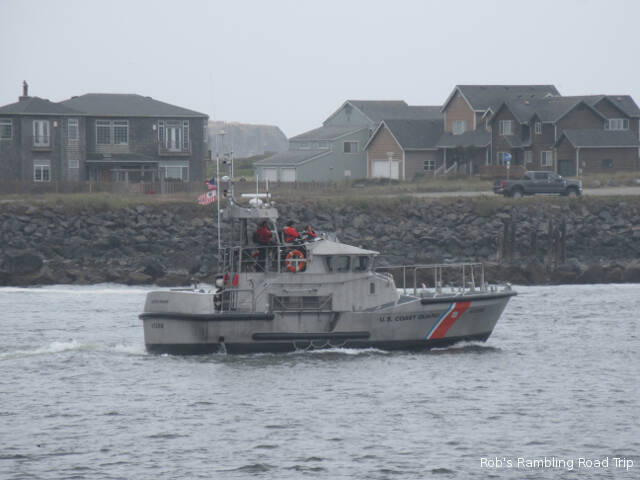
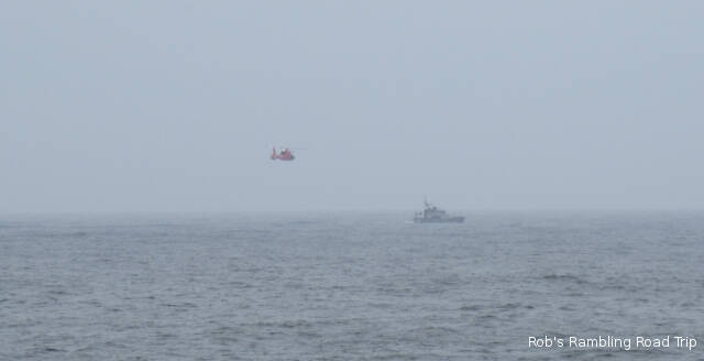
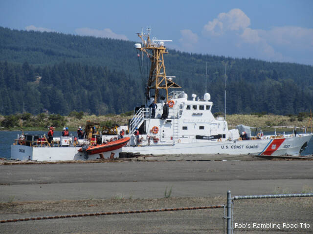
Coquille River LighthouseCoast Guard boat heading out the river for the ocean. Coast Guard Helicopter rendezvous with the Coast Guard boat.
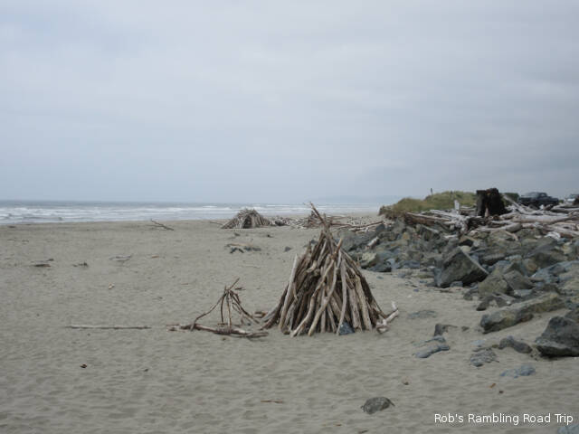
I walked the beach dodging all of the big pieces of driftwood that littered the beach. Somebody had put a lot of work into collecting many of the pieces into big piles. The intent may have been to have a fire on the beach, but right now the entire area is under a fire ban. The wave action in the ocean was very active with the incoming tide supported by the wind. A few of the waves were breaking over the jetty on the north side of the Coquille River when I walked out to the end, but the view was worth it.
Stacks of driftwood on the beach
Looking south from the north side jetty of the Coquille River Inlet.
Coquille River Lighthouse from the north side jetty.
The heavy clouds hung around longer this morning. It was after eleven before the sun made an appearance and it was lightly filtered most of the day. With a strong north wind, the temperature stayed in the sixties all day.
Coast Guard boat passing the campground.
Shortly after noon I headed for the coast. It was time to verify that the Pacific Ocean was still there. My first stop was at the beach in Sunset Bay State Park. The view out into the ocean was restricted by cliffs along both sides of Sunset Bay. The tide was away from the shore but rising making it dangerous to explore along the cliffs. Getting trapped by rising water would be a good way to start my visit to the coast.
Beach at Sunset Bay.
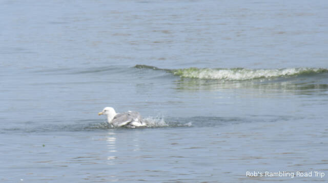
Gull getting ready to surf a wave.
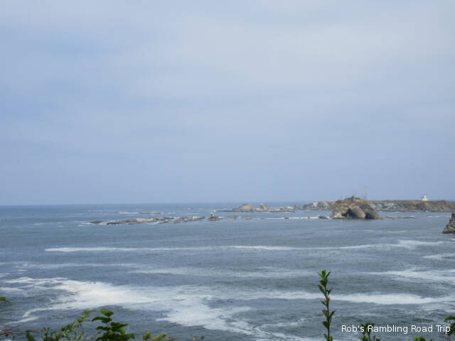
Incoming tide looking toward the south breakwater for the entrance to Coos Bay inlet.
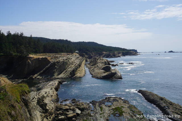
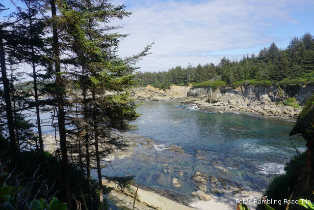
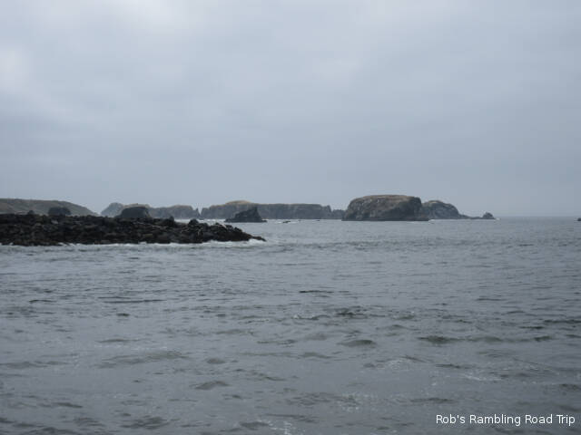
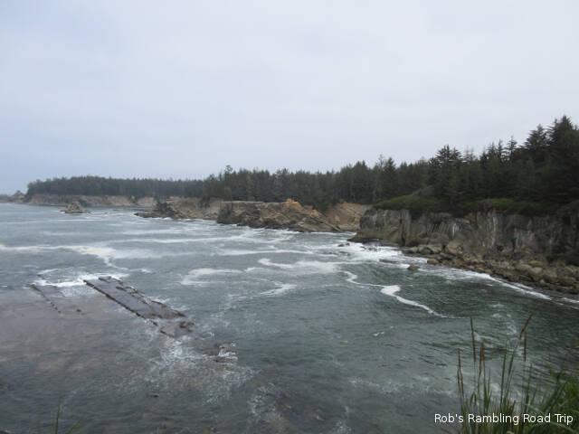
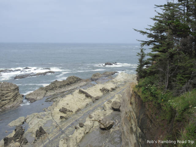
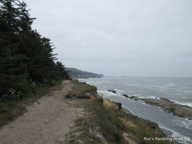
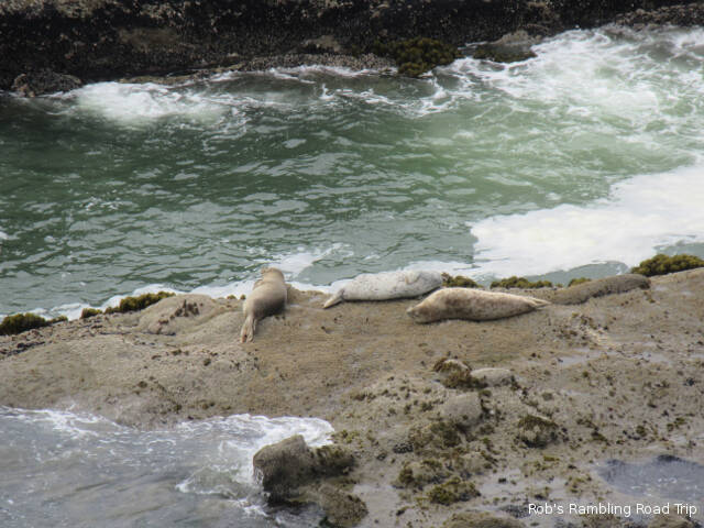
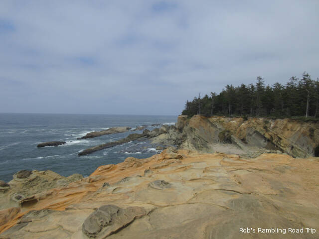
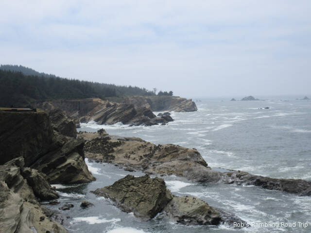
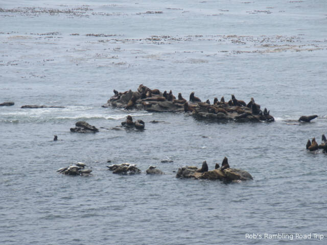
Next up on Hike along the cliffs overlooking the rocky shore. The views of rock formations and breaking surf were majestic. I even got to see some sea lions and seals on the rocks. I only walked one section of the trail. I wasn’t prepared for a long hike. The sun along the shore was heavily filtered by the clouds making most of my pictures look washed out and as usual my binoculars were back at my RV home. I’ll return another day with my binoculars and some water for the hike. Hopefully, the sun will be shining next time.
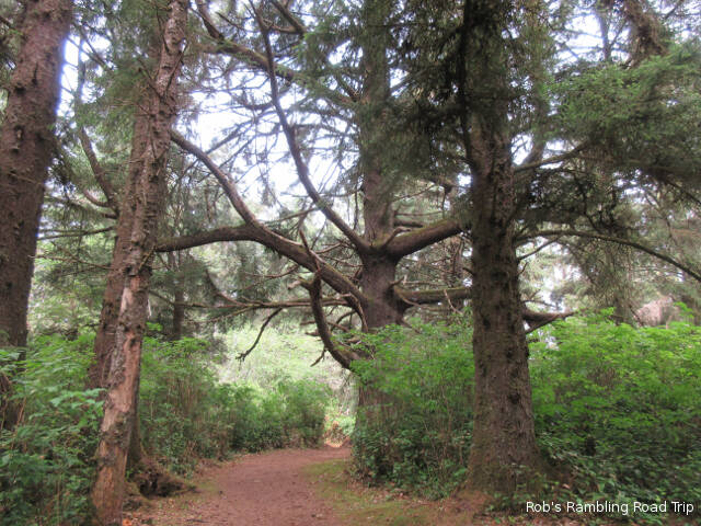
Trail through the forest to the cliff edge.
Trail along the cliffs.
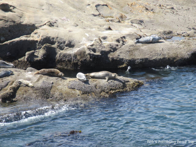
Sea Lions
Seals
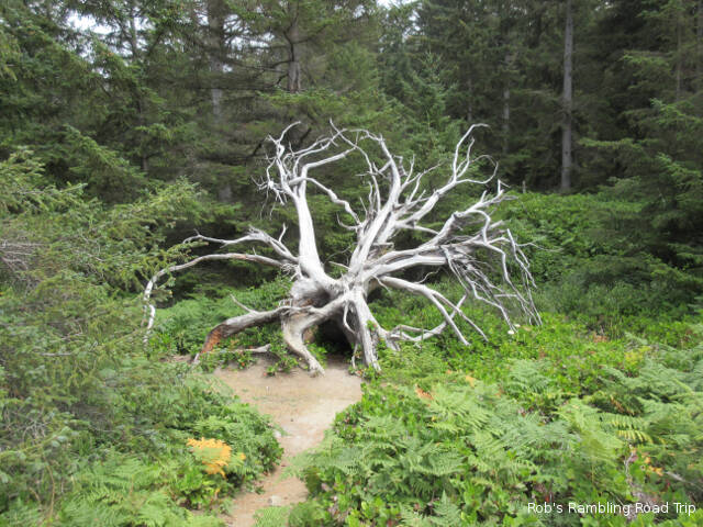
Picturesque tree roots.
I keep trying to draw parallels between the Pacific coast and the Atlantic coast. The cliffs are one difference. There aren’t as many places with high cliffs on the Atlantic coast of the United States. The other thing that I’m confused by is the lack of boat traffic. On the Atlantic coast there always seems to be a fishing boat, pleasure boat or an offshore ship in sight. Out here even near the port areas I’m not seeing many (any) boats from horizon to horizon. Maybe I’m just in the wrong place.
Last night just before sunset the clouds that had been just off shore most of the day moved inland. There was a very low cloud cover all night. It didn’t burn off until close to 10AM this morning. Eventually the temperature got to about seventy with a steady to strong north wind. This seems to be the normal weather pattern for this area. The temperature is in the high 80s to low 90s on the other side of the coastal mountains less than sixty miles to the east.
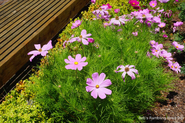
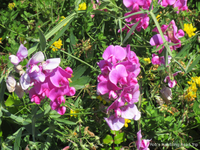
Today’s picture of a flower blossom.
I did my usual first day at a new location drill. That involves removing the bicycle and rack from the car along with a few other outside setup chores. Once the car was in touring trim, I took an orientation drive around the area. I found the major roads and the major stores. When it comes time for groceries I’ll know were to find the Walmart. Thinking it was a nice clear sunny day I headed for the ocean to check out the beach and coast line. Except it wasn’t a nice sunny day at the coast. The closer I got to the ocean the cloudier it got. When the cloud cover got low enough that it became foggy, I decided to turn around and try again another day.
The casino associated with the RV park I’m staying at is having a Food Truck competition this weekend. After my drive around town I walked over to check out the Food Trucks. The trucks are all in a fenced in parking lot. It costs $5 to enter the area to buy food from the Food Trucks. You then get to vote for your favorite. I wasn’t hungry and didn’t see anything that needed a closer look, so I just walked along the outside of the fence. If I think of it tomorrow, when I’m hungry, I might give it a closer look.
Tomorrow I’ll head for the coast again. This time I’ll have a full tank of gas and aim for the early afternoon. That window of time seems to have the highest probiblity that the clouds will be elsewhere.
I got started on my 130 mile drive up the coast about 10:30AM. It was a sunny clear day over the land for the drive. A fog bank hovered a short distance off shore. The temperature climbed to around seventy degrees.
Following US 101 up the coast presented just about every type of driving. It was mostly a two lane road, but a couple of areas had been upgraded to a divided highway. Between the slow crawl through towns the road followed high above the shoreline clinging to the edge of the cliffs or the road passed through forests well inland from the coast. There were several “surprise” hills that I couldn’t get a running start at the climb, so the RV bogged down to a forty to fifty mile an hour crawl up the slope. The down hills also required some down shifting. A lot of partially repaired road surfaces got the RV bouncing around more than I was comfortable with. The patched road was uneven. Often in just the wrong way. When the RV is the middle of a turn to the right a dip that only the left side goes down into is not fun to control.
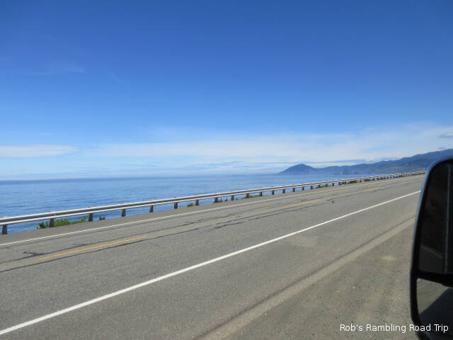
View of the Pacific Ocean from a pullout along US 101. The dark line crossing from the left near the middle of the picture is a fog bank out in the ocean.
It would have been nice to stop along the way, but without a navigator it is hard. The signs announcing a road side turnout don’t give you much warning. They usually were on the wrong side of the road and traffic prevented me from slowing down enough to determine if there was room for a big RV. I will be returning to various points along my route in the car over the next few weeks. I only managed to stop at one turnout on the inland side of the road to get a good look at the fog bank out in the Pacific Ocean.
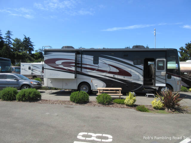
Site 49 at the Mill Casino Hotel and RV Park.
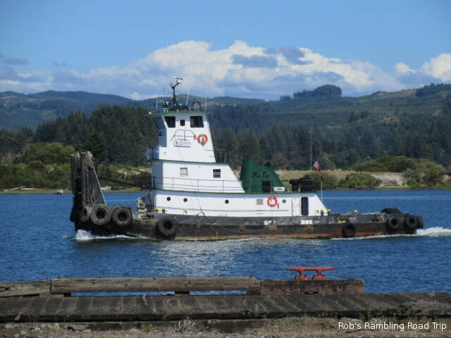
I arrived at my destination for the next two weeks shortly after 1PM. I’ll be staying at the Mill Casino Hotel and RV Park on the shore of the Coos River in a harbor area that is part of Coos Bay. This is a modern facility for RVs with paved full hookup sites separated by plantings in rock filled beds. The view of the boat traffic out my window should be entertaining.
Working Tugboat passing by my RV home during the afternoon.