The Green River

Saturday August 5th 2017

It was a sunny day with a high temperature in the mid 90s. As I’m starting to right this blog entry at 8:30pm a thunderstorm is moving into the area. The sky to the west and south is black and to east the sky glows red with the reflected sun passing over the top of the western clouds.

I slept in this morning. Somehow I’ve gotten into a sleep pattern that has me getting to sleep around one in the morning and waking up close to nine. This morning I slept even later. I need to break this pattern. I’m going to bed around eleven but still not sleeping for a couple of hours. Over the next few days, as I start to tour the area national parks, I’m going to have to set an alarm to get moving earlier. My late start today ended all thoughts of going to the National Parks this morning. I was only lukewarm to the idea anyway.

s1

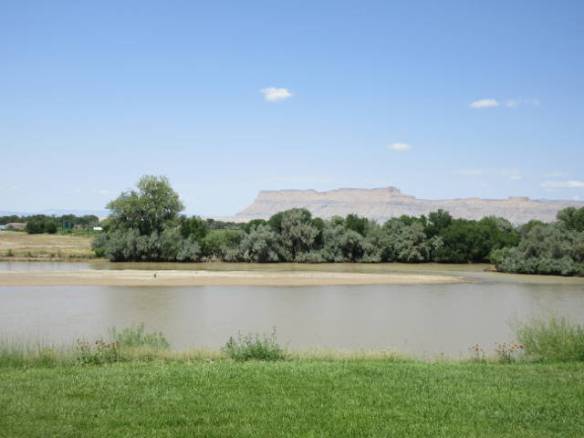
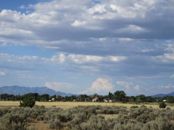
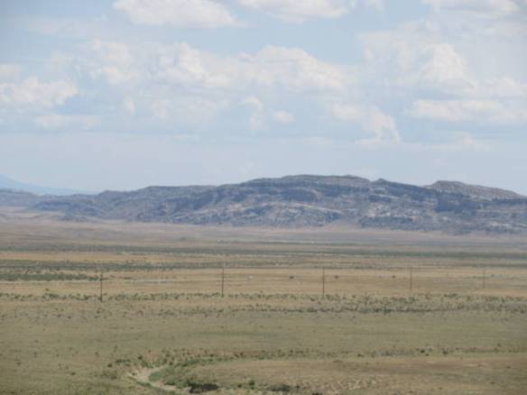
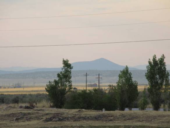
Looking west across the Green river in Green River Utah.

Today I learned about the Green River. The John Wesley Powell museum is across the street from the campground. It is located on the east bank of the Green River. It has a number of display boards that describe the history of the river and the crossing here in Green River Utah. The town is here primarily because this is the only easy place to cross the river for many miles in either direction. South of here the river is in deep canyons all the way to the Colorado river. It was first used by European settlers in the second half of the 1700s. The Old Spanish Trail from Santa Fe New Mexico to California crossed the river in this area. The region was explored by the Americans in the 1840s when John Freemont traveled through the area. In 1869 the river was explored by John Wesley Powell.

s2

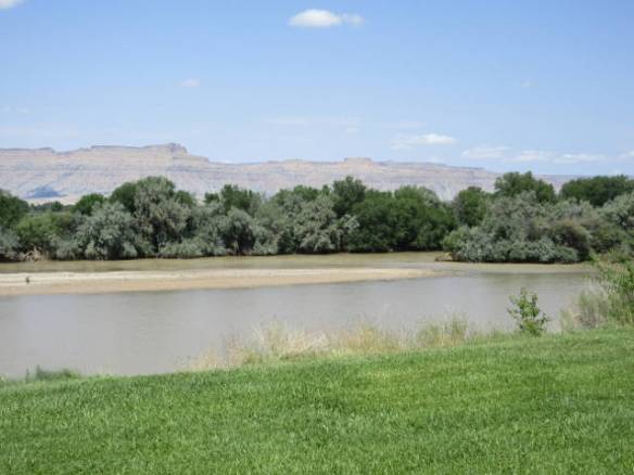
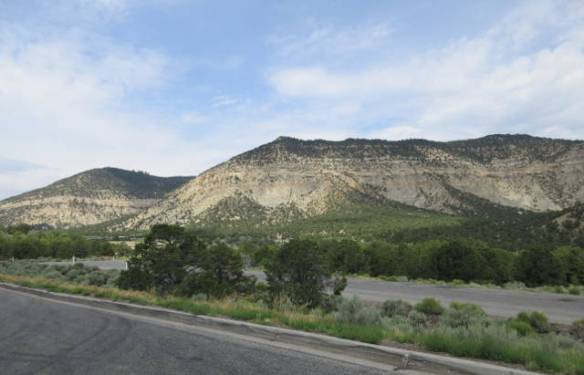
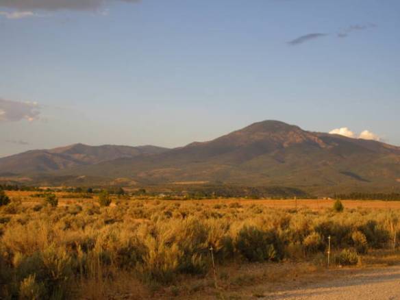
Looking north west across the Green river in Green River Utah.

Powell traveled the river from its headwaters in Wyoming down into the Colorado River all the way to where the Virgin River joined the Colorado River. That trip took his expedition through the Grand Canyon to a point that is covered by Lake Mead today. Most of the location names along the rivers owe their names to the Powell expeditions. The Green River joints the Colorado River in the Canyonlands National Park area.

s3

Green River full of silt. Looking upriver from the bridge in Green River UT.

My other “major” accomplishment today was finding the local grocery store. I was wrong in my assumption that I could find bread in one of the truck stop convenience stores. They had plenty of chips, cookies and pastries, but no bread. I found the grocery store under a sign that emphasized the bakery part of the business. It was a well stocked little store. I now have bread for sandwiches and English muffins for my morning coffee.

Green River UT

Friday August 4th 2017

It was a changeable weather day. Starting early last night this area has been subject to thunderstorms. There were three or four overnight into this morning and they resumed around 5:30 this evening. In between it cleared off and the sun came out to heat things up. These thunderstorms haven’t dropped a lot of rain, but have had strong winds with thunder and lightning. The sound of rain on the roof only lasted a couple of minutes and wasn’t very hard. Areas to the southwest of here have been in a flash flood watch so I suspect there are storms producing more rain.

f1

View to the Southeast toward Arches National Park from the rest area on Interstate 70 near the route 191 interchange.

During the calm between the storms, I drove around the area in an area familiarization tour. This town has under one thousand residents and not many resources to support them. There are several motels and restaurants along with truck and car repair facilities all designed for the travelers on Interstate 70. Green River Ut has the only significant amount of services in the over 200 miles between Grand Junction CO and Richfield UT.

One strange feature of the town is an Amtrak station. The California Zephyr train from Chicago IL to the Sacramento CA area stops here. I assume it is because of the national parks south of here, but the station has no services. As near as I can tell it’s a piece of concrete beside the tracks.

In addition to the convenience stores at the truck stops in town, there is a grocery store. It’s not on the main road through town. I haven’t found it yet. The staff here at the campground said most of the locals drive 60 miles or so north to Price UT or east 100 miles to Grand Junction CO when they need supplies. Since I only need bread right now, I’ll probably be visiting one of the convenience stores. They certainly are more convenient.

f2

Visitor to my campsite.

f3

They didn’t stay long.

The current monsoon based weather pattern is forecast to continue for the next couple of days. It is also the weekend. I have learned that touring National Parks on the weekend is a little more crowded than during the week. Wet weather and crowds may influence my touring plans for tomorrow. If I don’t head south to the National Parks, there are other things I can do in town or to the north.

Travel to Green River

Thursday August 3rd 2017

Today was a travel day to Green River Utah. It is about 160 miles from Fillmore Utah. The last one hundred and ten miles was along a very mountainous and picturesque section of Interstate 70. I started the trip around 10:30am in a very warm, but overcast day. At the end of the trip around 2PM in Green River it was clear with bright sunlight around 100 degrees Fahrenheit. Setting up camp was not fun on the sunny side of the RV.

I was not looking forward to today’s trip. The section of Interstate 70 was brand new territory for me. My research indicated it was a lot of up and down through narrow canyons and windy plateaus. It turned out to be all that and more. A several mile section was under construction resulting in a single lane of travel. I had a good backup of cars behind me. The engine got a lot of work going up and the transmission got a lot of work going down.

When possible, I tried to take a few pictures through the windshield. It is very interesting geology. I didn’t get pictures of some of the most interesting areas, because I had to have two hands on the wheel along with all my attention on the road. There are a number of viewing areas and rest areas along the road. I only stopped at one. Some of the pull offs looked like they might be a nightmare to negotiate in the motorhome.

r1

This series of pictures show the scenery on I70 from Salina UT east to Green River UT

r2

r3

r4

r5

r6

r7

Site 31 at the Green River KOA.

I will be staying in Green River for the next eleven days. I plan to use this as a base to visit Arches NP, Canyon Lands NP and some of the other parks and sites in this area. The Green River KOA is my home during my time here. It is level, has a few trees and some grass, but is mostly sandy desert like terrain.

Uploading Photos

Tuesday August 2nd 2017

It was another sunny day in the mid 90s with low humidity. For the second day in a row I didn’t do anything particularly blog worthy. I’m ready to move on, which is exactly what I am going to do tomorrow.

t1

View across the range to the west in the hazy setting sun.

I spent today doing various chores around the RV and getting ready to move on tomorrow. One task I accomplished that is a little outside the norm is uploading the pictures I’ve taken since the beginning of the year. This campground has very good wireless internet access. A speed test shows a transfer rate around 20MB/sec which is very good. I usually see internet speeds in campground around 1MB/sec. My 4G cellular data rates are better than many campgrounds, but I have a data cap so I don’t like to use it to upload pictures.

Today I uploaded more than 3500 images that I have taken since the beginning of the year. I take lots of pictures to record my experiences. I select a few to be used in this blog. I use Google Photos to store the photos in the cloud. It is easy to use from my smart phone and only a little more complicated from my laptop. I don’t rely exclusively on Google to retain the photos. I have all the files on my laptop and I also keep copies of the files on two portable backup drives.

I have enjoyed this campground, but not necessarily the area. The campground staff works hard to keep the campground clean and looking nice. They check every site after the visitors leave and clean the fire pit as necessary. Every day they setup sprinklers to water the grass between sites. They move them around every couple of hours. It’s working. The grass between the sites is a deep green. It looks like they had some nice flower gardens earlier in the year, but the plants are passed blooming now.

Rainbow to End the Day

Tuesday August 1st 2017

Today’s blog isn’t going to be a page turner. When I don’t do anything interesting, the blog reflects it well. It got to 95 degrees today and the next couple of days are predicted to be warmer. The monsoon weather is forecast to return over the weekend to cool things off. Until then the air conditioning will get a workout.

m1

Mountain view in the evening lighting.

Since today was the first of August, I started to look more seriously at my plans for the fall. I’m not sure where the summer is going, but it seems to be half over already. The month of August is pretty clear. I’ll be touring the national parks of Utah. There are parts of northern Arizona that I’d like to visit during September. In particular, Grand Canyon National Park, the Verdi valley and Sedona AZ are on my list. The problem starts when I look for available campsites before it gets cold enough to snow at altitude.

m5As I look at the planning process, I have one known date and one strong desire. I have a reservation in March of 2018 in Florida to see Grapefruit league baseball games and the strong desire is to settle in one place for a month or two. In April, I thought I’d spend December in the Lake Havasu AZ area. Further investigation didn’t identify a good place or as much to do in the area as I expected. The next thought was to spend December in San Antonio Texas. I’m still working on that idea. I’ve identified a possible campground and confirmed that there is plenty of things of interest in the area.

There is a lot of territory between where I am now and Texas. There is also several months to cover the distance. The next step is to fill in the gaps before I change my mind again. The trick is knowing enough of my itinerary so I can make reservations with some confidence.

m2

Rainbow behind the campground.,

m3

Where’s the pot of gold?

This afternoon I made another attempt to visit the Territorial Statehouse State Park in downtown Fillmore. This time I found the grounds filled with little tents. People were setting up awnings and cooking facilities. The parking facilities were filled with cars, trucks and trailers parked across multiple spots. Other than the tent city, which was probably boy scouts or something similar, there didn’t seem to be anyone around. I drove slowly around the block trying to decide if I wanted to get out of my air conditioned car. I concluded it wasn’t worth the walk from the available parking well away from the tent city.

m4

Still no pot of gold.

This evening a big black cloud passed through the area. It generated a lot of wind, but no rain. There was moisture in the cloud, because a very distinct rainbow was visible between here and the mountains. Since I could see where it intersected the ground, I was tempted to go in search of the pot of gold.

Trip Around Some Mountains

Monday July 31st 2017

This morning over breakfast I watched my neighbor pack up his carefully setup camp to move on. All of the work he put into setting up his camp yesterday was repeated this morning to put everything away. I understand getting a few things out that you need, but planting a bunch of little flags with a solar light and a string of LED lights is going too far for a one night camp. Everybody has their own ideas and priorities.

mon1

Through the window picture of the area behind one set of mountains.

Today I decided to see what’s on the other side of the mountains that are behind the campground. There are two ways to get behind the mountains. I could go north 25 miles to US 50 east or go south 30 miles to Interstate 70 east. In addition to my general curiosity, I also want to scout out the route I will take on Thursday when I move to my next destination. I decided to make a loop; out on US 50 and back on Interstate 70. It’s about one hundred and fifty miles.

US 50 had a gradual climb up about 1000 feet to about 6000 total feet. It then had a long occasionally steep descent into the town of Salina on Interstate 70. As I descended into Salina the terrain changed. More red rocks and striations were visible on the mountain sides. The valley floors were still cattle land with a few planted fields. On the way back, Interstate 70 had a significant climb to over 7000 feet with an accompanying descent.

mon2

Through the window shot of clouds gathering over the top of the mountains.

My conclusion is that there isn’t anything more interesting on the other side of the mountain than my current side. On Thursday I will follow the same route to Salina before going east on Interstate 70 instead of west. Using the US 50 route is a little shorter and seems to have less up hill and down hill issues. The one hundred and ten mile stretch on Interstate 70 to Green River is longest section of Interstate without services in the country. It will be an interesting drive.

Back at the campground this afternoon, I watched the new arrivals come in and setup. None of them setup as elaborate a camp as last nights neighbor. Even the folks in a tent trailer that cooked and ate outside didn’t setup as much of a camp. There’s always something to trigger my curiosity.

Touring and Cooking

Sunday July 30th 2017

I got a slow start this morning. Watching TV until well after midnight will do that. It was a bright sunny day this morning with a few high clouds over the mountains this afternoon. It got into the mid 90s, but overall it was a beautiful day.

sun2

Clouds over the mountains this afternoon.

I explored the community of Fillmore UT today. For a while in the 1850s the territorial government was based in this town. The oldest existing government building in the state is the old Territorial State house located in town. I stopped at the state park that houses the building, but it was closed. Everything in town seems to be closed on Sunday. The only places that seemed to be open were the gas stations near the interstate.

In the cities the big box stores were open on Sunday, but the independent and smaller franchise stores were closed. I assume it is the religious heritage of the state that causes this. Stores being closed on Sunday doesn’t bother me, but tourist places like the Territorial State House State Park and museums are another story. After driving from one side of the town and back again without seeing many people I took the hint and returned to my RV home for the rest of the day.

sun1

Pork Loin Roast I cooked for dinner.

I took the opportunity this afternoon to cook the Pork Loin Roast I bought on my provisioning run in Salt Lake City before heading down here. It made for a good Sunday dinner and will provide leftovers for various meals during the week. The convection part of the microwave/convection oven has proven to be quite versatile. What I can prepare is restricted more by size than capability. For example, a turkey wouldn’t really fit inside the oven, but I’m sure I could cook a whole chicken.

sun3

Lots of clouds to the north this evening.

This afternoon I got new neighbors at the campground. A motorhome, bigger than mine, pulled into the site beside me. It’s towed car stuck out into the road behind the rig. The driver didn’t bother to disconnect the car. He just put a couple of reflective triangles out as a warning to others. He then proceeded to hook up to the utilities, setup a gas grill, put up a couple of tiki torches, create a little flag garden with solar light and prepared a campfire to be enjoyed later. After that I didn’t see anybody for hours. They were inside in air conditioned comfort. When you don’t disconnect the car you are usually planning to leave in the morning. When you setup lots of stuff on your site you are usually planning to stay awhile. I can’t begin to guess what these folks are going to do.

Cleaning Day

Saturday July 29th 2017

This blog entry isn’t very exciting, because my day turned out to be mundane. During breakfast this morning I noticed that my hand was covered in dusty dirt. Further investigation showed my credenza had a fine coat of dust. The good news is that the off white color of the counter doesn’t show dirt well. The bad news is that somewhere over the last few weeks I must have left the windows open in a dust storm. My touring day turned into a cleaning day.

sat1

View of the mountains behind the campground

After breakfast I got started on cleaning. I hit the counter tops with soapy water and the woodwork with furniture polish. The floors got vacuumed with my built in vacuum cleaner. I considered that a questionable option when I bought the RV, but it has proven useful. Unfortunately, the tile floor really needs to be wet mopped, but I don’t have a mop. I used a sponge on a couple of areas with issues until I can buy a mop. My light beige fake leather upholstery also needed to be cleaned. Warm water with a little liquid dish soap seemed to work OK for those. The rig still isn’t perfect, but it’s a lot better than it was this morning.

sat2

Interesting cloud patterns over the mountains behind the campground. Is that a cloud scorpion or shrimp in the center?

This campground is on the Paiute ATV trail. The trail is rated as one of the best ATV trails in the country. The trail’s main loop is over 275 miles long and has side trails totaling over 1000 miles. I counted twelve ATVs in the campground. Most of the ATVs are two person side by side rides. They all headed out on the trail this morning and returned this afternoon. I saw reflections on the side of the mountain behind the campground that was probably an ATV or two going up and over the mountain. The majority of the trail is on the east and south side of the mountains behind the campground.

This campground has been close to full both nights I’ve been here. Most of the people are only here for a night or two. It was only about a third full from 11am-3pm when it started to fill up again.


Travel Day to Fillmore Utah

Friday July 28th 2017

Today was a travel day. I slowly packed and prepared to leave. My goal was to depart between eleven and twelve. I got on the road around 11:30. Traffic was heavy but moving. I do think it is ever light on I-15 through the Utah population centers.

I had one hundred and fifty miles to travel. It took an hour to get out of the population center which runs from about 70 miles south of Salt Lake City to a location about the same distance north of the city. The road south was four to six lanes of concrete all the way. The road surface was fine, but in some areas the sections of concrete weren’t even. It wasn’t difficult to launch the RV up on the shocks then back down. It made for a real bouncy ride in some areas.

Once I got south of the population center the road surface turned to pavement and the area opened into broad valleys used for cattle. The road also started to climb in altitude. It wasn’t long before I was passing signs indicating directions to “chain up” areas. Chains aren’t necessary this time of year, but you still see many tractor trailers with chains hanging from racks under the trailer. They’ll be ready when the snow starts to fly again.

frd1

Site 6 at the Fillmore Utah KOA.

I arrived in Fillmore Utah at two in the afternoon. I’ll be staying at the Fillmore KOA for six nights. This is a nice campground with reasonable separation between sites. The campground has an access to one of the bigger ATV trails in the area. A number of Toy Hauler RVs have been arriving for the weekend with ATVs in the back. It maybe noise at times with all the ATV motors, but I don’t expect any problems.

frd2

My co-pilot for the last year is taking a vacation for a while.

On today’s journey I had a new co-pilot. My co-pilots on the Rambling Road Trip sit on the dash and watch the road ahead. They also serve as a decoration. The last year or so my co-pilot was a little polar bear. He’s moved to the back of the rig for a rest so my new co-pilot is a little old bison. He beat out the black bear for the honor.   Unfortunately, neither of them are good at conversation.

frd3

My new co-pilot.

Tomorrow I’ll check out the area and figure out a plan of action for the next few days. There may not be a lot to do in town, but I will range out from here for fifty to a hundred miles.

Last Day in Salt Lake City

Thursday July 27th 2017

My plans for the day took a major change at breakfast. I didn’t have anything to accompany my breakfast coffee. I was out of bread for toast and low on milk for cereal. I needed to stock up on supplies. The urgency was increased since I was moving out of heavily populated areas tomorrow for at least a couple of weeks. The bottom line is that getting food and other provisions on board was the priority for the day.

I located a Walmart Supercenter about four or five miles away. The distance depended on the route I followed. I determined a route straight south then straight east would be the easiest. I don’t have a dedicated GPS for the car. My cell phone and Google Maps fill the gap when I get desperate. Today I needed a GPS. The street in this area are in a grid with Temple Square as the center point of the grid. The streets are number with a directional indicator of north, south, east and west from the center represented by the square. The only problem is they also use names for some streets in place of the numeric number, but not for the entire length of the street. What all this means is when I missed my turn to the east, I attempted to recover by going to the next major east bound road. I would have been fine if the road I was looking for hadn’t transitioned back to its numeric name by the time I got back to it. I was almost back at my campsite when I stopped in a parking lot to use my cell phone as a GPS. Overall the trip to the store took more than twice the travel distance than it should have.

This was an interesting Walmart. To have enough parking, they had to create an additional level above the ground level. The parking choices were open parking, covered parking or top level open parking. Not expecting this anomaly created a little bit of confusion when I arrived. I probably parked twice as far away as I needed. It was only after I was parked in the open that I realized how to deal with the whole upper deck. The ramp was hidden around a corner of the building. Inside it was your typical Walmart.

trd1

One of the flower beds at the campground. A few strategically placed artificial flowers add the color.

By the time I had all my provisions for the next couple of weeks it was too late to travel north to the Hill AFB museum. The area north of Salt Lake City to the Idaho border will have to wait for another visit to this area. Tomorrow I move about one hundred and fifty miles south. I spent the rest of the day relaxing and starting to put stuff away.