Multnomah Falls

Thursday July 11th 2019

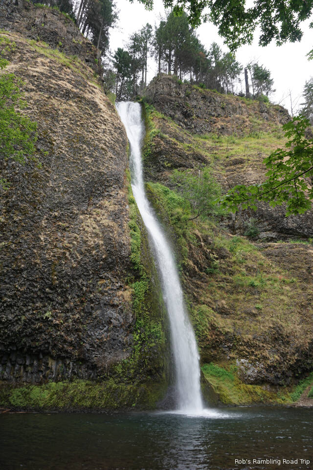
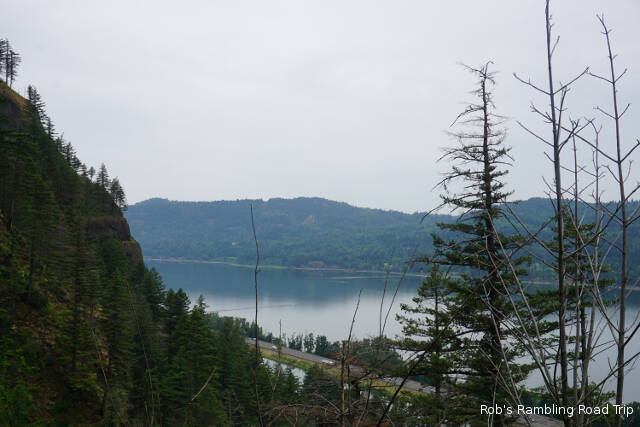
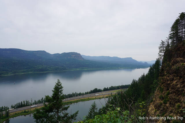
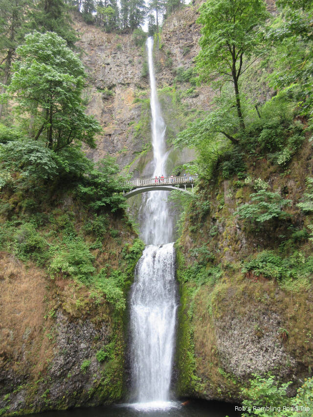
I waited long enough this morning for the cloud layer to climb the top of the gorge walls before heading out to tour the Multnomah Falls. It would have been nice if I could have waited for the sun to make an appearance, but Tuesday’s drive by the falls proved the fall’s popularity. I needed to get there before the parking lot filled and the trail got too busy.

Wildflower blossom of the day. Each blossom is about a half an inch in diameter.

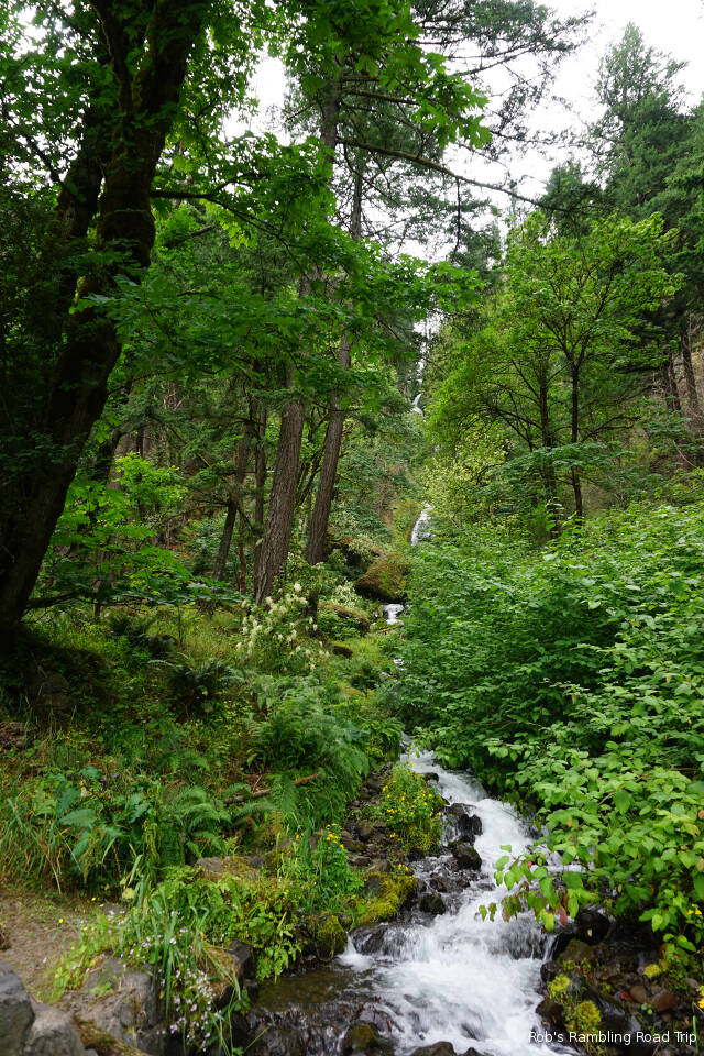
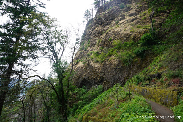
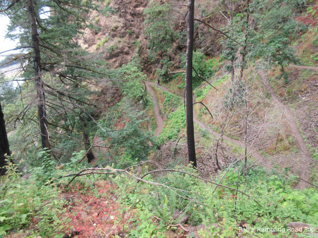
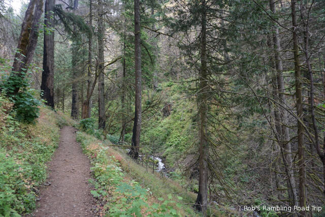
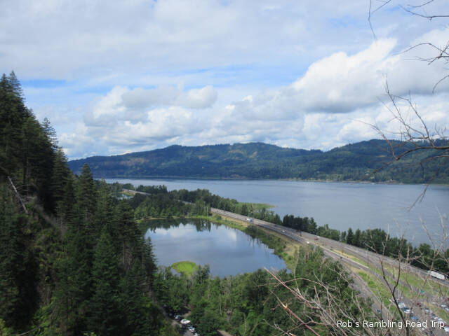
The big parking lot in the median of Interstate 84 was close to full by ten this morning and the smaller lot on the Historic Columbia River Gorge Highway was overflowing. I had plenty of company on the trails. Ultimately all of the people contributed to my turning around on the trail to the top of the falls. The mile plus long trail from the road up to the top of the falls was very congested. The eleven plus paved switchbacks that make up the trail were slippery from recently being in the clouds. Trying to navigate around the large groups of people that stop in the middle of the narrow paths with steep drop offs was a challenge. When you throw in the little kids barely old enough to walk wandering among the people and dogs on leach, it’s a disaster waiting to happen.

The Upper Multnomah Falls is 592 feet and the lower falls is 69 feet.

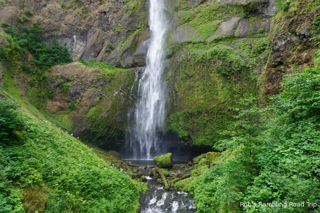
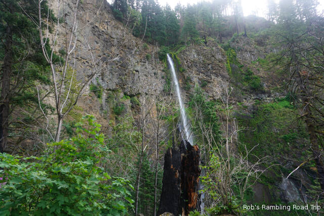
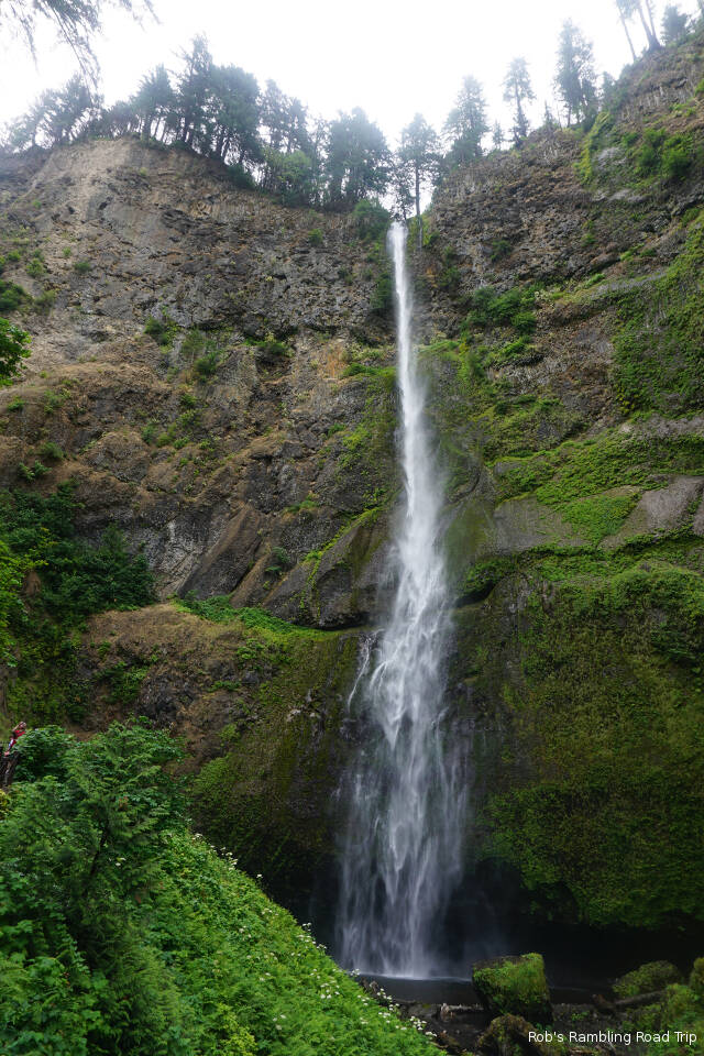
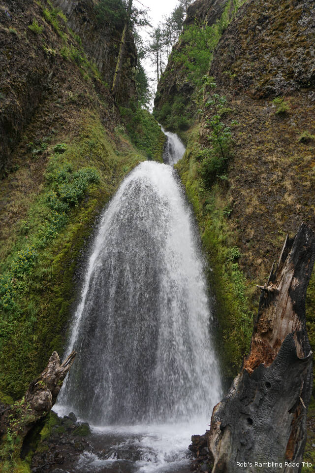
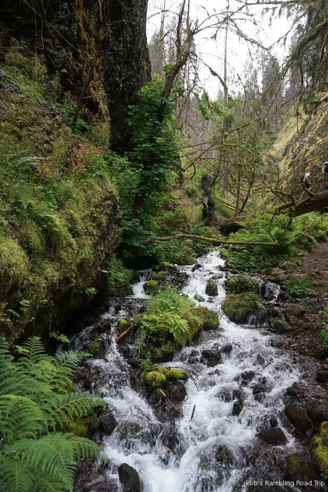
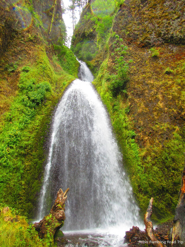
I was a little over halfway up the switchbacks when I had to wait for a group of about ten with tired kids and dogs sitting in the middle of the trail to move. There was a group above them on the trail trying to come down and the group I was in trying to pass going up hill. I decided it wasn’t worth the effort. I turned around. The part of the trail I took was the best part. I saw the waterfall from the base, the bridge that crosses between the upper and lower falls and again from the end of the second major switchback. The trail above that point doesn’t get near the falls again until the top.

Looking down the Columbia River Gorge in the Hood River area.
Looking up (west) the Columbia River Gorge in the Hood River area. Washington is on the far side of the river.
The rock face in the Hood River area is more rugged than down river in the Cascade Locks area.

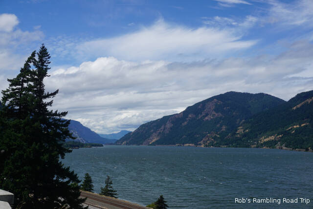
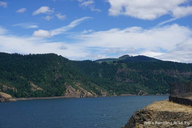
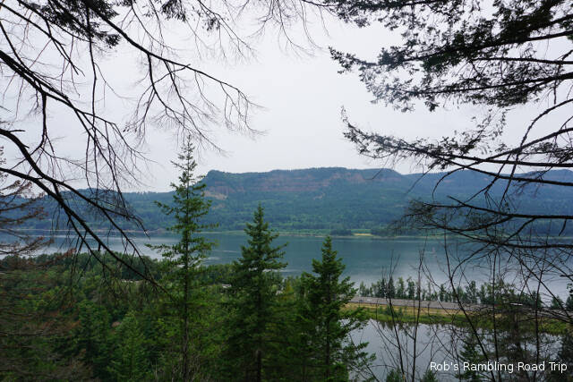
Later in the day I drove back up the gorge to the Hood River area. In Hood River the terrain is starting to change into a drier climate. There are fewer trees and the grasslands are brown in color. From my drive in on Monday, I know that it gets even more desert like at The Dalles near the east end of the Columbia River Gorge.

Another view of the Maltnomah Falls.

I’m moving on tomorrow to an area south of Portland. With a little luck, I’ll be able to stop in this area again in the fall. I would like to see the Salmon running and possible some color in the trees along the sides of the gorge.

More Touring in the Columbia River Gorge

Wednesday July 10th 2019

It rained off and on all night and into the morning. During the rest of the day the weather gradually improved. At the supper hour the sun tried to make an appearance. Hopefully, the trend will continue overnight and tomorrow will be a nice sunny day.

Today’s touring began at the Bonneville Fish Hatchery. Oregon’s largest hatchery was built in 1909. It is located just down river from the Bonneville Dam. It’s primary mission is harvesting, fertilizing and incubating Chinook and Coho Salmon. This time of year the young fish have been transferred to other hatcheries or released. There was one pool of little salmon for viewing. They are getting ready for the new spawning season that begins in late August through November. Even so, there is still plenty to see and do at the hatchery. I may stop at the hatchery again on my exit from Oregon in September.

One of many beautifully colorful plants at the Bonneville Fish Hatchery.

The grounds are very well kept with nice green lawns, water features and plenty of flowers in bloom. There are picnic facilities, a gift shop and a few fish related tourist attractions. The hatchery doesn’t raise trout, but keeps two ponds with trout from another hatchery for people to feed and interact with. The most famous resident of the hatchery is a seventy plus year old White Sturgeon named Herman. He and a few other Sturgeon from the Columbia River occupy a pond with an underwater viewing window. These are big fish. Herman is over 10 feet long and 450 pounds. The others are almost as big.

Big White Sturgeon in the viewing pool at the Bonneville Hatchery.
Several White Sturgeon in the pool.
Underwater view of one of the smaller White Sturgeon.
Some large Trout and a White Sturgeon (in the glare reflection) in the Sturgeon pool at the Bonneville Hatchery.
The cloud level is below the top of the gorge walls on the Washington side of the Columbia river.
Barge getting pushed by a tugboat leaving the lock at the Bonneville Dam.

After my visit to the hatchery, I stopped in the town of Cascade Locks. This area of the river was 4.5 miles of rapids before the Bonneville Dam was built in the 1930s. It was an obstacle to travelers up and down the river. The portage routes along the shore were difficult and dangerous to travelers. During a long thirty year period at the end of the 1800s a canal and lock system was built at the location of the town of Cascade Locks. After the Bonneville Dam was built the canal and lock were no longer needed. Today the area is used for boat launching and a public park. It appears to be very popular for weddings.

Looking down the old Cascade Lock at the Bridge of the Gods, a private toll bridge across the Columbia River.
Looking across the Columbia River from Cascade Locks. The high ground in the river foreground is what remains of the “rapids”.

Wahkeena Falls

Tuesday July 9th 2019

The fact that I’m in the wet part of Oregon was apparent today. I woke to a cloudy day with the temperature in the sixties. It climbed to seventy, but the clouds thickened during the day with an occasional light rain. As darkness moved in so did the real rain. Up to a half inch of rain is in the forecast for the overnight.

Horsetail Falls drops its water into a nice quiet pool.

I set out this morning to see some of the Columbia River Gorges famous waterfalls before the parking lots filled up. I started with Horsetail Falls which is right beside the road. It isn’t a very big or high falls by comparison, but is still very pretty. The next waterfall on my drive was Multnomah Falls. The parking lot was full. This is perhaps the best known of all the falls. I’ll try to get back to see it before I leave the area.

I spent most of my time at the Wahkeena Falls just west on the Old Columbia Gorge road from the Multnomah falls. I took a lot of pictures, so I’ll try to tell the story of my visit in the captions for the photos.

The Wahkeena falls from the road doesn’t look as impressive. It has several drops over the course of its flow from high up on the mountain ledge.
A paved and packed gravel path climbs the mountain with many switchbacks. A large portion of the Columbia River Gorge burnt in a fire in the fall of 2017. In this area the lower altitudes have a few burnt trees and charred tree trunks. Higher up there are more heavily burnt areas.
After a couple of switchbacks the path crosses the water fall on a stone bridge. The biggest drop of the falls is clearly visible here.
Continuing the climb after crossing the falls the views of the Columbia River and Interstate 84 below become the focal point.
The higher up you get the more trees with heavy charring come into view. This tree looks health twenty feet or so above the ground.
Moss covered walls line the switchbacks in portions of the climb.
Looking back at all the switchbacks I climbed from the Lemmons Viewpoint.
Looking at the Columbia River to the west from the Lemmons Viewpoint.
Looking a the Columbia River to the east from the Lemmons Viewpoint.
The path continues to climb from the Lemmons viewpoint. The trail is narrower and made up of gravel and loose rock in this area. I didn’t have good footwear for this section of the trail. It was also starting to rain, so I turned around after only a couple more crossings of the falls and a couple more switchbacks. There was still a lot of trail to climb.
Another view of the Wahkeena Falls on the way back down.

Travel Day to Cascade Locks Oregon

Monday July 8th 2019

I was up on time this morning. Since it was a travel day I couldn’t afford the time to sleep in. I had the rig packed and ready for travel a little after 10am for the 175 mile drive toward Portland Oregon.

The first challenge of the trip was filling the gas tank. The station near the RV park was empty so I had easy access to the pumps. It soon became apparent why the station was empty. They were out of gas. Yesterday I scouted a side road that lead to a gas station at the next exit off the Interstate. When I got there I discovered my luck was improving. They had a separate RV Island at the back of the station and the price of gas was five cents cheaper than the first station at 2.899. I put in $169 worth of gas.

Today’s journey was through two widely different areas. The first part of the trip was through the rolling hills of desert brush and irrigated farm lands similar to the Tri Cities area I’ve been in for the last three weeks. The second part of the journey was through the Columbia River Gorge. The Columbia River is rarely out of sight from Interstate 84. The road hugs the south side of the gorge wall going up and down and around bends to stay with path through the mountains cut by the river. Occasionally the Interstate is even on a causeway in the middle of the river. It’s a very pretty drive, but I didn’t have many opportunities to enjoy the view. In addition to all the ups and downs with big curves, the wind was blowing hard. The river gorge is a perfect channel for the wind blowing east up the river. It was a bit of a fight to keep the RV in my lane when the gusts came through.

Site 68 at the Cascade Locks KOA in Cascade Locks Oregon.

As the road gets further west onto the west side of the Cascade mountains, the terrain transitions from brown desert to green pine forests. In the forests the road seems more narrow and winding. My home for the next four nights is at the Cascade Locks KOA in the middle of the Columbia River Gorge. The campground is tucked into tall pines between the Interstate highway and the train tracks. The highway is far enough away that it can’t be heard, but I can’t say the same thing about the trains. The tracks are about 100 feet from my RV home. Eight long trains with three to four engines each have gone by in the first six hours I’ve been here. The train cars aren’t as disturbing as the whistle blasts before the train crosses the intersections on both sides of the campground. I’ll get used to it, but …

Last Full Day in Washington’s Tri Cities Area

Sunday July 7th 2019

Today was my last full day in the Washington Tri Cities area. I’ve enjoyed my three weeks in the area. A busy week would have been sufficient to see the area. When I decided to establish this area as a base, I thought it would be making day trips around the area. I found the distances to the things I wanted to see greater than I anticipated. As a result I visited various parks along the area rivers several times.

The blossom of the day.

A couple of things I considered doing I never got around to. The Sacajawea Historical State Park at the confluence of the Snake and Colombia Rivers is one of those items. I drove by it many times when I was staying at Hood Park, but never stopped. The other big attraction is the B Reactor National Historic Landmark at the Manhattan Project National Historical Park. You need to sign up online for escorted tours of the world’s first full-scale plutonium production reactor on the grounds of the Hanford Site. I never seemed to get around to signing up.

Today was a grocery shopping day. I didn’t remember my observations about Sunday afternoons being a very busy shopping day until I walked in the door. The local Walmart was very busy again today. Some of the shelves looked like people had been stocking up for an impending storm. There were a number of things I wanted that were nothing but empty space on the shelf and I got the last lonely can of corn. Despite the slim pickings I managed to stock up on all the essentials.

Tomorrow I’m traveling to the Cascade Locks area of the Columbia River Gorge east of Portland Oregon. I’ll only be there until Friday. It is back in a prime tourist area and I couldn’t find a longer reservation. To see some of the things I want to see, I’ll have to be in full time tourist mode this week. There is also the possibility that I’ll stop in the Columbia Gorge again on my way out of Oregon at the end of summer.

Scouting My Escape Route

Saturday July 6th 2019

The hot weather pattern of the last couple of days changed overnight. Today was cooler in the mid eighties with lots of wind and less sunshine. It still qualified as a great weather day.

McNary Lock and Dam

Today my mission was to scout my escape route for my departure on Monday. Specifically, I want to know where I can stop for gas in Washington State. The gas prices are cheaper by more than thirty cents on this side of the state line. The down side is stations seem to be fewer and more congested than I’m used to finding. The station nearest the campground might work if it isn’t busy, but with a few customers I could easily get boxed in. The two or three other places I saw on the thirteen miles to the interstate had similar issues. The first station I found with easy access was across the state line in Oregon. Tomorrow I’ll check out a few options off the main route to the interstate.

While I was out I stopped at the overlook for the McNary lock and dam on the Columbia River. It creates Lake Wallula by holding back the flow of four rivers. The Yakima, Snake and Walla Walla rivers all flow into the Columbia in the area behind the McNary Dam. About 64 miles of the Columbia river is considered part of Lake Wallula as well as the portion of the Snake River below the Ice Harbor dam.

Boat in the river below the dam.

There was a lot of water passing over the spillways at the dam. The current in the river below the dam was strong. I watched a boat cut power and drift back down the river much faster than it came toward the dam. It might have been a sight seeing boat, but I think it was just a recreational craft. Before I could figure it out, a long train came along the river between my vantage point and the river. My attention was on the train.

Two Engines in the front and two more in the rear.

Random Wandering Kind of Day

Friday July 5th 2019

The overnight temperature has been getting down into the sixties and even the high fifties. It makes for good sleeping weather. The day time temperature makes up for it. Today the temperature peaked in the low nineties. The inside temperature with the windows open and the AC off was near 100 before I switched the AC on around five in the afternoon.

Blossoms of the day.

I spent some time in the retail district of Kennewick this afternoon. Kennewick is the biggest of the Tri-Cities at a little over 80 thousand people. Pasco is the next largest at seventy plus thousand people and Richland is in the fifty thousand range. When other communities in the area are added in the overall population is near 300 thousand people. It doesn’t really feel that big to me. There is so much open land between areas of dense packed housing.

This morning a lot of my neighbors that filled the campground last night departed. I had the false sense that the weekend was over and it was time to go back to routines. The campground is full with new arrivals tonight. I wonder if they are here for the weekend or just the night. Hopefully many will leave and I’ll get a chance at the laundry. I’ve been trying to get access to the machines since Tuesday morning. Most of the times I’ve checked all eight machines have been in use.

Fireworks Everywhere

Thursday July 4th 2019

Happy Independence Day!

Today began and ended with high wispy clouds. During the middle of the afternoon the clouds dissipated and allowed the sun to heat everything up to about ninety degrees. The light breeze that was around early in the day went away with the clouds. It was an air conditioning kind of day, but I held out until it was necessary to start cooling my RV home off for sleeping tonight. Most of my neighbors were inside their RVs with all the windows closed and the AC on. As the temperature increases over the next couple of days, I may follow my neighbors example.

I was surrounded by fireworks all day. During the daylight hours it was just the loud sounds of firecrackers followed by the barking of nearby dogs. As dusk approached fireworks were being set off all around the mid Columbia River valley. Every direction I looked there were colorful fireworks near the ground. Most of the fireworks were being set off in backyards. They didn’t have a lot of rocket power to get them high into the air so only part of the shell burst was visible.

The Pasco Washington municipal fireworks show was at 10PM. They were set off about a mile from the campground and were mostly visible from the playground area. Forty or fifty people from the campground gathered to watch the show. I understand from people that had watched from the playground in past years that a new building now obstructs some of the view. The lower shell bursts were partially obstructed by the building and a tree. The higher bursts were clearly visible.

I attempted to take pictures of the fireworks, but didn’t bring my tripod or monopole. My shaky grip on the camera during the long exposure added some artistic interpretation to the pictures I’ve included below.

Horn Rapids Park

Wednesday July 3rd 2019

After a slow start this morning, I drove out to Horn Rapids Park on the Yakima River northwest of Richland Washington. It is a Benton County park with a boat launch, lots or trails and a small campground. If I’d known about this campground earlier, I would have considered it a better destination than my current location. The campground has 22 water and electric sites avilable on a first come first served basis. Today there were only three sites occupied.

Today’s blossom of the day.

I spent a little over an hour walking some of the trails in the trees along the river. Once I had to move into the open area away from the river, the direct sun made the hiking less comfortable. It only got up into the high eighties which is a little low for this time of year in this area, but I only had one bottle of water with me. I needed to be better prepared for a longer hike.

The biggest flying thing I saw along the Yakima River.
View down the Yakima River.
View up the Yakima River from the Horn Rapids Park boat launch.
Another view up the Yakima River.

The walk along the river was fun. I saw lots of flying things from dragon flies to float planes. The wading birds were on the far bank of the river so it was hard to get good pictures. I’ve cropped a couple of long shots and included them in this blog post. I’m not sure what kind of fish are in the river. Nobody was fishing today, but I heard and saw a few fish jumping. It looks like a promising location.

At the campground this evening it isn’t as full, but it is noisier. Despite several new signs forbidding fireworks in the campground several loud bangs have gone off. Legal fireworks in the tri-cities area is a new thing this year. They could only start selling last Saturday and the restrictions on the types of legal fireworks are huge. Nothing that is launched into the air is legal.

Getting Settled in Pasco WA

Tuesday July 2nd 2019

The little bit of rain over night was gone by morning. It was a bright sunny day with a high temperature in the mid eighties. It was a welcome, but surprising, relief from yesterday’s low nineties. The new forecast doesn’t have highs in the nineties again until the weekend.

Meeting of the birds along the banks of the Columbia River.

I took the bicycle and rack off the car this morning. The bike is much safer locked to the picnic table at my site than it is riding around on the back of my Honda CRV. With the bike rack off, the hatchback gate allows access to the back of the car. Whenever I’m at a location for more than a couple of nights I take the bike and rack off. Once the car was in touring trim, I drove down to the Columbia River for a little exercise walking in Columbia Park. I enjoyed the walk, but I didn’t see much activity in the river.

Looking down the Columbia River. Pasco is on the left side and Kennewick is on the right.

This campground seems to fill most of its 40 to 50 transient sites every night. This campground seems to get more long distance travelers than my last stop. Tonight I’ve have neighbors from Texas, Delaware, and Illinois. My Florida plates don’t draw nearly as much attention as they did at Hood Park. During my two weeks there I had several conversations that started with “Your along way from home” or something similar.

View up the Columbia River at the junction with the Yakima River. Interstate 182 passes over the river on the bridge.

I got the gas grill unpacked and setup this afternoon. The hamburgers I cooked for supper are the first of a series of meals from the grill. Once the grill was unpacked I consider myself settled in at my new location. All of the unpacking is done. The packing starts in five days for my Monday departure.