Bryce Canyon National Park

Friday August 25th 2017

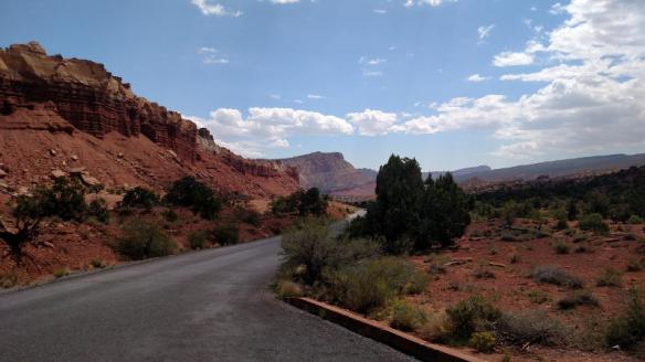
Today I drove about 80 miles to visit Bryce Canyon National Park. It is very picturesque drive over the mountains on to the high plateau that Bryce Canyon sites in. I got there shortly before 11am to find that today was a Fee Free Day at the National Parks in celebration of the National Park Service Birthday. Since I bought a year long pass earlier this year this didn’t impact me financially, but it raised some concern about volume of visitors in the park. I don’t think that fear was realized, as I had no problem with parking or crowds.

I took around 400 pictures. Some of the better pictures are included in this blog post. All of them will be uploaded to a Google Photos Album once I get good internet connectivity.

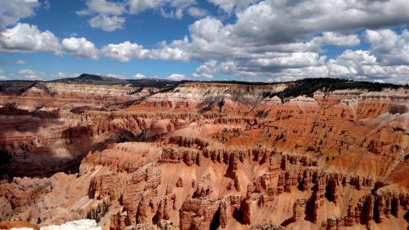
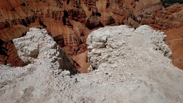
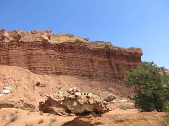
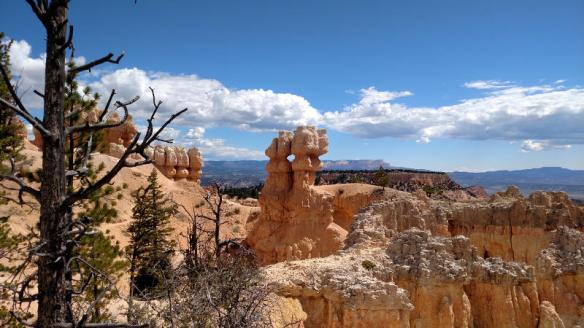
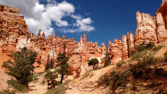
My touring plan for the day was to walk sections of the Rim Trail around the amphitheater. I visited the park once before on an overnight trip from Las Vegas. That trip was in November and snow covered most of the Rim Trail so I was restricted to the observation areas near the parking lots. I started my exploration near the North Campground and walked along the canyon rim to Sunrise Point. That’s where my touring plan went bust. Instead of continuing along the rim to Sunset Point, the sirens song of the Queens Garden down in the canyon called.

b01

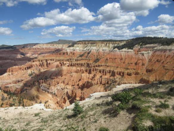
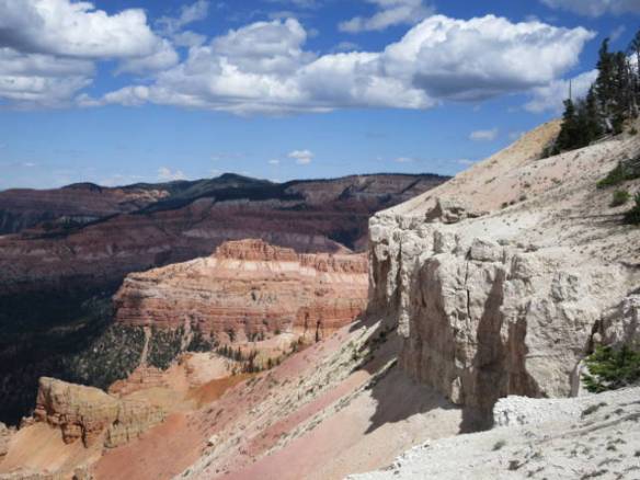
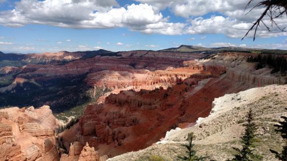
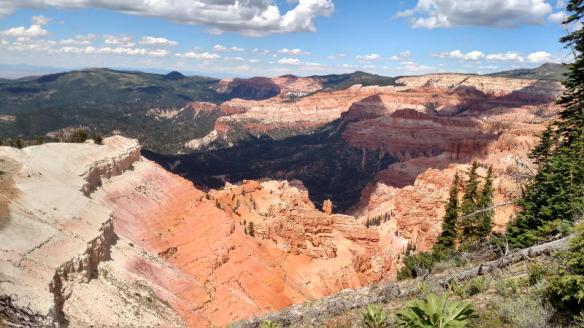
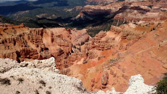
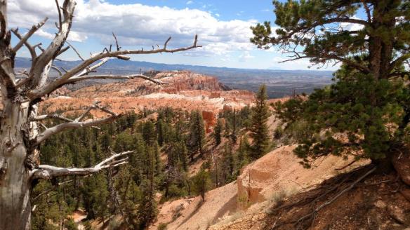
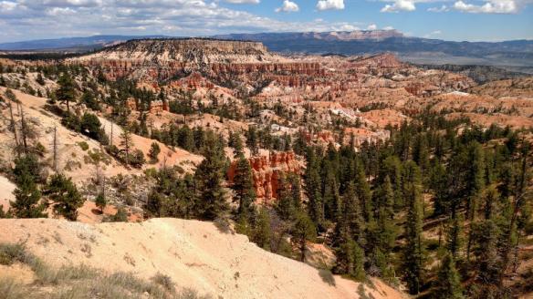
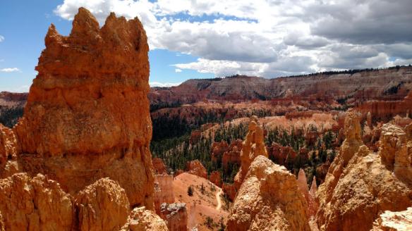
First view of Bryce Canyon from the Rim Trail near the North Campground

b02

b03

b04

b05

b06

b07

b08

b09

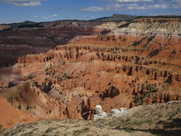
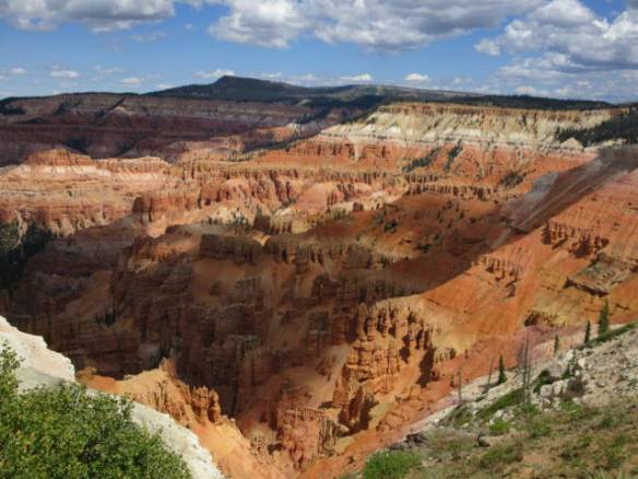
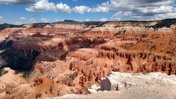
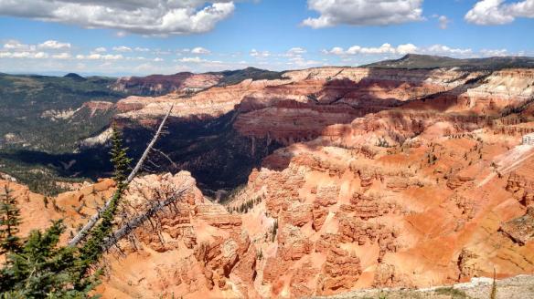
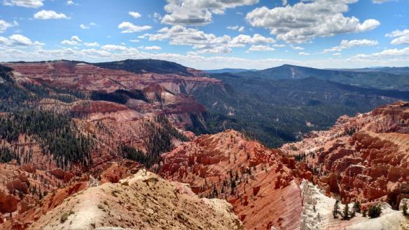
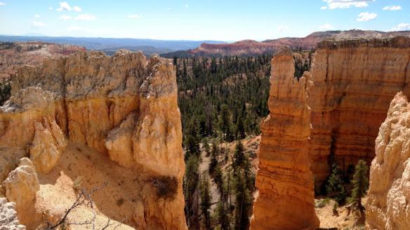
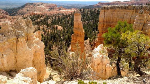
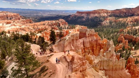
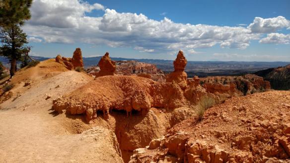
View of the Queens Garden from the Rim at Sunrise Point

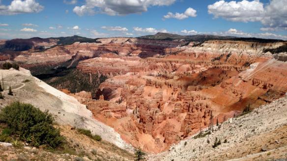
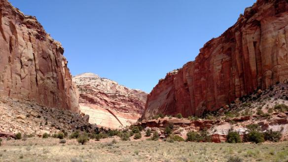
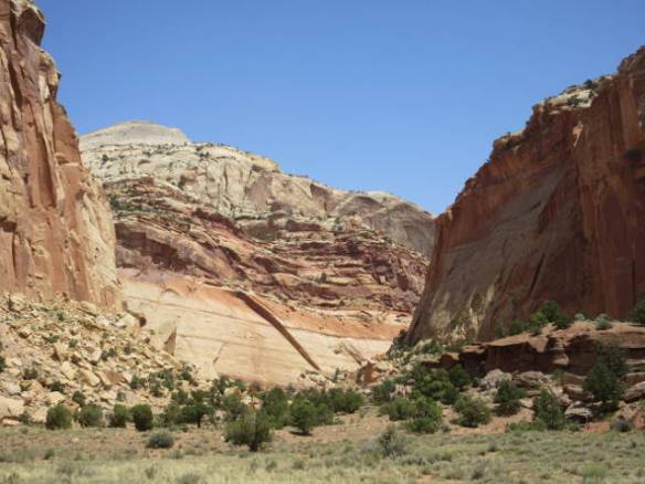
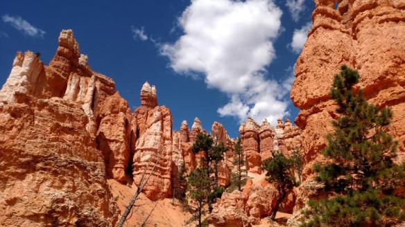
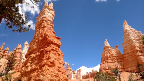
The trail down to the Queens Garden was advertised as eight tens of a mile long and 320 feet of elevation change. For some reason I didn’t thing that sounded too bad. Never mind that 320 feet is a thirty story building. Two hours later I was back at the rim after visiting Queen Victoria on top of a hoodoo near the bottom of the canyon. The walk through the rock formations and hoodoos was magnificent. I didn’t continue my hike along the rim trail. I went back to the car for a late lunch and decided to call it a day.

b10

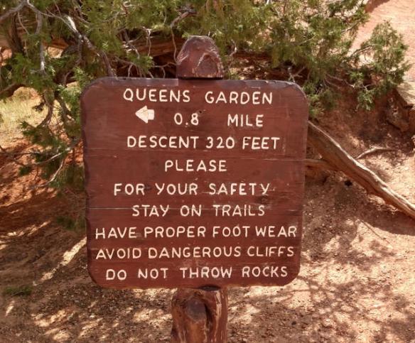
It doesn’t sound that difficult. Three hundred and twenty feet of elevation is significant.

b11

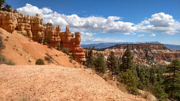
The trail is wide with lots of switchbacks most of the way.

b12

b13

b14

b15

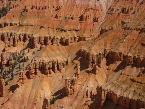
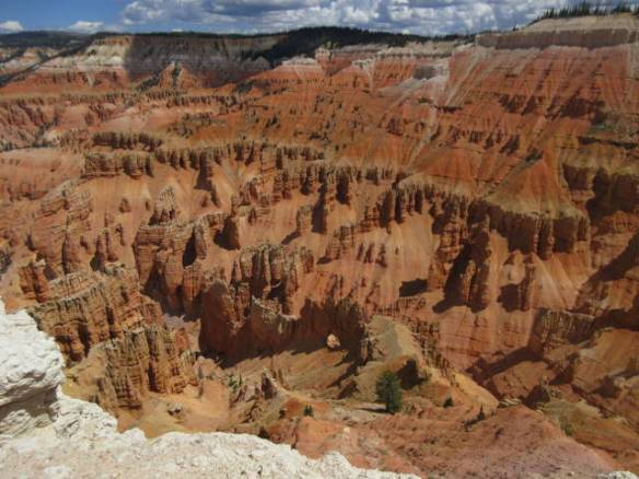
Soon the fins and hoodoos are above your view instead of below it.

b16

b17

b18

b19

b20

b21

b22

b23

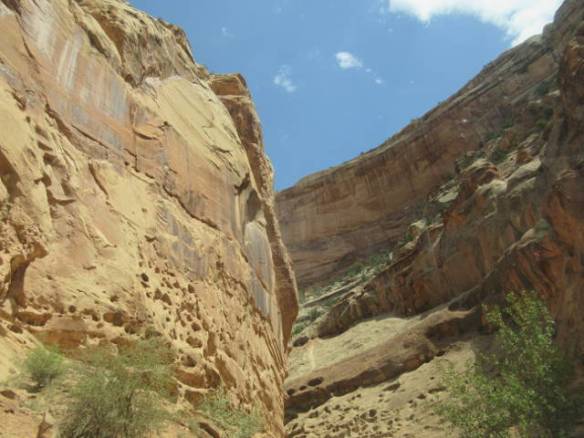
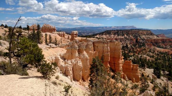
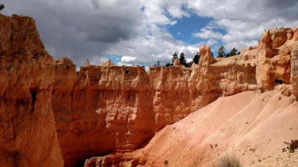
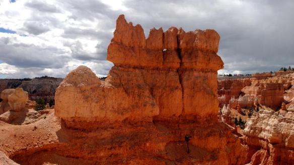
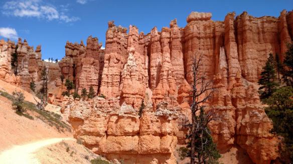
The trail goes through several rock fins.

b24

b25

b26

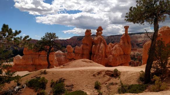
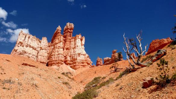
Queen Victoria on the hoodoo on the right.

b26a

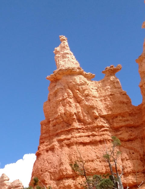
Zoomed in view of Queen Victoria.

b27

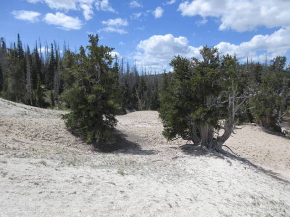
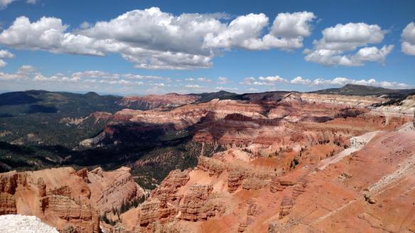
Back near the top of the trail and the rim.

I don’t think I’ll return to Bryce Canyon National Park on this visit to Utah, but I’ll be back to see more of park. Hopefully, next time I’ll be able to find a campground closer to the park.

More on Cedar Breaks National Monument

Thursday August 24th 2017

After yesterday’s exploration of Cedar Breaks National Monument, I spent today at home. I’m assuming it was the combination of altitude with the climbing on the 2 plus miles I hiked yesterday that really wiped me out. I slept very well last night. Unlike the day after my first hike in Arches National Park I feel fine today. I don’t have any of the muscle aches I had after that excursion. The pictures in this blog are from Cedar Breaks National Monument.

cbr01

Cedar Breaks Amphitheater from the main viewing area.

cbr02

Real log cabin used as the visitors center.

cbr03

cbr04

cbr05

Close up of some of the hoodoos.

cbr06

There are many of these squirrels.

cbr07

cbr08

cbr09

cbr10

A couple of the nearly 2000 year old Bristle Cone pine trees.

cbr11

cbr12

I really enjoyed Cedar Breaks National Monument. There isn’t a lot variety to see in the park. Other than viewing the rock formations in the amphitheater, there is a hike to an alpine pond that I didn’t take. I suspect there are larger animals like deer to be seen at the right time. It would be nice to see the amphitheater at sunrise or sunset. I’m staying a little too far away to make that practical. There is a campground in the park, but it doesn’t have sites that would accommodate my rig. I really can’t see driving up there with my RV anyway. The road is very steep for more than 10 miles as it winds through a canyon and up the side of the mountain.

The view with snow on the ground would also be interesting, but not easy to see. The park is open in the winter, but the road is closed from mid October to May. Signs indicate that there are a series of groomed snowmobile trails. With over ten feet of snow in the average winter it can’t be a very enjoyable experience.

Tomorrow I hope to get an early start. Bryce Canyon National Park is about 80 miles away. I’ll take a lunch and plenty of water to spend the day in the land of hoodoos.

Cedar Breaks National Monument

Wednesday August 23rd 2017

I drove 20 miles and climbed five thousand feet to visit Cedar Breaks National Monument. Simply stated Cedar Breaks is a half mile deep hole in the ground filled with red and white stone formations. It is filled with fascinating cliffs, windows, arches and hoodoos.

I took about two hundred and fifty pictures. Taking pictures was a way of keeping my pace slow as a hiked the trails. It is very easy to over do it at ten thousand feet. I walked around one section of the amphitheater to Spectra Point. Not only is the view from the point spectacular, it is also home to a grove of Bristle-cone pines. Some of the trees in the grove are almost two thousand years old. A group of similar bristle-cone pines in Nevada are the oldest trees on the planet at around 5000 years old.

The hike is labeled as “Moderate”, but it has a lot of altitude changes. The actual Spectra Point is lower than the start of the trail, but to get there you need to climb to a much higher elevation. It was a 2 mile total out and back hike. The trail continued another mile to the Ramparts Overlook, but I chose not to push my ability to hike at altitude.

The remainder of this blog entry contains some of the pictures I took today. I will put all of the pictures in my Google Photos album when I get better internet access. Upload speeds at this campground are almost non-existent.

cb01

Cedar Breaks is a half mile deep bowl in the grown known as an amphitheater.

cb02

cb03

cb04

cb05

Bristle-cone pine trees

cb06

Bristle-cone pines overlooking the amphitheater.

cb07

cb08

The trail continues around the amphitheater and down onto the white rock area known as Spectra Point

cb09

cb10

cb11

Some of many wildflowers along the path

cb12

cb13

cb14

The ground drops straight down through the opening in the white limestone rock.

cb15

Field of yellow wildflowers along the road at the visitors center.

cb16

cb17

cb18

cb19

cb20

End of Cedar Breaks National Monument entry.

Travel to Cedar City UT

Tuesday August 22nd 2017

It was raining lightly as I packed up to move this morning. The intermittent rain continued most of the way to my destination in Cedar City Utah. With only a little over one hundred miles to travel, I managed to time my departure right at the 11AM checkout time. The traffic was light on the first part of the trip, but it got heavy once I turned south on Interstate 15. I made two stops along the way to time my arrival after the specified checkin time. One stop was for gas and another was at a rest area for a bite to eat.

The gas stop was a little surprising. The cost of gas was $2.89 a gallon for 85 octane gas. I’m still getting used to Regular grade gas only having 85 octane in the mountain areas of this country. The oil companies have determined that the lower octane is all that’s required to prevent the engines from knocking at altitude. To get an octane level closer to the 87 I’m used to, I would have had to pay an additional 20 cents a gallon for 88 octane.

The surprising thing was the $2.89 a gallon price. The last gas I purchased in Richfield UT for the car was $2.69 a gallon. I expected the price to be cheaper in the more heavily traveled area of I-15 so I waited to buy gas. What my miscalculation resulted in is having to pay more for more gas. I put in a little more than 48 gallons of gas for around one hundred and thirty seven dollars. If I’d bought gas at the start of the trip in Richfield UT, I’d have only put in about 38 gallons at twenty cents a gallon less. One way or another I had to buy gas today. I don’t like to let the 75 gallon tank get below a quarter full.

The kicker to the gas saga is that the gas price at the exit for my destination in Cedar City was $2.59 a gallon, but I don’t know if I could have gotten in an out of the station. It is always a trade off of cost vs. convenience. I don’t mind paying a little more for easy access to the gas pumps. In this case, I had scoped out the station I bought gas at in Google Maps satellite view before departing this morning.

td1

Site D2 at the Cedar City KOA. Once again I get nice shade, but no satellite visibility.

I’m staying at the Cedar City KOA for the next 6 nights. From here I can tour the Cedar Breaks National Monument and Bryce Canyon National Park. Cedar Breaks is at the top of mountains to the east of the city and Bryce is about 80 miles away over the same mountains. This location is a compromise resulting from not being able to find a reservation at a closer location.

2017 Eclipse

Monday August 21st 2017

I got a little caught up in the hype about the total eclipse. Back in the spring, I had an opportunity to make a reservation in the area of totality for the eclipse. I just wasn’t interested and I stand by that decision. I’m located in south central Utah. The eclipse is about 80% of total in this area. Television coverage from Salt Lake City is in an area closer to 90% coverage and each of the stations has traveled to Idaho and Wyoming to be under the path of totality. I’ve been inundated with Eclipse coverage.

I didn’t have any glasses or pin hole contraptions to watch the sun, so I watched for other indicators. If I didn’t know an eclipse was happening I wouldn’t have noticed anything strange. The brightness outside went down, but the sun still shined from high above. Looking at the light pattern filtering through the leaves on the trees a regular pattern of curves was visible on the patio cement. The usual irregular pattern of light was gone. I’m attributing this to the eclipse, but I’m not going to bet money on it.

md1

Light pattern coming through the tree leaves onto the concrete patio. Is this the result of the partial eclipse? Probably.

The television coverage was intense. The weather channel correspondent in Oregon was sobbing with emotion after the eclipse. Other commentators were gushing with superlatives. I did feel sorry for the meteorologists and scientists that were in cloud covered locations like Nashville, TN, but they seemed to take it in stride.
They probably understand that another total eclipse with a greater period of totality will occur over the US in seven years during April of 2024. Many of the reporters were incorrectly reporting the next total eclipse over the US to be in 2045. That is the next eclipse to pass over the western US from northwest to southeast. The 2024 eclipse will pass from Texas to Maine.

I think my lack of passion for about this eclipse is because this isn’t my first “rodeo” so to speak. The March 7th 1970 total eclipse got a Junior High School kid really excited. The path of the eclipse came up the east coast of the United States. From my home in Worcester, MA the nearest point of totality was the waters around Nantucket Island, about 100 miles to the southeast. I spent the days leading up to the eclipse building a pin hole camera and watching the weather forecast for a clear day. On the actual day of the eclipse, my pin hole camera didn’t work. I had to fashion a new one on the fly out of a cardboard packing box. I got to see the crescents reflected in the box, but the pictures taken by the professionals shown on TV were more impressive. I continue to believe to this day that having good optics and high definition cameras are necessary to really enjoy the eclipse. Maybe the folks using the correct blackout glasses have a better experience. I really find the emotional experiences I observed on TV hard to understand.

RobEclipsce1970-1

Carefully built pin hole camera that didn’t work.

RobEclipse1970-2

Sticking my head in a box with a hole in one end worked.

Living this mobile life style keeps the possibility of viewing the next eclipse a viable option. Maybe I’ll have a different view on watching the eclipse in person in seven years, but I’m not going to hold my breath.

I’m writing this entry in the middle of the afternoon rather than late evening. The weather clouded over and threatened to storm shortly after the eclipse passed. Right now the sun has broken back through the clouds. I decided against taking a scenic drive and instead have been getting ready to move tomorrow.

When Plans and the Weather Don’t Agree

Sunday August 20th 2017

The weather got in the way of today’s plans. Last nights forecast for this area was possible thundershowers late in the day. That forecast held trough the morning. I sat outside in the sunshine, with the TV on, reading, finishing my morning coffee and watching the weekend residents depart. The park was alive with little kids all weekend. It’s amazing how quiet it got after they all departed.

sn1

Another of the interesting flower plantings at this campground.

Around 1PM I came in to get a bite of lunch in preparation for taking a drive to the southwest. While I was inside the clouds moved in and the wind began to howl. The change was sudden. It couldn’t have been more than five minutes from full sun to gray and cloudy. A minute long cloud burst that didn’t do much more than wet the ground followed about 5 minutes later. It then went back to just wind and started to lighten up a bit. When I went outside to assess the impact of the cloud burst, I saw the main area of rain less than a quarter a mile away. There is a school next to the campground. The far side of the schools athletic field was getting drown in rain. It continued over there for fifteen or twenty minutes, but nothing here. I just don’t understand the way weather works in this area. The combination of mountains and desert seem to generate some interesting weather behavior. You really need the local knowledge that comes from past experience in the area.

The cloud cover continued and it threatened rain all afternoon. My cell phone weather radar showed the whole area covered in storm conditions.  I found the RedSox game on TV and settled in for a good outcome. The Sox won five to one over the Yankees. I may move today’s plans to tomorrow after the eclipse. This area has an 80 percent coverage and will peak around 11:30am. I don’t want to be on the roads during the event. People seem to be going crazy about the eclipse.

Thoughts on Capitol Reef National Park

Saturday August 19th 2017

It was a mostly sunny day with highs in the mid 80s today. One brief shower kept it from being a perfect day. After lots of driving yesterday to visit Capitol Reef National Park, I stayed at home and enjoyed the weather. I’m including a few more pictures of the National Park in this blog entry.

st1

st2

st3

Capitol Reef National Park is less developed than Arches or Canyonlands National Parks. There are fewer paved roads and big parking lots than the others. The vast majority of the park is only accessible on gravel roads best traveled in a four wheel drive vehicle. The main scenic drive runs south in the Watershed Divide from the historic community of Fruita for about 12 miles. For the first 9 miles the canyon is wide enough that there is high ground for the paved road. You are still very close to the steep side walls as you pass over the river and washes. To continue south the road transitions to gravel and often runs in the bottom of the washes. There are many signs warning not to proceed if there is rain in the area. You can see were the road has been regraded many times after water has run across and along the road. In this area the rock walls are right beside your car doors.

st4

st5

It’s the fact that you are so close to everything in your car that makes this park different from the others in the area. I really liked this aspect of the park. There were a couple of other gravel roads off of the scenic drive that I could have explored and a couple of trails I considered hiking. I also didn’t spend much time in the Historic Fruita town displays. Touring the Gifford house, blacksmiths shop and orchards would have added another dimension to my visit. The tension of driving the narrow gravel road between massive rock walls with on coming traffic that had no business on the road (wide rental Class C motorhomes), wiped out my enthusiasm for more adventure.

st6

Taken out the window while navigating the narrow road in the wash. 

st7

Taken through the windshield. 

The park has fewer visitors than the other parks in the area. It is a long way from the Interstate or any significant towns. There were a few places with lodging and food in the town of Torrey Utah about 11 miles away, but the town hasn’t really developed into a tourist attraction town. I think these are some of the things that make the park more enjoyable to me. I look forward to another visit during a time of year that doesn’t pose the same level of flash flood risk that the current monsoon season presents.

Capitol Reef National Park

Friday August 18th 2017

Today I made it down to Capitol Reef National Park. It is about seventy five miles from by campsite in Richfield UT. I climbed over several areas of high ground to get there. The highest was 8200 feet. Most of high ground was range land and the valley before you get to the park was farm land. It was a nice scenic drive. I made the right decision not to take the RV closer. I passed a coup le of possible campgrounds, but you had to climb a two plus mile eight percent grade.

This blog entry will be all pictures. I will provide a link to all 140 plus pictures once I get them uploaded.

ri01

As you drive across the valley with farmland and range land you approach a high red wall of rock.

ri02

Twins Rocks.

ri03

ri04

ri05

Panorama Point

ri06

Panorama Point

ri07

The Fluted Wall

ri08

ri09

Layers of rock slanted over time.

ri10

View from Slick Rock Divide

ri11

ri12

The gravel road continues between the rock cliffs.

ri13

Closer view of the rock cliffs.

ri14

ri15

ri16

ri17

Many of the pictures from here forward were taken from the moving car. Some were through the windows.

ri18

ri19

ri20

ri21

ri22

End of Capitol Reef Pictures.

Where did I store that … ?

Thursday August 17th 2017

I live in a box that’s around 200 square feet. Why do I have more trouble finding things than I had in a much bigger house? This morning after breakfast I started a search for my RV road service membership card. I wanted to confirm that I had another year on the membership. It wasn’t in any of the places I thought it should be stored.

th1

One of the valley walls surrounding Richfield Utah.

I emptied and repacked three cabinets and three draws that were the most logical place for me to store the card. The good news is I decided to get rid of more junk that I don’t need to carry around the country with me. The bad news is I didn’t find the membership card. It will turn up eventually, but it’s going to bug me until it does. I was able to confirm the expiration date by finding the statement for the renewal from last fall in my records.

This is not the first time I’ve misplaced small things in this small space. I made a similar search for a backup camera battery last year. It finally showed up in a container with similar things about six months later. Why I didn’t find it when I was looking for it is a mystery. I have around 12 cabinets and 3 draws not dedicated to food or cooking. They aren’t big spaces, but they manage to collect a lot of junk. Keeping it organized is a challenge that I’m apparently having difficulty with. The larger of the cabinets have several small plastic bins each filled with similar stuff.

th2

Two of the many places explored in my search this morning.

I sent over 3 hours in my search for the proverbial “needle in a haystack”. It was too late to drive the seventy miles to Capitol Reef National Park and still have enough time to enjoy the place. I’ll try again tomorrow. I used the time to run a couple of errands and to get the laundry done.

The Laundry facility at this campground is cheap, but not ideal. A load of wash costs $1.75 and forty five minutes in the dryer costs $1.25. The machines are squeezed into a small room that doesn’t have any real space for folding. I needed to use the tops of the washing machines to fold and stack my clean clothes.

Random Thoughts on Travel Planning

Wednesday August 16th 2017

Today was very similar to yesterday. The weather was just as great. It might have been a degree or two warmer, but it was an overall nice day. My activity level was very similar as well. I did various odd tasks around my RV home and generally just enjoyed the day. This blog entry is today’s set of random thoughts. I won’t be offended if you stop reading now. I won’t even know.

wd1

Sky above the mountain to the north of the campground.

Since we are now in the second half of August, I took another look at my travel plans going forward. I’ve had a reservation in Florida starting March 10th since April 10th. That was the start of the reservation window for that particular park. The window for the park I want to stay in for the two weeks prior to March 10th opens on August 24th. I’ve been looking at the current status of that park to see what I’ll face at 6am on the 24th of August when I try to beat the other mouse clickers for a site. It isn’t looking real promising.

Florida in February and March is prime season. The end of March this year has a little less competition. Easter is on April 1st and many Snowbirds want to be home in the north for the holiday. I see plenty of opportunities after my current two week reservation ending on March 24th. My rough plan is to stay in Florida most of April, before heading for the Mississippi River area. Next year I plan to start the summer season in the Midwest and end in the Northeast next fall. I’ll return to Florida for most of the winter of 2018-2019.

Between now and February I have an outline of a plan. I’ll call it a plan when I get more of it reserved. As of now, I have reservations through September 13th. I’ve figured out where I want to stay through the end of October. I just have to commit and make the reservations. The open questions are November to January. Do I stay in one location for all three months? Unlikely, but maybe the months of November and December. A couple of more days of contemplation without major changes and I’ll start locking in reservations.   I don’t mind researching travel and places to stay.  It’s the actual planning that I don’t like.

wd2

Another of the decorative planters around the campground.

For some reason this campground hasn’t filled up as much tonight as it has the last two nights. I don’t have neighbors on either side and one of the rows in front of me is mostly entry. I don’t understand what governs the volume of overnighters. I wonder if the campgrounds know.