Canyonlands National Park

Friday August 11th 2017

I took a journey to the Canyonlands National Park today. The northeast corner of the park is known as the Islands in the Sky Unit. It is located about 30 miles east of Arches National Park. This area of the park is a contained on a mesa at around 6000 feet in altitude. It is surrounded by canyons cut into the rock by the Colorado and Green Rivers. The canyon floors are fourteen hundred to twenty five hundred feet below the top of the mesa. This blog entry is mostly pictures. I took 220 pictures today. I’ll make all of the pictures available in a Google Photos album when I have internet band width to upload them.

rd01

First view of the canyons after entering the National Park.

rd02

Storm clouds moving in over Mesa Arch. A few raindrops fell before it started to clear.

rd03

Mesa Arch

rd04

View through Mesa Arch.

rd05

Ghostly tree

rd06

Green River View. The winding green water at the bottom of the canyon is the Green River.

rd07

Green River Overlook

rd08

Panorama at the Green River overlook

rd09

Buck Canyon

rd10

Grand View Point Overlook

rd11

Grand View Point Overlook

rd12

Path along the side of the Canyon. It turned out to be a one mile hike to the actual point.

rd13

One of the Islands in the Sky climbing out of the canyon floor.

rd14

rd15

Rock martini anyone?

rd16

At the point. This is the southern most point in the Islands in the Sky Unit. The canyon continue for miles beyond the butt across the first narrow canyon.

rd17

rd18

The things that grow in the dirt that accumulates in the cracks in the rock.

rd19

Panorama of the canyons at the end of the trail.

rd20

The return path climbs back up the steps built of quarried stone.

rd21End of Canyonlands National Park

Final Thoughts on Arches National Park

Thursday August 10th 2017

After finishing touring Arches National Park yesterday, I spent today recovering. There are two ways to see Arches National Park. You can drive along the park roads and stop occasionally at a pull out or you can stop at the trail heads and hike to see the arches. I chose to hike some of the trails and I’m paying for it today. I have a few aches and pains associated with muscles I haven’t used recently. The pictures in this blog entry are from yesterday’s trip to Arches National Park.

fr4

Back side of the Tunnel Arch.

fr1

If you just travel the roads of the national park you will see some beautiful scenery. There are high desert plains with red rock buttes and mountains scattered across your view. Everywhere you look there is something unique and beautiful to see, but you aren’t going to see many arches close up. An occasional arch or hole in a rock cliff can be seen in the distance.

To really see the arches you need to walk the trails. The park service has done what they can to create nice improved trails, but it isn’t possible to remove the changes in elevation or to build steps into solid rock. You need to go up and down hills on some pretty rough ground at times. All of this is at about 5000 feet in altitude.

fr3I probably walked about 6 miles total yesterday. Unlike Monday, I had my hat, plenty of water and was wearing a good layer of sun screen. I took lots of pictures which helps to slow me down. When I don’t pause for pictures I find myself passing people half my age only to have to stop and catch my breath at the top of the hill. Then I’m right behind the people I passed again. I need to remember slow and steady wins the climb.

fr2

Heavily improved trail area near the Landmark Arch. The fences were installed to keep people away from the arch.

fr3

Scrambling up and down the rocks requires attention to your footing. The park service has tried to make sure the boulders used for steps are secure, but they have natural spacing and size. One step may be three inches and the next fourteen. My calf muscles are one of the aches I’m experiencing today. Where I drew the line, both Monday and Wednesday, was when the trail went up smooth boulders at a steep angle. Getting to the top wasn’t what I was concerned with, it was getting back down safely. I’m pretty sure some people were backing down the hill.

fr5

People scrambling up an down the rocks to get to the next arch viewing area. I chose not to make the climb.

Tomorrow I plan to go to Canyonlands National Park. The Island in the Sky section of the park is accessible from this area.

Arches National Park Day 2

Wednesday August 9th 2017

I went back to Arches National Park to pick where I left off on Monday. There weren’t as many people waiting to get in, but I think there were more cars in the park. I had difficulty finding a place to park at several of the trail heads. I took over two hundred pictures of the beautiful alien looking landscape. This post contains about twenty of the better pictures. I’ll insert a link to all of my Arches National Park pictures once I get them uploaded. My current internet connection is not very fast.

n01

Delicate Arch is in the center of the picture on the mesa. This is the arch I was hiking to on Monday when I turned around.

n02

Close up of Delicate Arch. Note the people that hiked up to get a close view.

n03

This is the view from the end of the park road. It is necessary to hike out further to see more arches.

n04

n05

n06

Tunnel Arch

n07

n08

Pine Tree Arch

n09

View through Pine Tree Arch

n10

n11

n12

n13

n14

n15

Landscape Arch

n16

Landscape Arch

n17

Landscape Arch

n18n19n20n21

The End of Arches National Park Day 2

We Interrupt the Road Trip for some Planning

Tuesday August 8th 2017

There was some nasty weather in this area last night. It did a good job of disrupting a good nights sleep. Around two in the morning I woke to the sound of rain on the roof. A little rain isn’t a big deal, but this accompanied by wind that rocked the RV. It was enough to cause me to get out of bed to check my cell phone for the weather radar and any warnings. Neither showed anything more than an ordinary thunderstorm. I think the wind direction was what made it seem so strong. I managed to dose off only to repeat the exercise a couple of hours later.

The pictures in this blog entry are from yesterday’s visit to Arches National Park.

e1

The interruptions overnight caused my plans for the day to change. I was going to return to Arches National Park today. However, I was really dragging this morning. Instead of getting another late start for the park, I used today as a planning day. I started the day without any reservations for the rest of the month. I ended the day with reservations through the middle of September.

I view reservations as a necessary evil. Having to commit to a direction of travel and a particular campground without knowing the specifics of an area is very limiting. It makes it necessary to depend on reviews people publish on the Internet. Reading online reviews is a crap shoot. There are always a wide spectrum of opinions. The trick is to figure out what the real store is and what is important in the review. For example, a review that complains about dust in a desert campground should probably be taken with a grain of sand. Every campground in the desert is going to have a dust issue.

e2

The route I selected for my travels this month is a little different than I had been thinking about. My first plan was to travel into the middle of south central Utah around Bryce Canyon National Park. I started looking for a RV park in that area back in June. The issue has been that the available sites are marginal for my size rig. Marginal usually means the campground gets very conservative with compatibility once your rig is bigger than 30 feet. They have to account for people that don’t know how long their rig is and those that can not maneuver their RV into tight areas. Most won’t let you book a site that their reservation system claims is too small for your rig. I’m left with the choice of lying about the size of my RV or getting someone on the phone that really knows what size rig will fit on a site. I chose a third option. I’ll stay further away and commute to the parks in my SUV.

My plan is to go back west on Interstate 70 to the town of Richfield for a few days. From their I can travel to Capital Reef National Park. Then I’ll move on to Cedar City. In Cedar City I can go up into the mountains to the Cedar Breaks National Monument and down the other side to Bryce Canyon National Park. I might even visit the Utah Shakespeare Festival in Cedar City.

Ill spend the Labor Day weekend in the St. George Utah area. From there I can visit Zion National Park and a few other areas. After the holiday weekend I cross southern Utah and Northern Arizona to Lake Powell National Recreation area for a week. That brings me to the middle of September. I still haven’t found a viable plan for visiting the Grand Canyon. The places that I’m willing to pay a premium to stay at are not available and haven’t been since I first looked in March. Some of the places in Williams and Flagstaff, which are 60 to 80 miles away, are more than double what I’d expect to pay. So I’m still looking.

I plan to spend a couple of weeks in the Verde Valley near Cottonwood AZ, then a few days in the Phoenix area before continuing southeast toward New Mexico and Texas. I still have a lot of planning to complete.

Arches National Park

Monday August 7th 2017

I got another slow start this morning. I lingered over my coffee for longer than I should have to get to Arches National Park before the hordes of tourists and the heat of the day. Around 10:30, like trowing a switch, I got up from the breakfast table and headed for Arches NP.

o01

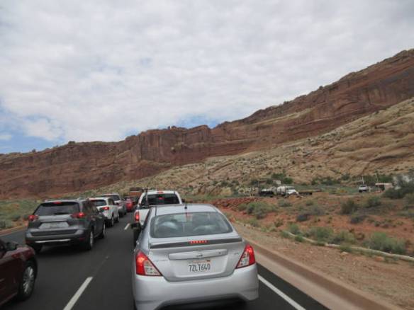
Line of cars waiting to get into Arches National Park. It was over half a mile long.

I arrived in time to join the hordes of tourists in line at the toll plaza. There were two lines of cars backed up about half a mile. It took more than half an hour to get to the toll booth. I think the rangers on duty were trying to keep the flow of traffic into the park under control by processing people into the park slowly. The ranger studied my Annual Pass and drivers license as though it was the first time she’d ever seen anything similar. Usually, it’s a cursory look.

o02

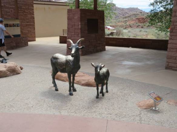
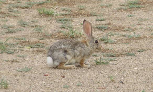
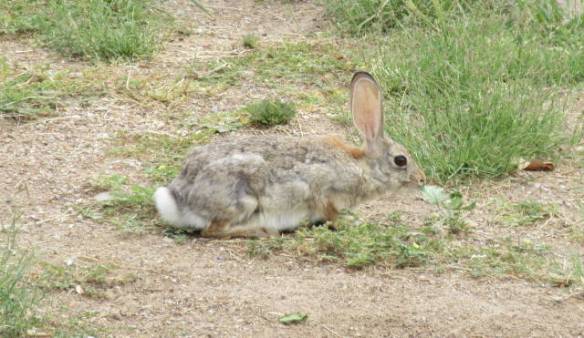
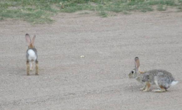
The only wildlife I saw today was the bronze kind at the visitors center.

o03

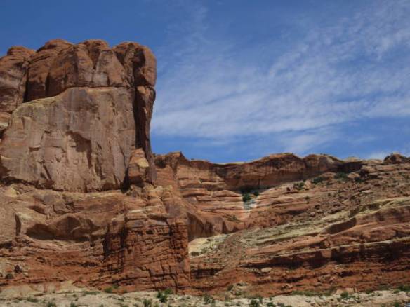
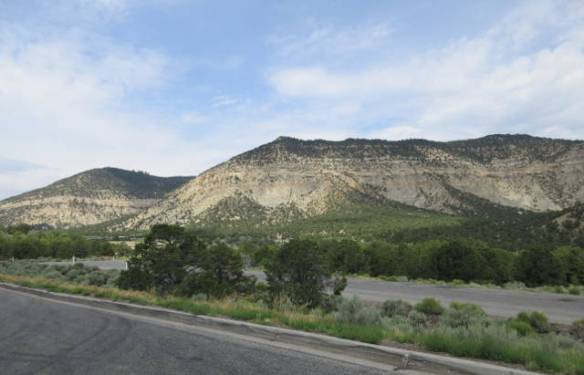
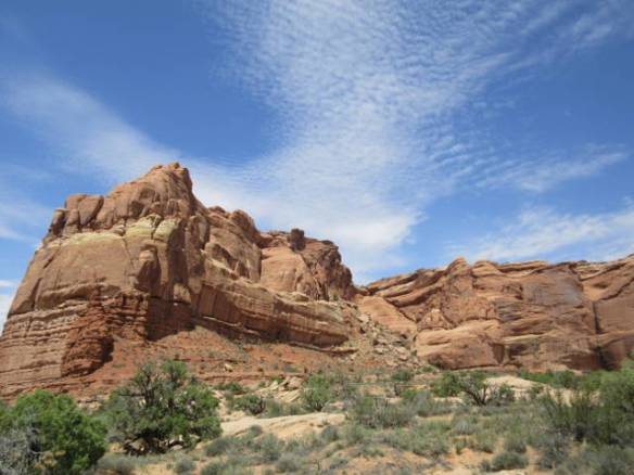
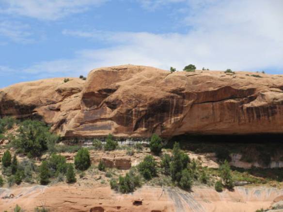
Cliff behind the visitor center.  The road climbs up the cliff using switch backs. 

My first stop was at the visitors center to watch the movie. This movie was very good. It gave an overview of the geology of the area while showing beautiful scenes of the park in different seasons both during the day and at night. Thankfully, this movie didn’t have a moral or political agenda. The movies at the last few National Parks have been very heavy on protecting the natural resources. Yes, it’s important, but I came to enjoy the park not to attend a lecture.

o04

o05

o06

o07

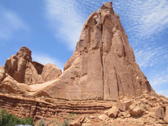
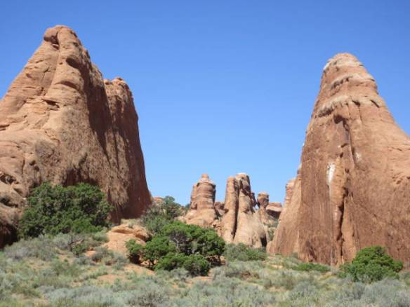
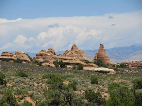
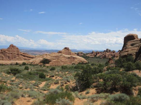
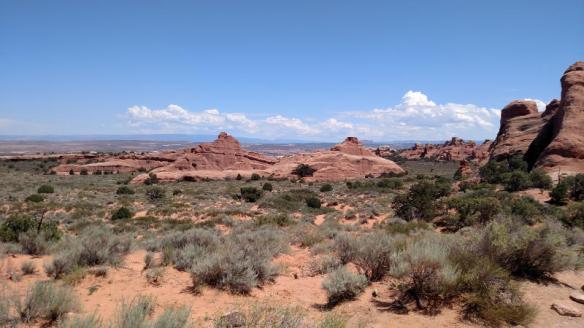
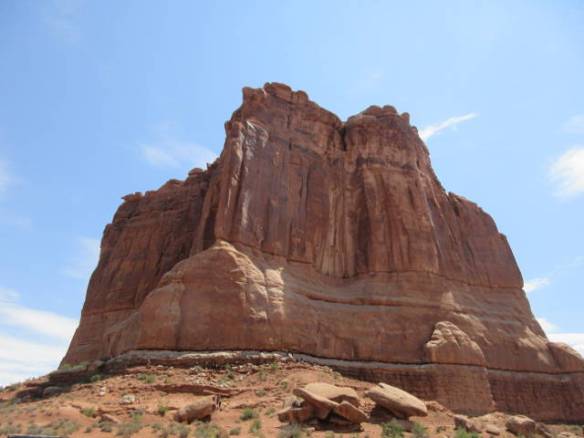
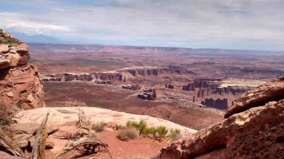
From the visitors center I drove up the cliff onto the high ground and started viewing the sites. The roads and parking lots in the park are under repair this summer. All of the turnouts have new gravel and construction barrels to deal with. The barrels made it difficult to fit more than a car or two. The Windows section of the park, with many of the more famous arches, is closed for reconstruction of the roads and parking lots. Even with these constraints there was still a lot to see and surprisingly I didn’t have difficulty finding places to park.

o08

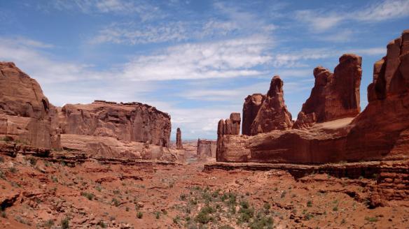
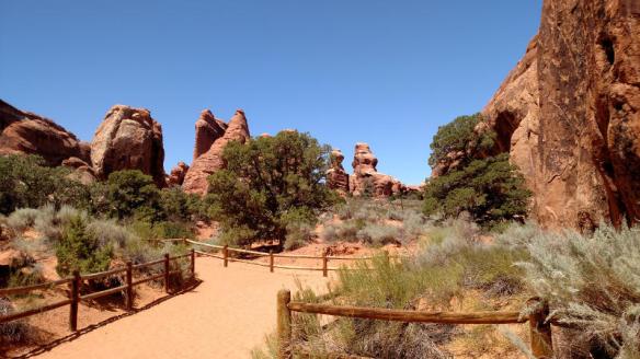
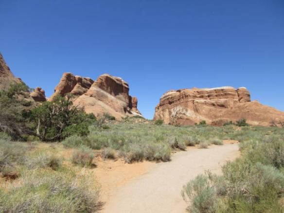
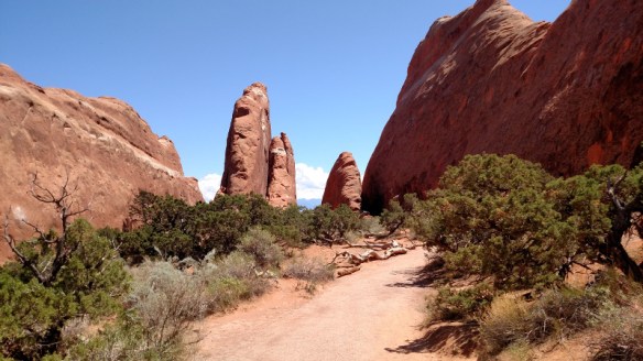
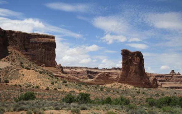
View down “Park Avenue”.

o09

To actually see the arches it is usually necessary to park and walk a little ways into the park. Most of the time the walk is only a few hundred yards and not terribly difficult. At my first stop, at an area called Park Avenue, I realized I’d left home so abruptly that I didn’t bring my hat. I had sun screen and plenty of water, but nothing to shade my face and neck. For a bright sunny day in the 90s that was not a good thing. I did fine without the hat at the first three or four stops.

o10

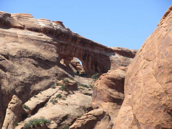
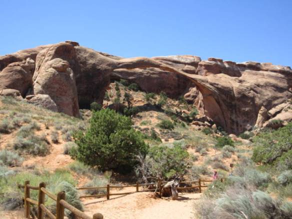
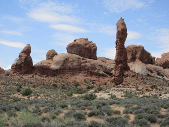
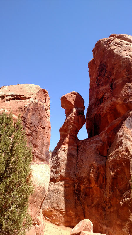
There used to be an arch between the two points in this picture.

o11

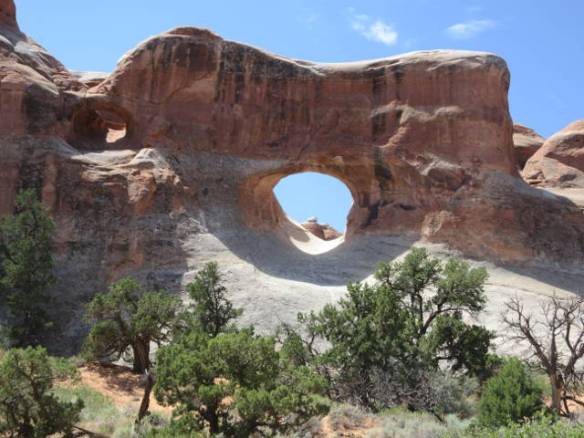
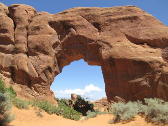
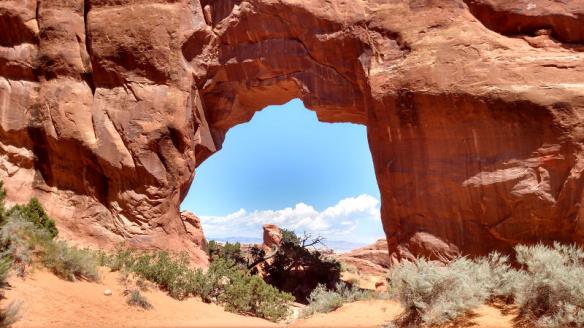
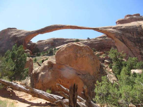
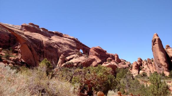
The first and only real arch I saw today.
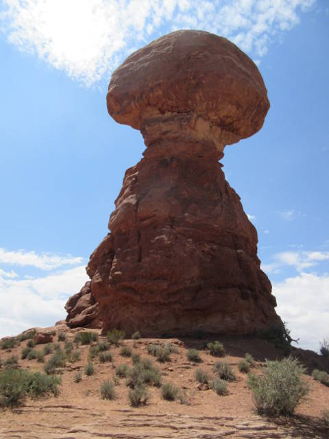
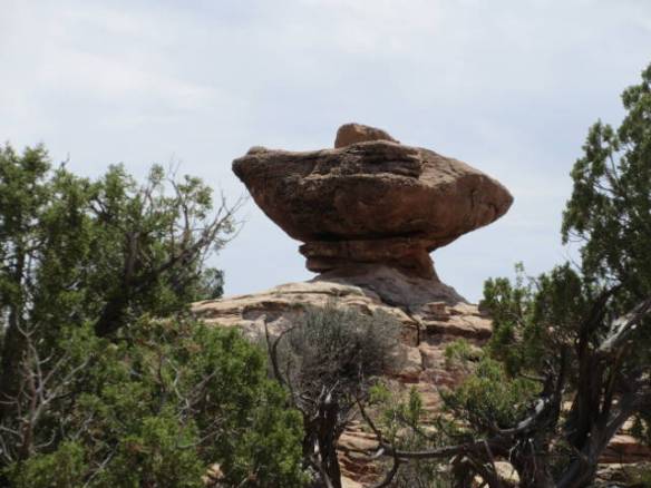
o12

Balanced Rock

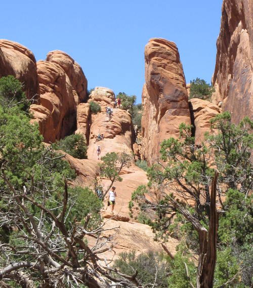
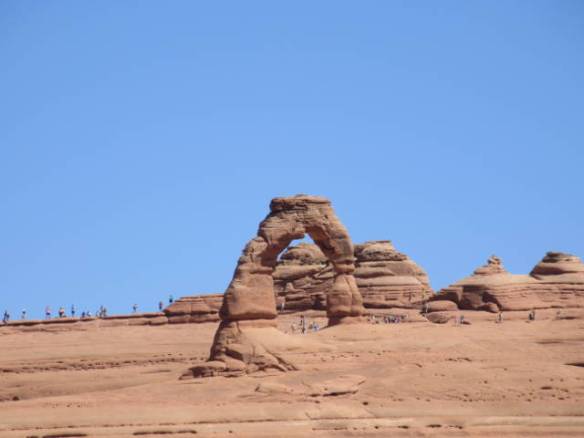
At the parking area for the Wolfe Ranch and Delicate Arch trail head the lack of a hat along with a bad assumption created a problem. I assumed that this stop was similar to the others. All I’d need to do is walk a little ways out beyond the Wolfe Ranch ruin to find a view of the arch. I grabbed a bottle of water and headed out. I didn’t read the trail description. The whole trail was in the bright sun and it was two in the afternoon. There was no shade at all. I climbed the first hill and crossed the top. I went down into the wash and back up the grade. The sun was starting to warm the skin on the back of my neck. A little water on my neck cooled it down. A little water in my mouth cooled the rest of me a little. I continued to walk along the well marked path going up and down as necessary. There were many people on the trail going both ways. I paused after a particularly long climb and noted that I was two thirds of the way through my water and I hadn’t reached my destination yet. Looking forward on the trail I could see people climbing up about a hundred feet on a rock incline. I had not idea how far beyond the top of the rock incline the trail continued. So, I turned around and made my way back to the car. At the trail head I read the trail information. “Difficult trail with elevation gain of 480ft. No shade. Open slick rock with some exposure to heights. 3.0 miles round trip.”

o13

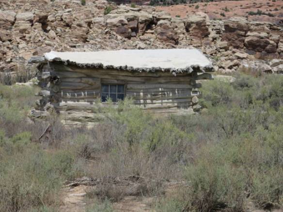
Wolfe Ranch building.

o14

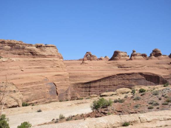
Once I got back to the car I was hungry and tired. I decided to end my touring of the park for the day. Reading the map, this evening, I found that if I’d driven a little further into the park I’d of had a view of the Delicate Arch without having to hike the “difficult” trial. I will go back tomorrow or the next day.

Three lessons learned today. Don’t forget your hat. Read the trail head information before starting the hike. Don’t wait until you get home to read the park map.
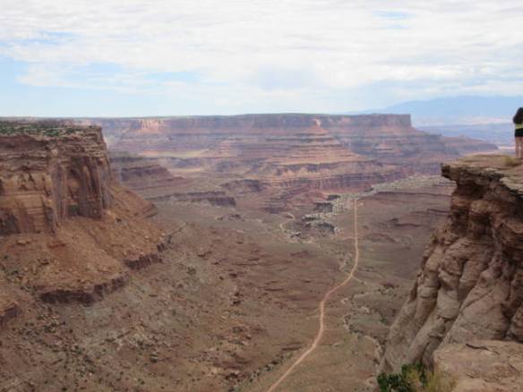
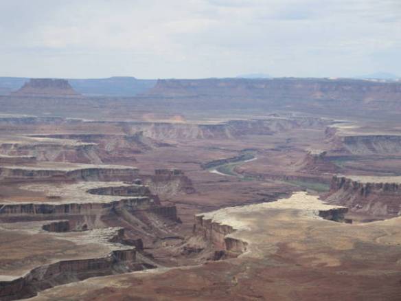
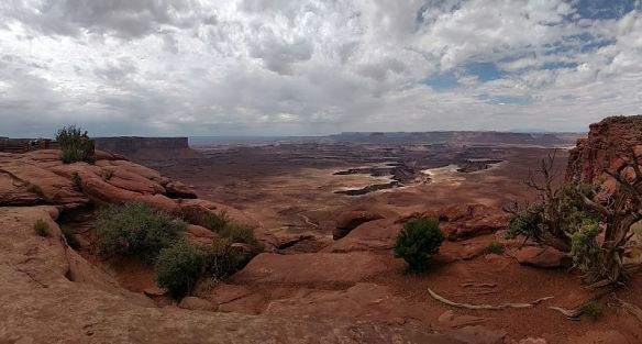
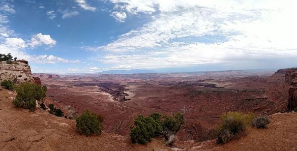
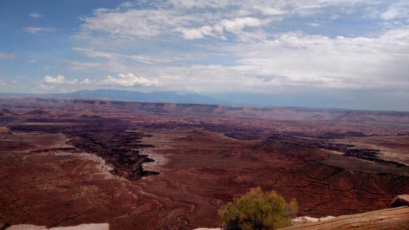
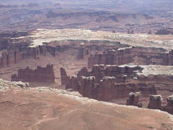
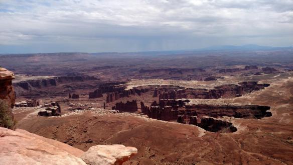
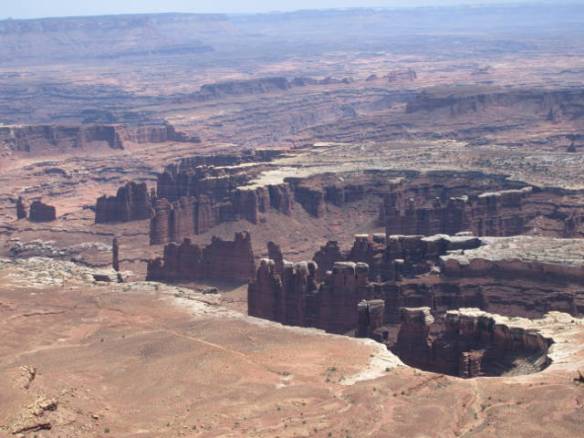
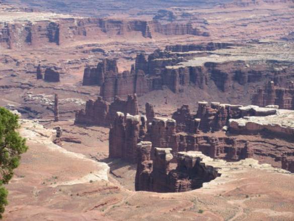
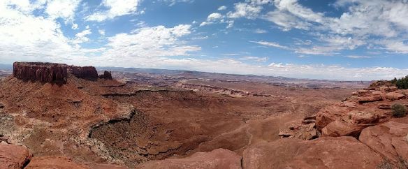
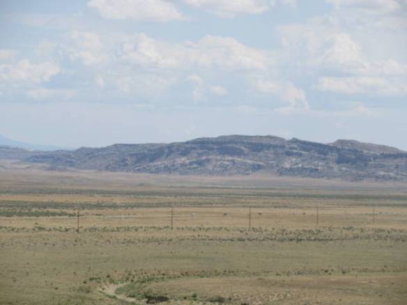
Watching Rabbits Hop

Sunday August 6th 2017

I succeeded in getting up earlier today, but I was even slower getting started than yesterday. It was well afternoon before I had any ambition. By then it was too late to head down to the National Parks. They are around 50 miles away. I spent most of the day in couch potato mode. I watched various sporting events on TV all day. Part of my lack of motivation is the knowledge that I’ve got another week here before moving on. I don’t think it will take more than three or four days to see most of the nearby sights.

u1

Mr. Big ears hides from the sun under my RV. When I go outside he hops away watching me closely.

I took a couple of walks around the campground to get a little exercise. This campground is unusual in that it seems to fill up late in the evening. At most campgrounds the majority of the new arrivals have come in by six or seven in the evening. For some reason, this park seems to get many arrivals in the late evening. When it gets dark there are many empty sites, in the morning a lot of the empty sits have been filled.

It has looked like rain since mid afternoon. As I write this blog, it is between 6:30 and 7:00 and a thunderstorm has finally arrived. This one is a real thunderstorm. The last couple of days we’ve gotten wind, thunder and a little rain. Today’s storm has all of that plus air to ground lightning and lots of rain. I’ve seen at least two good lightning strikes in the distance. It has been a continuous roar of water hitting the roof of the RV and big areas of standing water are forming outside the rig. It has been awhile since I’ve been in this heavy a rain storm. Similar storms are in the forecast for the next couple of afternoons.

The Green River

Saturday August 5th 2017

It was a sunny day with a high temperature in the mid 90s. As I’m starting to right this blog entry at 8:30pm a thunderstorm is moving into the area. The sky to the west and south is black and to east the sky glows red with the reflected sun passing over the top of the western clouds.

I slept in this morning. Somehow I’ve gotten into a sleep pattern that has me getting to sleep around one in the morning and waking up close to nine. This morning I slept even later. I need to break this pattern. I’m going to bed around eleven but still not sleeping for a couple of hours. Over the next few days, as I start to tour the area national parks, I’m going to have to set an alarm to get moving earlier. My late start today ended all thoughts of going to the National Parks this morning. I was only lukewarm to the idea anyway.

s1

Looking west across the Green river in Green River Utah.

Today I learned about the Green River. The John Wesley Powell museum is across the street from the campground. It is located on the east bank of the Green River. It has a number of display boards that describe the history of the river and the crossing here in Green River Utah. The town is here primarily because this is the only easy place to cross the river for many miles in either direction. South of here the river is in deep canyons all the way to the Colorado river. It was first used by European settlers in the second half of the 1700s. The Old Spanish Trail from Santa Fe New Mexico to California crossed the river in this area. The region was explored by the Americans in the 1840s when John Freemont traveled through the area. In 1869 the river was explored by John Wesley Powell.

s2

Looking north west across the Green river in Green River Utah.

Powell traveled the river from its headwaters in Wyoming down into the Colorado River all the way to where the Virgin River joined the Colorado River. That trip took his expedition through the Grand Canyon to a point that is covered by Lake Mead today. Most of the location names along the rivers owe their names to the Powell expeditions. The Green River joints the Colorado River in the Canyonlands National Park area.

s3

Green River full of silt. Looking upriver from the bridge in Green River UT.

My other “major” accomplishment today was finding the local grocery store. I was wrong in my assumption that I could find bread in one of the truck stop convenience stores. They had plenty of chips, cookies and pastries, but no bread. I found the grocery store under a sign that emphasized the bakery part of the business. It was a well stocked little store. I now have bread for sandwiches and English muffins for my morning coffee.

Green River UT

Friday August 4th 2017

It was a changeable weather day. Starting early last night this area has been subject to thunderstorms. There were three or four overnight into this morning and they resumed around 5:30 this evening. In between it cleared off and the sun came out to heat things up. These thunderstorms haven’t dropped a lot of rain, but have had strong winds with thunder and lightning. The sound of rain on the roof only lasted a couple of minutes and wasn’t very hard. Areas to the southwest of here have been in a flash flood watch so I suspect there are storms producing more rain.

f1

View to the Southeast toward Arches National Park from the rest area on Interstate 70 near the route 191 interchange.

During the calm between the storms, I drove around the area in an area familiarization tour. This town has under one thousand residents and not many resources to support them. There are several motels and restaurants along with truck and car repair facilities all designed for the travelers on Interstate 70. Green River Ut has the only significant amount of services in the over 200 miles between Grand Junction CO and Richfield UT.

One strange feature of the town is an Amtrak station. The California Zephyr train from Chicago IL to the Sacramento CA area stops here. I assume it is because of the national parks south of here, but the station has no services. As near as I can tell it’s a piece of concrete beside the tracks.

In addition to the convenience stores at the truck stops in town, there is a grocery store. It’s not on the main road through town. I haven’t found it yet. The staff here at the campground said most of the locals drive 60 miles or so north to Price UT or east 100 miles to Grand Junction CO when they need supplies. Since I only need bread right now, I’ll probably be visiting one of the convenience stores. They certainly are more convenient.

f2

Visitor to my campsite.

f3

They didn’t stay long.

The current monsoon based weather pattern is forecast to continue for the next couple of days. It is also the weekend. I have learned that touring National Parks on the weekend is a little more crowded than during the week. Wet weather and crowds may influence my touring plans for tomorrow. If I don’t head south to the National Parks, there are other things I can do in town or to the north.

Travel to Green River

Thursday August 3rd 2017

Today was a travel day to Green River Utah. It is about 160 miles from Fillmore Utah. The last one hundred and ten miles was along a very mountainous and picturesque section of Interstate 70. I started the trip around 10:30am in a very warm, but overcast day. At the end of the trip around 2PM in Green River it was clear with bright sunlight around 100 degrees Fahrenheit. Setting up camp was not fun on the sunny side of the RV.

I was not looking forward to today’s trip. The section of Interstate 70 was brand new territory for me. My research indicated it was a lot of up and down through narrow canyons and windy plateaus. It turned out to be all that and more. A several mile section was under construction resulting in a single lane of travel. I had a good backup of cars behind me. The engine got a lot of work going up and the transmission got a lot of work going down.

When possible, I tried to take a few pictures through the windshield. It is very interesting geology. I didn’t get pictures of some of the most interesting areas, because I had to have two hands on the wheel along with all my attention on the road. There are a number of viewing areas and rest areas along the road. I only stopped at one. Some of the pull offs looked like they might be a nightmare to negotiate in the motorhome.

r1

This series of pictures show the scenery on I70 from Salina UT east to Green River UT

r2

r3

r4

r5

r6

r7

Site 31 at the Green River KOA.

I will be staying in Green River for the next eleven days. I plan to use this as a base to visit Arches NP, Canyon Lands NP and some of the other parks and sites in this area. The Green River KOA is my home during my time here. It is level, has a few trees and some grass, but is mostly sandy desert like terrain.

Uploading Photos

Tuesday August 2nd 2017

It was another sunny day in the mid 90s with low humidity. For the second day in a row I didn’t do anything particularly blog worthy. I’m ready to move on, which is exactly what I am going to do tomorrow.

t1

View across the range to the west in the hazy setting sun.

I spent today doing various chores around the RV and getting ready to move on tomorrow. One task I accomplished that is a little outside the norm is uploading the pictures I’ve taken since the beginning of the year. This campground has very good wireless internet access. A speed test shows a transfer rate around 20MB/sec which is very good. I usually see internet speeds in campground around 1MB/sec. My 4G cellular data rates are better than many campgrounds, but I have a data cap so I don’t like to use it to upload pictures.

Today I uploaded more than 3500 images that I have taken since the beginning of the year. I take lots of pictures to record my experiences. I select a few to be used in this blog. I use Google Photos to store the photos in the cloud. It is easy to use from my smart phone and only a little more complicated from my laptop. I don’t rely exclusively on Google to retain the photos. I have all the files on my laptop and I also keep copies of the files on two portable backup drives.

I have enjoyed this campground, but not necessarily the area. The campground staff works hard to keep the campground clean and looking nice. They check every site after the visitors leave and clean the fire pit as necessary. Every day they setup sprinklers to water the grass between sites. They move them around every couple of hours. It’s working. The grass between the sites is a deep green. It looks like they had some nice flower gardens earlier in the year, but the plants are passed blooming now.