More Butte Touring

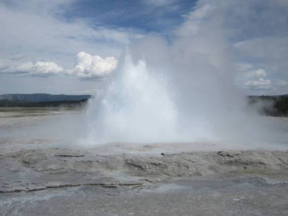
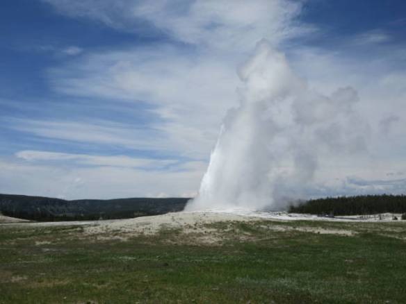
Saturday June 10th 2017

Today was a repeat of yesterday. The weather was very similar and my activities were too. It was mostly cloudy with occasional rain showers. The temperature was cooler than yesterday. It only got into the mid fifties.

st1

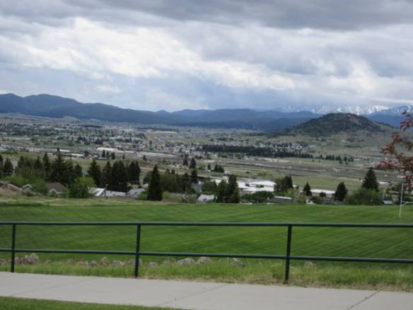
View of the lower parts of Butte from the Montana Tech campus.

My day started slowly with an extra cup of coffee while catching up with my Internet reading. Eventually I got in the car to explore the area some more. I drove into the downtown Butte area. As with most things in this area it is on a hill side. Unlike a lot of towns the old buildings are still in use. They may have been re-purposed a few times, but I didn’t see many signs of new construction replacing the old buildings. I found the World Museum of Mining that I want to visit on a better weather day. Walking around outside today was wet and cold much of the day. To get to the museum I had to drive through the Montana Tech campus. I was surprised by the number of students around on a Saturday in June.

st2

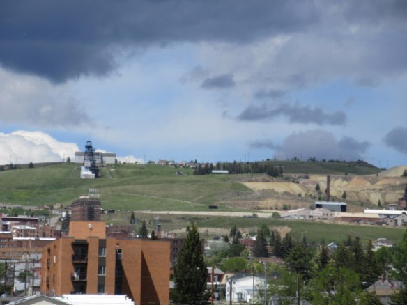
A Head frame from an old mine on the hillside above downtown Butte.

st3

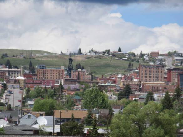
City of Butte with and old head frame for a mine shaft.

Another observation from my wanderings today is the amount of land dedicated to cemeteries. I saw two huge active cemeteries. I also saw signs for more than one mortuary and a crematorium. I didn’t see any funeral homes, maybe that function is done by the mortuary. I’m not in the habit of looking for cemeteries, but for some reason the cemeteries of Butte got my attention.

st4

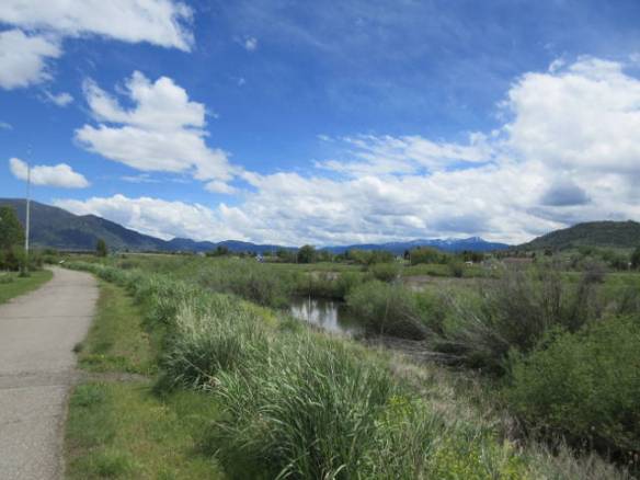
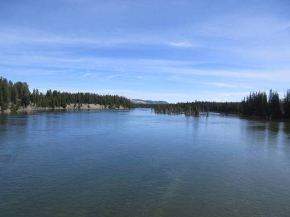
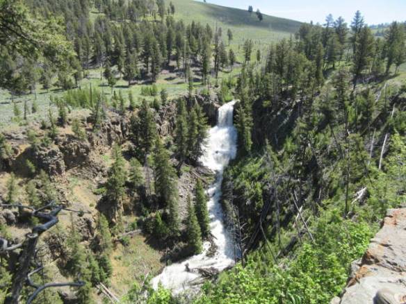
Blacktail creek beside the county trail behind the campground. This picture was taken during the hour the sun was out this afternoon.

The rain chased me back to the RV at mid afternoon. For an hour or so the occasional shower turned to a steady rain, but it was followed up by about an hour of sunshine. Taking advantage of the brief period of better conditions I took a walk on the county walking trails around the campground. There is a creek that passes between the campground and the interstate that the trails follow. The water is not high today, but a flood watch is on until Wednesday. It doesn’t look like this creek will be much of a threat. I was disappointed not to see any water birds in the creek area.

Rainy Day in Butte MT

Friday June 9th 2017

The campground came alive early. Many of the overnight guests, including my immediate neighbors, left before seven this morning. I rolled over and managed to sleep until eight. When I got up I notice that many other sites that were occupied last night were already empty. There are new guests on those sites tonight. This is a stop for travelers.

fr1

Our Lady of the Rockies statue looking down on the city of Butte from the Continental Divide. The statue is 90 feet tall.

Today was a mixed bag weather wise. It started out cool and cloudy then transitioned to occasional showers. There were a few brief periods of sun and a thundershower mixed in. Overall the temperature didn’t get above the mid 60s. Tomorrow is predicted to be similar and the beginning of the week has steady rain in the forecast. The only reasonable day in the forecast is Sunday.

I spent some time today checking out the area. There is a nice park with bicycle and walking trails beside the campground that I’d like to take advantage of if the weather will cooperate. This seems to be an old community. The streets are narrow and don’t follow any particular pattern. It fits the idea of a community that built up quickly with the discovery of gold, silver and copper in the surrounding mountains. I’m looking forward to learning more about it.

The one major goal for the day was restocking the refrigerator. I found the local Walmart Super Center and replenished the basics. I was struck by how friendly the people were at the store. The greeter actually greeted people and the checkout clerk engaged me in conversation. Most of the time the greeter is half asleep in a chair and the checkout clerk doesn’t even say hello.

Back at my RV home I listened to the rain on the roof. As the evening progressed the rain became heavier and more constant. I had to crank up the volume on the TV to hear it over the rain. Continuous rain acts as white noise at night to help with sleeping, but occasional rain overnight will wake me up every time it starts.


Travel to Butte

Thursday June 8th 2017

Today was moving day to Butte Montana. I was packed and on the road by 10am. My goal was to get the travel over before the forecast severe thunderstorms moved in. It was a trip of about 150 to 160 miles.

The first half of the trip was fine the road had a few small hills but was had a wide shoulder and passing lanes when necessary. The second half of the trip wasn’t that great. The road got narrower and the hills increased. I had one steep climb and decent that was seven percent going down and that seemed less steep than the climb. I was down to 40 mph at the top with a trailer truck and several cars lined up behind me.

I also had to stop for a cattle drive across the road. Several men on horseback supported by four dogs moved the black herd across the road. Then decided to drive 2 of the animals back to the original side. I’m sure there was a method to the task, but I was stopped for a good five minutes and I wasn’t the first car in line.

Once I reached Interstate 90 the real work began. I had to cross the Continental Divide again. This crossing was a several mile stretch of five and six percent climbs. In a couple of the steeper areas I slowed below 50 but topped the divide around fifty five. The decent into Butte didn’t loose as much altitude, but it still had a couple of curves along miles of six percent grades. The transmission got a workout.

Today’s drive was the most mountain work I’ve had to deal with so far on my Rambling Road Trip. The length of the climbs and the number of different climbs I had today is what makes the travel day standout. I’ve crossed through passes at higher altitudes on other travel days.

rd1

Site 90 at the Butte MT KOA.

I arrived at the campground in Butte a little after 1PM. I beat the weather to my destination. Getting everything setup was a bit more challenging than normal. The bouncing around I did on some of the roller coaster roads knocked a couple of things onto the floor and the power supply for my satellite dish bounced loose. After I found the satellite power problem, the dish couldn’t find the satellite. It is blocked by a tree. I can live with the strong local channels.

The weather went downhill around 3PM. Very strong winds have been buffeting the RV. I’ll be here for a week before I move on to Glacier National Park. This is a big mining area with several related museums and exhibits. The weather is also taking a turn for the worst. The high was in the eighties today. The weekend and the days into next week are forecast to be cooler with showers and full blown rain. The first good day is next Thursday when I move on to Glacier.

Reflections on Yellowstone NP

Wednesday June 7th 2017

Today was the wrap up day for my Yellowstone experience. I didn’t go into the park today, but spent some time in the village of West Yellowstone. It is the center for most of the tourism into the park. There are hotels, bread and breakfasts and campgrounds throughout the town. All of the major tour operators seem to be based in here as well. A MacDonald has even opened in town. You have to look hard to find it since it is a wood sided building that blends in well and it is pretty small.

w1

Mountains and sky above my RV home. This view out my front window is memorable.

Overall I’ve enjoyed my visit to Yellowstone National Park. It wasn’t in my original plans for this summer, but when I saw how close to my route north the park was I added the stop in West Yellowstone into my plans. During the eight nights I’ve spent in West Yellowstone I spent five days in the park. Each day I drove between one and two hundred miles to see the areas along most of the main roads. The only route I didn’t explore was the road south toward the Grand Tetons. Touring that area will come another time.

The park’s geology exceeded my expectations. I did not know there were as many diverse geysers, hot springs, vents and such in the park. I though going in that all of the geothermal activity was around Old Faithful. It surprised me to see geysers and vents on the other side of the park forty or miles as the crow flies. I liked walking around the Norris Basin better than the area around Old Faithful. I will admit that Old Faithful is impressive. I would like to have seen another one of the bigger geysers going off, but the timing never worked out.

The mountains, rivers and canyons were beyond my expectations. While I knew the park was in the mountains I didn’t consider all of the elevation changes that you encounter driving around the park. Visiting at this time of year with the snow caps still visible and the rivers near flood stage with the runoff contributed to the beauty of the park. The Yellowstone River canyon was another surprise.

I expected to see lots of bison and I did. Perhaps the only surprising aspect of the bison is the number of different areas that they roam through. I was not surprised by their use of the roads as their own. I had that experience in North Dakota a number of years ago. It was nice to see the bison calves. They add an element of cuteness to the otherwise ugly beasts.

The Mule Deer were a surprise. I had heard of the animal, but had never considered what their habitat was like. Once I knew what to look for, I saw several. I also saw more ordinary deer and a couple of pairs of Prong Horns. Unfortunately, I never saw any Elk. I wasn’t in the right place at the right time. The warm weather may have pushed them to higher altitudes.

I saw several Black Bears, but no Grizzles. Once again I wasn’t in the right place at the right time. I met several people that had seen Bears the previous day or earlier the same day if they are to be believed. The Wolves also went undetected, but this is not as surprising. The Wolves are usually only seen near night fall and I’m back at my RV home by then.

The animals I haven’t seen provide a reason to return another time. Late spring was a good time to visit. The snow had melted enough that most everything was open, but it wasn’t the heat of the summer yet. I’d like to time my next visit to be in September before it gets too cold.

Yellowstone National Park Day 5

Tuesday June 6th 2017

I was back in Yellowstone National Park by nine this morning. My touring plan for today was the eastern section of the park. I traveled from the West Yellowstone to the Madison Intersection, on to Norris then on to the Canyon area down to Fishing Bridge. Fishing Bridge is where the east access road intersects with the loop road. I went out the east access road about half way to the entrance. The area had a fire in the last few years so is not very interesting.

I took around fifty pictures today. They can be found in my Google Photos Album called Yellowstone June 6 2017.  Click the link to see all of today’s pictures.

Yesterday I didn’t see any Bison on my way into the park. Today, they were all over the place. You can tell the first day visitors to the park from the reactions to the bison. A lone bison back in the woods gets the attention of the new visitor. Those that have been here before know that there will be more around the next bend. This morning the bison were on the West access road and on the road south of the Canyon area. In both cases I took pictures with one hand while driving with the other. Since you can only roll along at 2 or 3 mph in these Bison traffic jams, the pictures aren’t too bad.

yt01

Who are you looking at?

yt02

Hold on, I’ll be out of your way when I’m out of your way.

yt03

Another bison jam along the Yellowstone River south of the Canyon junction.

yt04

The little ones follow quickly.

This morning I stopped at the Mud Volcano area south of Canyon. I passed by the area last Friday. Parking was difficult today, but a lot better than Friday. The geysers and springs in this area are mud filled rather than clear water. They are also hotter. There is a paved path, boardwalk and a few stairs to the top of the volcanic hill with several geothermal features along the way.

yt05

Dragon’s Mouth Spring. The steam and bubbling mud come out of the cave like it was a dragon’s mouth.

yt06

Mud Volcano

yt07

Churning Caldron is scolding hot but not boiling. The bubbling is caused from gas escaping from deeper in the earth.

yt08

View from the top of the Muc Volcano hill of the parking lot and hill side beyond.

From the Mud Volcano I went on to the Fishing Bridge visitors center. There are visitor centers at most of the named intersections in the park. This one featured the birds in the park with stuffed versions of all the bigger birds. While parked at the visitors center I walked over to the Fishing Bridge Campground. This is the only campground that takes reservations and has facilities for RVs. I wasn’t impressed. The sites for RVs were side by side and back to back very densely packed. I’m happy staying outside the park and driving in.

yt09

Yellowstone river as it flows away from the Fishing Bridge. These waters are prime Cutthroat Trout spawning grounds.

yt10

The Bridge has a naming problem.

yt11

Yellowstone lake as seen from Fishing Bridge on the Yellowstone River.

yt12

Yellowstone Lake.

Tomorrow is my last day in the Yellowstone area. I need to spend some of the day getting ready to travel on Thursday. It is a toss up if I return to the park tomorrow. I have seen all of the big areas and attractions. If I knew of an area with a high probability of seeing different animals I might venture in. There is a ranger presentation at the West Yellowstone Visitors Center at 9:30 tomorrow on the animals of Yellowstone. Attending that presentation is the extent of my plans for tomorrow.

Yellowstone NP Day 4

Monday June 5th 2017

Today I was back to touring Yellowstone National Park. My goal today was to visit the northeast corner of the park. The Lamar River valley along the park access road from Cooke City MT is known to be a major wildlife area. To get there I passed over Dunraven Pass at 8859 feet. It is the highest pass on a main road in the park. The snow pack on the sides of the road was still over 6 feet high in some areas.

ym01

View of the expansive Yellowstone Caldera.  The snow covered Mount Sheridan is  on the far side of the caldera.   

ym02

A pair of deer above the overlook of the Yellowstone Caldera.

ym03

There is still plenty of snow above eight thousand feet.

ym04

Yellowstone River Canyon north of Tower Falls. The spires are the result of volcanic activity and are the origin of the name Tower Falls. The cliff wall at the far end of the picture is the home to several mountain goat mothers and kids. I am going with the crowd of tourists and calling them goats.  I think they may actually be Big Horn Sheep.

ym05

Mountain goat (rear end) and kid to the right at center of picture

ym06

Kid is partially behind mother in center of picture.

ym07

Mother and Kid (bottom center) just came out from under the overhang.

The Lamar River Valley is the home to large herds of bison, the winter range for elk and many of the parks predators. The recently re-introduced gray wolf population live in this area as do grizzly bears. I was hopping to get a glimpse of any of the predators. I saw many many bison, a few deer and a couple of prong horns, but no bears, wolves or elk.

ym09

Lamar River Valley. I didn’t know until I was driving away that a bison was lying on the ground in a depression no more than 30 feet from where I was standing.

ym10

Lone bison on the far side of the Lamar River.

ym11

A few lazy bison on the side of the road.

I didn’t take as many pictures today. All fifty can be viewed in my Google Photos album called Yellowstone June 5 2017. Click on the link to visit the shared album. Many of the photos are at the full zoom of my camera to get shots of distant deer and mountain goats with young.

The number of cars, buses and rental motorhomes in the park seems to be increasing every day. Today I was in a steady line of traffic from the time I entered the park until I turned north at the Canyon intersection about 40 miles. Unlike other days I didn’t see any animals over that stretch either. It rain fairly hard overnight, so the bison may have retreated into the trees.

Tomorrow I’ll focus on the southeast section of the park.

1959 Montana Earthquake

Sunday June 4th 2017

After three straight days touring Yellowstone National Park, I took today off from the go go driving, walking and viewing. Instead I had slept until 9AM then had a leisurely breakfast. Around noon I ventured out to check out some of the territory north of the village of West Yellowstone. It was also a scouting trip for some of the route I will take out of town on Thursday.

u1

Earthquake Lake formed by the 1959 Montana earthquake. The view is from on top of the rocks that plugged the canyon.

u2

Looking northwest from the end of the canyon at the rolling range land.

What I found was an area devastated by a magnitude 7.3 earthquake in 1959. The Madison River Canyon downriver of Hebgen Lake was blocked when a large part of the south side mountain, at the end of the canyon, collapsed into the canyon. A new lake 190 feet deep called Earthquake Lake was formed by the block river and additional water that went over the dam at the end of Hebgen Lake.

u3

Earthquake Lake in an area that used to be the Rock Creek Campground now under water.

Over 250 people were trapped by the Earthquake and 28 were killed. Herculean efforts were undertaken to get to those trapped. This included air drops of supplies followed by helicopter rescues. Helicopters weren’t as common fifty eight years ago as they are today. Most of the people trapped were tourists enjoying the mid August weather in the National Forest. The flooded area included two campgrounds.

The area beyond the canyon was gently rolling range land. Buildings in the area are mostly made of logs with metal roofs. Once upon a time logs were the easily available resource, but I suspect today it is more of a style thing. Milled lumber is probably just as readily available, if not more.

u4

One of the clouds moving in at the end of the day.

Back at camp this afternoon, I got ambitious and cooked Scalloped Potatoes and Ham for Dinner. It came out pretty good in my Convection Microwave oven. The only complication with using the convection oven is that I had to heat the can of corn on the stove instead of in the microwave.

Late this afternoon the clouds moved in. It had been sunny all day. The TV reported severe thunderstorms to the west. This evening the sky darkened and the wind blew. A brief minute or two of rain followed. The sun came back out within half an hour.


Yellowstone National Park Day 3

Saturday June 3rd 2017

In my last two blog entries on Yellowstone park I incorrectly pictures of female Mule Deer as Elk. I wasn’t really convinced they were Elk, but I didn’t know of any other animal in the area as big as Elk. I have updated the previous two blog entries with the correct description of the animals.

I got into Yellowstone National Park shortly after nine this morning. The long line at the entry toll both was representative of the volume of traffic in the park today. My goal was to explore the northwest corner of the park. I drove directly to the Mammoth Hot Springs and Gardiner area without stopping at many of the sights, since I would be returning on the same route.

I only took a little over one hundred pictures today. The number of pictures is down because the traffic prevented me from stopping in a few areas. The terrain is also very different from the geothermal features in the areas I was in the last two days. All of the pictures can be found in my Google Photos Album Yellowstone June 3 2017. Click on the link to view them all.

I also saw a lot of animals that I didn’t get a chance to photograph. Two in particular standout. I saw a Black Bear a short distance off the road in an area that stopping wasn’t possible and a Coyote was trotting along the road in the opposite direction.

ys01

Gardiner River flowing out of the park toward the town of Gardiner MT. The water was crashing hard against the foot bridge.

ys02

The Gardiner MT area at 5224 ft. Mammoth Hot Springs is a thousand feet higher and I drove down a mountain another thousand feet to get there.

ys03

An interesting marker between Gardiner and Mammoth Hot Springs.

ys04

Undine Falls East of Mammoth Hot Springs on the way to the Tower-Roosevelt Intersection. I turned back at Tower-Roosevelt. The area east of there is for another day.

ys05

Representative of the land between Mammoth Hot Springs and Tower-Roosevelt.

ys06

Village of Mammoth Hot Springs below the Hot Springs Terraces on mountain side.

ys07

Boardwalks and steps climb the terraces of the hot springs.

ys08

ys09

ys10

ys11

ys12

ys13

On the way out of the park I had to share the road with a herd of bison. They didn’t bump into the car but there were a few close calls. Larger bison would side bump another bison and force them to go between the cars and down the other side.

ys14

Here come the bison.

ys15

Passing to the left of the car.

ys16

Passing to the right of the car. Lots of shedding matted hair.

ys17

Two minutes later they’re still coming.

ys18

This one couldn’t make up his mind. Left? Right? Over the top of the big gray thing? At the last minute he went down the right side.

ys19

They lean young.

ys20

Running to catch up on the left.

ys21

Running to catch up on the right. This one had a broken horn. Probably from fighting.

Tomorrow I plan to sleep in. The heavy Sunday park visitor count doesn’t need me too. I’ll tour in the West Yellowstone area outside the park. I still have three days next week to see more of the park.

Yellowstone NP Day 2

Friday June 2nd 2017

After a full day yesterday, today started slowly. I had high hopes of getting to Yellowstone NP early to see more animals, but I didn’t get up until 8AM. After a quick cup of coffee and a muffin I was out the door. I actually made it to the park a little earlier than yesterday at around 8:50. The cost of rushing out of my RV home was forgetting to pack a lunch again.

I only took 215 pictures today. The camera battery life indicator was blinking for the last couple of pictures. All of the pictures are in my Google Photos Shared Album called Yellowstone June 2 2017. Click on the link to see all of the pictures. I have selected some of the better pictures to tell the story of my day. The captions will attempt to provide some context.

yf01

About ten miles into the park I got stopped in a long line of traffic. It took about 10 minutes to get by the Bison along the side of the road. This seems to be the same group I saw yesterday further up the road. This is the only group I’ve seen with youngsters.

yf02

North of the Madison intersection is another thermal area. With the outside temperature in the 50s the heat was really producing steam. This pool has a lot of nice yellow wildflowers.

yf03

Notice all the steam at this bubbler.

yf04

Continuing north the road follows the Gibbon River. This is the Gibbon Falls.

yf05

At Norris there is another big thermal area known as the Norris Geyser  Basin. This is an overview picture of the Porcelain Basin part of the Norris area..

yf06

Today’s wind direction requires you to pass through the steam cloud from this spring to get to the Porcelain Basin.

yf07

The Hurricane Vent was very warm. The heat along with the smell was noticeable from the boardwalk.

yf08

The Porcelain basin had many colorful flows caused by the minerals secreted from the earth.

yf09

More colorful Porcelain Basin.

yf10

Also in the Norris Geyser Basin area is an area known as the Back Basin. This is the Echinus Acidic Geyser. It was very active in the 1990s, but is very random now.

yf11

Looking at the mountains across the Back Basin.

yf12

The Green Dragon Spring.  The Boardwalk passes along the rock overhang above the spring.   You need to walk trough the steam, smell and some water spray from the spring.

yf13

This geyser is called the Vixen. It seems to be going off as often as it is building up pressure.

yf14

This dead tree stump is in the runoff from the basin.

Today when the West Yellowstone access road reached the Madison junction I turned north and did the inner loop roads clockwise. I passed through Norris, Canyon, Lake Junction, Grant Village and Old Faithful before getting back to the West Yellowstone access road in Madison. I skipped a couple of the bigger natural attractions south of Canyon that I hope to get back to next week.

yf15

From Norris I drove east over a seven thousand plus feet mountain to the Canyon area of the park. This area is named for the Yellowstone River Canyon that is just east of the intersection. This Crow was watching over the parking lot at the Lower Falls of the Yellowstone River.

yf16

The Lower Falls of the Yellowstone River.

yf17

Rushing water heading for the Upper Falls of the Yellowstone River. The climb down to the top of the falls was not as long as the climb to the Lower falls. I made this hike but turned around a quarter the way down to the lower falls.

yf18

High meadow area along the Yellowstone River. I would image at times this area is teaming with animal life. Today I saw a lone bison and lots of ducks and geese.

yf19

Lake Yellowstone.

yf20

One of a group of Mule Deer along side the road.

Tomorrow is a weekend day so the crowds may be even worse. I plan to head north in the park toward Mammoth Hot Springs. The road construction in that area shouldn’t be going on tomorrow and I think it is a less popular area.

Yellowstone NP Day One

Thursday June 1st 2017

Today was a partly cloudy day that got into the mid to upper 60s. Late in the afternoon a line of storms passed through the area. They brought a lot of windy and a little rain.

I tried to get an early start today. The goal was to get into Yellowstone before all the animals went into hiding. I wasn’t very successful. It was a little after nine when I passed through the West Yellowstone entry toll booth. I still saw many bison and a few other critters.

I took over 300 pictures. My main camera ran out of battery juice so I switched to my cell phone and my backup camera. This post will be mostly pictures but I can’t put all of the pictures. My Google Photos library has all of today’s pictures in an album called Yellowstone June 1 2017. If you click the link you can review all of today’s photos.

yr01

Geese landing in a meadow along the Madison River.

yr02

The entry from West Yellowstone follows the Madison River.

yr03

Firehole Falls on the Firehole River.

yr04

Roots of a dead tree at the Fountain Paint Pots area. The chemicals in the run off from the eruptions kill the trees.

yr05

These dead trees have “Bobby Socks” from the chemical absorption.

yr06

yr07

yr08

yr09

Fountain Geyser

yr10

Wild Flowers growing beside the Excelsior Geyser Crater

yr11

Excelsior Geyser Crater

yr12

Grand Prismatic Spring

yr13

Grand Prismatic Spring

yr14

Opal Pool

yr15

Turquoise Pool

yr25

Panorama of seating area surrounding Old Faithful Geyser on close to 270 degrees.

yr16

Old Faithful

yr17

Old Faithful

yr18

Old Faithful

yr19

Bison watching the world go by from the side of a geyser.

yr20

Teakettle Spring

yr21

Bison decided to take a walk from the side of the geyser across the boardwalk.

yr22

yr26

yr24

Blurry picture of Mule Deer on the side of the road as I slowly drove by.

yr23

Bison with calfs in the Mather area of the park.

I spent about six and a half hours in the park and only did one small section. My focus today was on the caldera section of the park with the geysers and hot springs. Tomorrow, I’ll check out another area of the park.