Wiring Repair

Thursday May 11th 2017

My focus today was preparing for tomorrow’s travel day. It was more complicated than normal because I had a little repair work to complete before traveling.

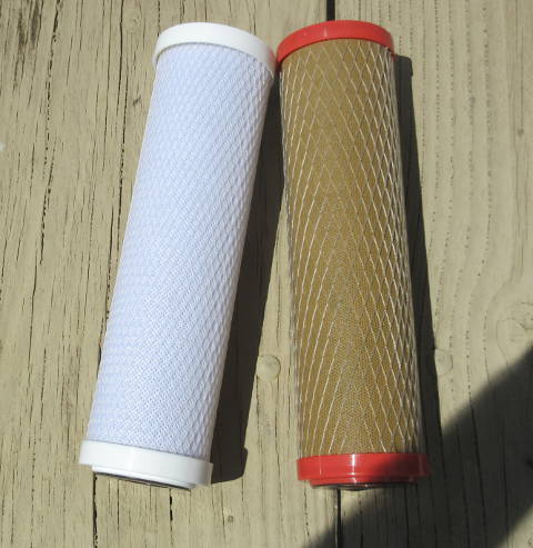
Earlier in the week I spotted something hanging under the car. When I crawled under the car to investigate, it turned out to be the wiring for the lights when under tow. For the cars tail lights to work when it is being towed by the RV, a four wire cable was run from a socket at the front bumper to the lights at the rear of the car. Somehow that cable got snagged and cut sometime along the way. I’m pretty sure it was working when I left Las Vegas last week, but I really can’t be sure.

tr1

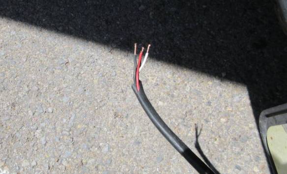
One end of the wire cable cut under the car. This is after I’ve cleaned it up and made it ready for a splice. Initially, the last three inches on this side were in pretty bad condition.

The best solution would be to run a new cable from the socket to the break and have only one splice. I took a less permanent direction by splicing it twice in the middle of the cable adding about a foot of new cable. When I can find some good shielded cable I’ll do it the right way. I tried several places over the last couple of days but could only find wire glued together as a ribbon.

The hardest part of this repair was access under the car. There is barely enough space to get under far enough to reach the wires. Ideally, the car should be on a lift or at least a good contoured slope of ground. I had the next best thing; a paved flat surface to work from. It’s the next best because it wasn’t wet or rough gravel. The only complication is the grounds crew decided to cut the grass beside the car. It turned out to be a good time for a lunch break. All told it took me an hour over about three to complete the task. With the right conditions it should have taken fifteen minutes.

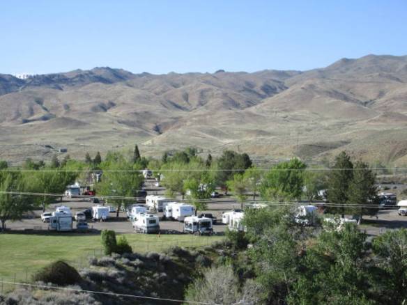
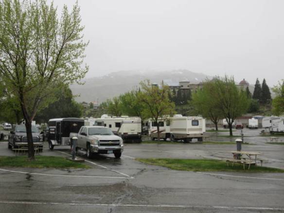
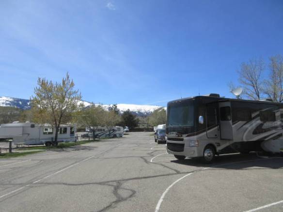
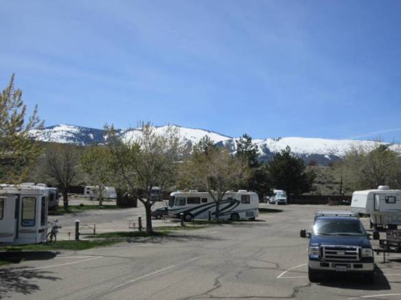
Later in the day I made a pre-travel provisioning trip to the Super Walmart. Having a good stock of groceries allows me to travel without worrying about finding the next store. Parking was at a premium at the store. The local trend of springtime repaving projects has hit the Walmart. Half of the parking lot was closed so they could repave it. I may just be sensitive to paving because the RV park is getting repaved, but it seems like everywhere I go I see a paving crew.

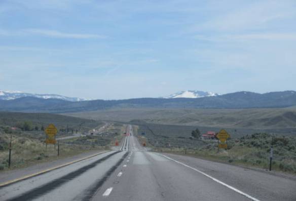
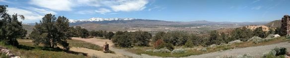
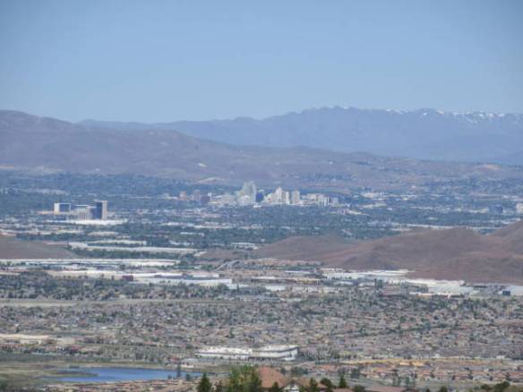
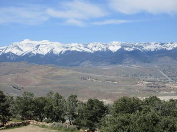
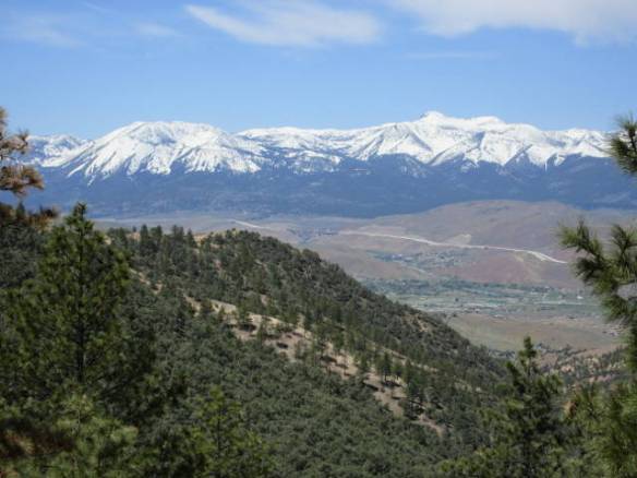
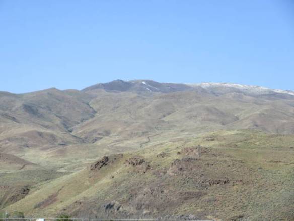
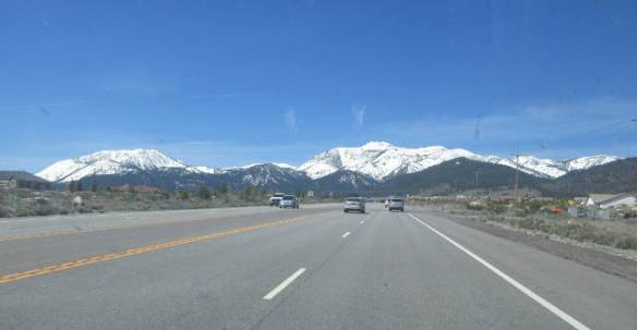
Tomorrow I’m heading a little under 200 miles east on Interstate 80. I hope the wind is calmer tomorrow. This afternoon the wind has been blowing at twenty miles per hour or more. Gusts have been even higher. Staying here is not an option. This park will be full for the weekend. KOAs have a deal going, if you stay Friday night, Saturday is free this weekend. There is also a River festival going on in Reno.

A Random Touring Day

Wednesday May 10th 2017

I got a slow start today. I spent all morning slowly drinking my coffee while catching up on my Internet reading and watching TV. It wasn’t until mid afternoon that I ventured out of the campground.

Without any specific destination I found myself wandering through the local neighborhoods on the northwest side of Reno. These are upscale neighborhoods with homes built in the last ten years. Some areas are gated communities and others are clustered around shopping. It is interesting to speculate on what it would be like to like in this area. The combination of the city of Reno and the nearby mountains provide a good combination of urban for culture and rural for recreation.

we2

Route US 395 returning to Reno from northwest of town.

After passing through the neighborhoods I drove northwest on US 395 into California. This route pretty much keeps to the valleys on the east side of the Sierras from southern California north to Oregon and Washington. I expect it is a route I will use in a future year of travels to tour the Oregon and Washington areas. The scenery is pretty interesting. At this time of year the mountains still have snow at altitude and the slopes are green. As the snow melts the green will also turn brown creating a completely different visual palette.

we3

Mountains to the west of US 395.

US 395 is a big enough entry into California that it has an agricultural inspection station. In California all vehicles need to go through the inspection. In other states with inspections it’s usually only trucks. Today the volume of traffic was low, so my car without a front license plate from a nearby state got selected for questioning. You could see the inspector’s mind work. He stared at my front bumper then looked down the road behind me. Since there were no other cars in sight he decided to talk to me. Once I said I didn’t have any plants or fruit on board I was allowed to continue, only five seconds of delay. I have passed through the inspection station on Interstate 80 a couple of times in the last week without any interrogation, but that was a busy road.

we4

Pretty display at the Grand Sierra Resort, but are they real? I’m not sure, probably not.

When I returned to town I checked out another casino. This time I stopped at the Grand Sierra Resort Casino. It is large complex outside of the center of town on Interstate 580. Over the years it has been known as a Hilton, Bally’s and MGM resort. It has a big entertainment theater, but not as many slot machines as some of the other casinos in the area. Unfortunately, it had enough slots to take twenty bucks from me.

we1

Two rafts in the Truckee River below the RV Resort.

Back at the RV resort I saw another interesting use for the Truckee River below the campground. Today, three adventurous folks were riding the rapids in rafts. Two people were in one traditional raft and one guy was in a pontoon raft. The traditional raft was fairing better than the pontoon craft. It was getting hung up on some of the hidden rocks. I didn’t see any disasters as they passed by, but I don’t know how far they had to go before their take out.

Virginia City Nevada

Tuesday May 9th 2017

It was another beautiful sunny day with the high temperature in the mid 70s. I set out in late morning to visit Virginia City NV. Virginia City was the center of the late 19th century gold and silver mining bonanza that gave Nevada its name as the Silver State. At its peak over 25,000 people lived in and around Virginia City. Today there are still many residents of the community but their primary focus is tourism.

tu3

Panorama of the Truckee Meadows from the overlook in the Virginia Mountains

Virginia City is located at over six thousand feet on the east side of the Virginia mountain range that make up the ridge line on east side of the valleys that are home to Reno and Carson City. It is about halfway between the two cities north to south. To get there I climbed the side of the mountain range on a good wide road that had plenty of switchbacks from the valley floor south of Reno. Unlike some of the roads around Lake Tahoe there were plenty of turnouts to stop and admire the view. My first stop had a very good view of the Truckee Meadows Valley area with Reno to the northwest and the Washoe Valley to the southwest.

tu1

Reno at the north end of the valley.

tu2

South end of the Truckee Meadows with route I-580/395 passing on the side of the valley.

The second turnout that I stopped at had a historic marker for the Old Geiger Grade Road. This was a toll road that Dr. Davison Geiger and John Tilton built in 1862. It provided the most direct route from the Truckee Meadows to the Comstock Load. It is hard to imagine the difficulties that people must have had getting to the mines. The road path is very steep, narrow and rugged.

tu4

Area that the Geiger Grade Road passed through before the modern road was cut along the slop above on the left side of the picture.

tu5

Mt Rose across the Washoe Valley.

Virginia City becomes visible after you cross the pass and start the decent on the east side of the mountains. My initial impression was of an old west town on the side of a steep hill. The wide road was lined with old buildings and store fronts on both sides. A boardwalk serves as the side walk. It isn’t a dirt road with horses and buggies. It is a paved road with cross walks and cars parked on both sides. There is even a traffic light for emergency vehicles at the south end of town. When you get closer it becomes apparent how much of a tourist attraction the town has become. The store fronts are mostly gift, antique, junk or food shops. Others charge a fee to enter what is advertised as a museum. The bigger tourist attractions like the Virginia and Truckee railroad ride and the bigger mine tour are not open yet. I wanted more history and less tourist attraction. Once again a visit during the summer is on my list.

tu6

Long west bound freight train. It had three engines in the front and one at the rear.

tu7

East bound California Zephyr Amtrak train.

Back at my RV home this afternoon, I finally caught sight of trains I’ve been hearing on tracks along the Truckee River. While I was out for a walk around the campground a west bound freight train with three engines in front and one in the rear passed. I stopped counting at 100 cars, probably halfway along the train. Just before it passed out of sight the east bound California Zephyr Amtrak train came into view. It started in San Francisco and will end in Chicago. Reno was its next stop.

Watching the Campground Road Repairs

Monday May 8th 2017

The temperature made it to the mid 70s today. A gentle breeze arrived in the afternoon to keep things interesting. I spent a slow day at home.

mo2

Paving crew working on the campground roads.

After extending my stay here in Reno yesterday, I spread out the ideas I had for today over the next few days. Instead I did some tasks around the RV and watched the paving crews work in the campground. The little boy in me came out as I became fascinated with the work to repair some of the campground roads. A little after eight this morning the paving crews started grinding out various areas of the campground roadways. The grinder stripped about three inches of pavement off and loaded it into a truck. There were twenty or more spots that had been identified by red paint last week that needed to be repaired. They ranged in size from about 6 by 4 feet to around 20 by 30 feet. What the criteria they used to determine what to repair is a mystery. To my untrained eye other areas were worse than some of the selected areas. Shortly after the lunch hour they started filling in the areas with new pavement. Around six thirty this evening they stopped for the day. It looks like they will be back in the morning.

I could have gotten out of the campground by cutting through empty sites and going the wrong way on some of the roads, but I choose to get my entertainment by watching the crew work. I got a few chores done around the RV. One task was replacing the water filter. A filter usually lasts from three to six months depending on the area of the country. The desert areas are particularly notorious for needing to replace filters frequently. I put a new filter in last February and waited until I was out of the desert area to replace it. The old filter looks bad, but not as bad as I feared. The new one should get me another three months or more.

mo1

New water filter on the left and old one on the right.

Tomorrow I plan to head toward the old mining town of Virginia City. I know that many of the tourist attractions don’t open until Memorial Day, but I will get a feel for the area. As with many northern tourist destinations, Memorial day is the magic start to the summer tourist season in this area. I need to come back sometime during the season to experience more of the area. In addition to the tours in Virginia City, the boat rides on Lake Tahoe and the summer gondola rides up the mountains all get going Memorial day weekend.

Stirring the Travel Plans

Sunday May 7th 2017

Yesterday’s rain stopped overnight. The day started as a cloudy and cool day. It ended with sunshine in the high fifties. The temperature in the camper this morning was forty three degrees.

su2

Snow on top of the northern mountain. It wasn’t there before the storm and it is almost gone now compared to this morning.

I began the day in travel planning mode. Yesterday’s rainy cold weather reminded me that I was moving north and up in altitude. The idea of getting up near the Canadian boarder before summer caught up was a real possibility. I have decided to slow down while speeding up. Isn’t that a confusing statement.

My original plan was to make my way more or less straight north to Glacier National Park with a pause in southern Idaho near Twin Falls and Craters of the Moon National Monument. This plan got me to the Glacier area in the beginning of June. The “Going to the Sun” road across the park doesn’t usually open until the end of June so that plan was pushing the window. After Glacier, I didn’t have any real plan until the middle of July in the Salt Lake City area.

Looking at a real map rather than the narrow view shown on Google Maps, I realized it was missing an opportunity to visit Yellowstone National Park. The west entrance to the park is at the intersection of Idaho, Montana and Wyoming. I checked the route and even though it crosses the Continental Divide, it is accessible in my RV Home via route US 20. A little more research and I found an open campsite for the first week of June. It isn’t the cheapest place by a long shot but it was available.

In the near term, I have extended here in the Reno NV area for three more nights until Friday the 12th of May. Then I’ll make my way to Twin Falls for the 14th of the month. I also have the Memorial Day weekend booked in Arco Idaho near the Craters of the Moon National Monument.

su1

Boomtown campground as seen from the casino.

After I got through stirring my jello travel plans, I did some shopping to replenish the refrigerator and cabinets. This evening I stopped at the Boomtown Casino up the hill from the campground. No money made and no money lost, but an hour or so of play and people watching.

First Rainy Day Since February

Saturday May 6th 2017

I may be a little too happy that today is a rainy day. The day started cloudy and cool. It never got above the high fifties. Shortly afternoon the rain started. It has rained steadily and the temperature is down near forty. The forecast is for it to continue until mid day tomorrow.

a1

Rainy view in front of my RV home. Clouds block the view of the tops of the surrounding mountains.

I haven’t experienced a real rainy day since February in Florida. On the way west I had a brief overnight shower in Texas and another quick squall line shower in New Mexico. Parked for the month of March in Arizona it rained one night for about an hour. April in Arizona and Nevada has been bone dry with lots of wind. The car and motor home accumulated a good coat of dust.

This afternoon I put my raincoat on and went out in the raw wind blown rain to wipe down the car. I used a sponge and squeegee to make sure the rain gets the bird droppings and other accumulated stuff off the car. The RV is going to require a professional was job. I never did get an appointment for a wash while in Las Vegas despite the extra weeks stay.

To augment the TV for entertainment today I went to a couple of the bigger casinos. I started at the Atlantis and followed it up with the Peppermill casino. Both casinos were hopping. The parking lots were full and most of the slot machines were in use. I’m not sure if this is a normal weekend or if the crowds are increased by extenuating factors. The weather might be drawing more people to the casinos and today is the Kentucky Derby.

The area around the sports book at both casinos was full of people. Many of the women were dressed in Derby outfits. The chief accoutrements of a Derby outfit is a fancy hat. There were brightly colored wide brim hats, basic white sun hats and fancy feathered head gear. Some of the hats gave the ones at the Derby shown on all the big screen TVs a run for their money.

I was back at my RV home in time to watch the Derby on TV. Now I’ve got the electric heater cranking out some warmth to offset the decreasing temperatures. It my get down toward freezing overnight at this altitude. They are warning about the higher passes to the west.

Touring the South Lake Tahoe Area

Friday May 5th 2017

Since today was forecast to be the last good weather day for the foreseeable future, I drove south to tour the south Lake Tahoe area. I got there by taking the highway from Reno to Carson City then US 50 over the mountains into the south Lake Tahoe area. It sounds like the long way around, but it was the quickest.

f1

View of the lake looking north west from the car window.

f2

Lake behind the trees. Picture taken through the car window. I like the cloud pattern.

f3

View out the front window of the car of a mountain on the west side of the lake that I will be navigating around in a little while.

The scenery, when I could see it, was beautiful, but the area didn’t really impress me. It is a tourist area and worst yet, it is between seasons. The winter activities shut down last month and the summer activities don’t start up until Memorial day. Finding a place to park near the water proved difficult. The one public parking area I found had a ten dollar all day fee.

f4

Lake from high on the side of a mountain.

f5

Marker buoys waiting to moor all of the summer boats.

From the southern end of Lake Tahoe I returned north along the west side through the National Forest. Most of the facilities were still closed for the winter. The small parking areas at the trail heads were packed with cars. The mountains in this area on the west side of the lake meet the lake without any flat area for the road. Consequently, the road climbs and winds along the side of the mountains. North bound traffic hangs over the edge of the cliff with out any guard rails.

I needed both hands on the wheel but managed to catch a glimpse of the lake below a couple of times. Anytime there was a chance to stop it was already occupied by a car or two. I finally found a parking area back away from the lake that had space. That was probably because there was a fee to park in the lot. I saw the iron ranger collection box as I was leaving so I don’t know how much I should have paid for the five minutes I stopped. I feel a little guilty, but I wasn’t the only one. Actually, it was probably covered by my National Parks Annual Pass.

Like yesterday, to return to camp I followed the Truckee river to the town of Truckee on Interstate 80. Today there was a long traffic backup getting to the interstate. Road crews with a huge crane worked on clearing trees and rock slide areas from winter damage. In some ways the work with the crane was the most impressive man made thing I saw today.

North Lake Tahoe Touring

Thursday May 4th 2017

It was another beautiful day in the Reno NV area. A new record high temperature for the date was set at 88 degrees. I used the good weather to explore the North Lake Tahoe area.

r1

Approaching Mt Rose from the east. How do you get through that solid wall of rock? You go over it.

I selected a route from the map that I thought would take me through a pass in the mountains to the north of the lake. It turned out to take me over the summit of Mt Rose at 8911 feet. Following routes selected from a map without a GPS in this area is a challenge. The map shows the roads with route numbers, but the road signs only use the road name. In this case, I knew Mt Rose was in the direction I was going so I found my way.

As I approached a wall of mountains I could see a narrow ribbon of road near the top. I didn’t believe that I would soon me on that road. A construction project near the base of the climb backed up traffic so I was in a steady line of fifteen or twenty cars climbing the mountain. It had plenty of switch backs and steep climbs to deal with. The steady line of cars and the lack of good signs made it impossible to stop at any of the pull outs on the way up to the summit. My first stop was at the summit. The primary view was of snow.

r2

r3

Snow at the top of Mt Rose

r4

View to the east from the top of Mt Rose

The trip down the other side to the lake was not as curvy nor as long. The turn outs on the way down did not provide a view of anything but trees. I had several opportunities to see the lake and the surrounding mountains through openings in the trees. I started trying to take pictures through the car windows when I had a chance. The curves and traffic limited the number of times I was comfortable without two hands on the wheel.

r5

Lake and mountains in the distance as I went down the north west side of Mt Rose

My next surprise was caused by another one of my incorrect assumptions about the area. I thought the south and east sides of Lake Tahoe were relatively flat ground and the mountains were to the north and west. I was wrong again. Lake Tahoe is at 6225 feet in altitude surrounded by pine tree covered mountains. It is picturesque in all directions.

r6

Snapshot of the lake as I drove along the shore.

r7

Snapshot of the still water of Lake Tahoe as I drove around the northern shore.

I drove around the northwest quadrant of the lake until I came to route 89 back to the town of Truckee on Interstate 80. This route passes through the Squaw valley site of the 1960 Winter Olympics. The road around the lake passed through interesting towns. For the middle of the day on a Thursday in early May the sides of the road were lined with parked cars and the lots that weren’t blocked off looked full. It makes me wonder what the area is like during one of the prime seasons for the area like summer or winter. This time of year is the lull between seasons. Many places are not open.

My tour of the northern part of Lake Tahoe has wet my appetite to see more of the lake. Tomorrow is the last good weather forecast for awhile, so I plan to head down the east side of the mountains surrounding the lake through Carson City NV to the South Lake Tahoe area.

Donner Pass and Downtown Reno

Wednesday July 3rd 2017

Warm weather officially arrived in the Reno area today. It was the first day in 2017 that the temperature got above 80 degrees. Apparently, this warm weather is a few weeks late this year. This is another point that goes against my preconceptions about the area. For some reason I thought it would be cold in winter and hot in summer, but I didn’t expect to find a spring season.

As is my habit the first day in a new area, I checked out the region today. I started by driving west on Interstate 80. The road follows the Truckee River for a few miles then turns up into the mountains. The route follows the path up to the Donner Pass area. Interstate 80 actually peaks a little to the north of the actual Donner Pass in an area more suitable to Interstate road construction. Donner Pass gets its name from the Donner party of travelers to California in the mid 1840s that had to make camp short of the pass for the winter. They ran out of food and resorted to cannibalism to survive.

w1

Snow bank in the rest area on Interstate 80 at the top of Donner Pass. The snow bank on May 3rd is over 10 feet high.

Climbing the mountains to the pass the road has some beautiful views to the north and south. Unfortunately, the scenic view was closed for construction so I couldn’t get pictures. As I neared the top I thought the road was passing through a different type of rock ledge, but it wasn’t rock. The road was lined with gray sand encrusted snow. In some areas it was ten or more feet high even after having melted for several weeks. The temperature today at the 7300 feet summit was 65 degrees Fahrenheit.

w2

Interstate 80 at the top of the Donner Pass area. The grey surface is sand encrusted snow.

I stopped at the rest area at the top of the pass. It had high snow banks that weren’t quite as gray as the snow along the roads. There wasn’t a very good view from the rest area. It was isolated from the road by the trees that started near the peak and continued down the west side of the mountain range. The difference in foliage of the east slope from the west slope is striking. It brings back geography lessons on barrier mountains and coastal ranges.

I continued west on the Interstate as the road worked its way to lower altitudes. I passed the six, five, four and three thousand foot marker signs before I turned around for the return trip back up and over the mountain range. All total I drove 65 miles west from my campsite at least 60 of it in California. I’ll be back in the town of Truckee CA, about halfway up the mountains, sometime in the next few days to check out the western side of Lake Tahoe.

This afternoon I drove into Reno to checkout that area. Once again I didn’t find what I was expecting. Driving down Virginia Street, which seems to be the main drag, I passed several casinos. I didn’t pass many pedestrians. In Las Vegas and even Atlantic City there is pedestrian traffic between casinos. I didn’t expect anything like Las Vegas, but I thought it would out do Atlantic City. Maybe at night it will. I never found a place to park so I didn’t stop. The parking facilities are on the roads behind the casinos that parallel Virginia Street. I’ll go back before I leave the area.

Travel to the Reno NV Area

Tuesday May 2nd 2017

I got on the road from the rest area west of Tonopah NV shortly after 8am. Stopping at the rest area was the right decision. I got a good nights rest and the next fifty or sixty miles after the rest area were open territory with no campsites in sight. It would have been white knuckle driving for a long way with yesterday’s wind. This morning there was no wind for the first couple of hours.

u1

My RV Home in the Rest Area west of Tonopah NV. There were rigs on each side of me a few minutes before this picture was taken.

The basic pattern of travel is cross a relatively flat wide valley then climb out at the far side. You then descend into the next valley and repeat the pattern. The highest passes out of the valleys have been a little over 6000 feet. Yesterday’s valleys and the first few today were very much desert. They had little more than ground cover plants with a few Joshua trees thrown in, in some areas. The road signs warned of wild burros and I even saw a couple of groups near the highway. Today started out with open cattle range warnings. As I got further north the valleys started to be cultivated and there was a lot more green and even a few trees.

u3

Site E117 at the Boontown Reno KOA.

u2

View to the west from the door of my RV home. The mountains are in California.

I finally reached Interstate 80 in Fernley NV and turned west. I passed through the population centers of Sparks and Reno heading for a wall of white capped mountains to the west. My destination was the Boontown KOA in Verdi NV. It is about ten miles west of Reno and four miles short of California. I’ll be here for a week while I checkout the area. The RV park is essentially a paved parking lot with hookups and a few patches of grass. It’s not too bad and it will serve my purpose.

u4

Trukee River below the campground filled with spring runoff.

Somehow I envisioned this area as flat land before the mountains. I was wrong. The entire area is carved out of the foot hills before the bigger mountains. This campground is at about five thousand feet. I passed over higher terrain to get here. The Trukee River winds through the whole area. It goes by the campground about 50 feet down the cliff. It is full with the spring runoff from the mountains. The campground may be a parking lot in a developed area but nature is not far away.