Sunday at Home

Sunday November 20th 2016

The predicted cold front went through last night. Today’s high temperature was in the mid 70s with a strong north wind that made it feel much cooler. There wasn’t a cloud in the sky. If you sat in the sun out of the wind it was almost too hot. Overall it was a very nice day.

I stayed at home today and enjoyed the campground, the weather and watching a lot of sports on TV. The NASCAR championship race was fun to watch. In addition to a bunch of cars turning left, this race had lots of excitement. The four drivers vying for the championship were in the thick of the race until the end. There were significant and frequent lead change along with enough crash drama to keep my attention. However, I will admit to channel surfing to the football games a few times.

su1

Sailboat ready to enter the lock.

su3

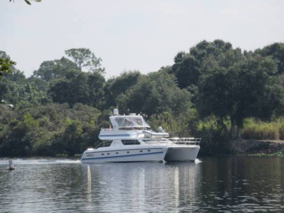
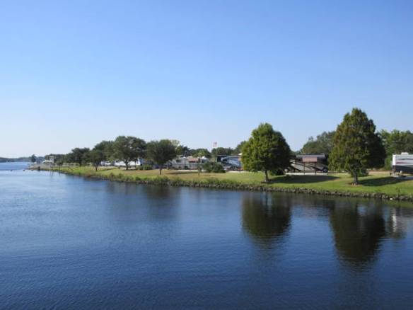
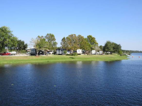
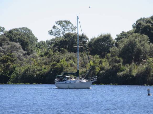
Boats staying at the campground tonight.

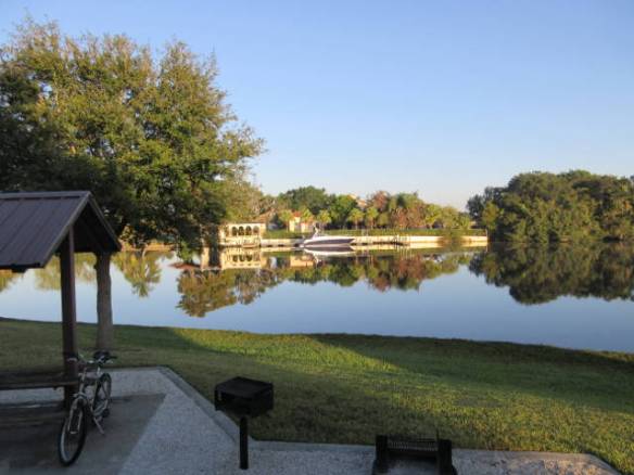
Around the campground the weekend residents departed. Most of the sites were taken later in the day by new residents. I expect the few that remained open tonight will fill tomorrow. Even four of the eight boat slips that are part of the campground were filled today. The boats are bigger than most of the RVs.

su2

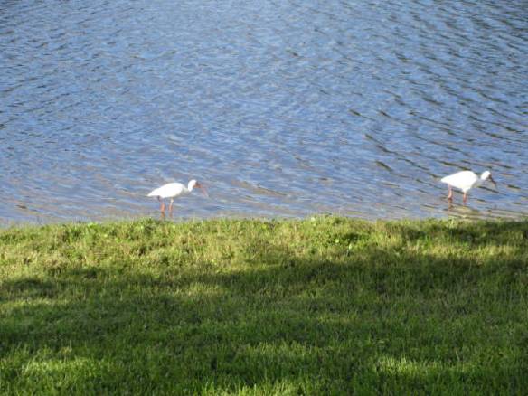
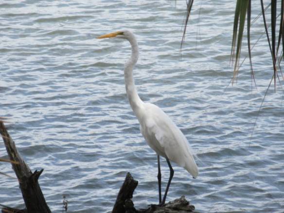
Taking lunch in the weeds at the rivers edge.

With the change to cooler weather I was in the mood for stew. I spent some time this afternoon preparing and cooking a beef stew. The limited size of the kitchen made the process a little more complicated than I’m used to. It was necessary to do more staging than I would typically. I needed to get all of the ingredients ready before starting the cooking process. Preparing the vegetables while the meat browned wasn’t an option since I needed the counter space of the covered stove to spread out. The stew turned out fine and the cooking process kept the RV warm. I now have leftovers to eat over the next couple of days. It is supposed to warm back up by Wednesday so I better hurry.

Pine Island

Saturday November 19th 2016

There were more clouds than sun today, but it didn’t really feel like a cloudy day. The temperature got to the high 70s. Tonight and the next couple of days are predicted to be well below normal temperature. I might even have to wear a long sleeve shirt. I can’t complain about this weather when the TV news is talking about the first major snow storm crossing the country to the north. I’m just getting spoiled by the good weather.

I started the day slowly. I had my morning coffee outside watching the fish in the river. Every minute or so a fish would break the surface of the water. Usually it was only a ripple, but a couple of times a fish actually jumped clear of the water. It’s cheap entertainment that lasted until a breeze came up to disturb the calm surface.

sa1

Waiting for the lock.

My morning exercise was a couple of laps around the campground. It isn’t a long walk. The campground only has thirty sites in a figure eight pattern. The nice thing is that every site has a view of the river. I enjoy checking out the boat traffic and the folks fishing from the bank and the pier connected to the dam. I still haven’t seen anybody catch a fish.

sa2

All white boat waiting for the lock

This afternoon I took a drive to Pine Island. It is a barrier island northwest of Fort Meyers. I was expecting a similar experience to Fort Meyers Beach. It was totally different. I didn’t find any beaches or houses lining the shore. I found a forested island with small fishing style villages. What homes I saw were far more modest than on some of the other islands. Often the homes were older one story dwellings on canals. Along the main north south road there were several trail heads for hiking paths into the pine forests. It’s nice to knnow that the island offers a different type of experience.

This evening the campground smells of wood smoke. The weekend campers are all gathered around campfires. The good thing is they are enjoying their weekend here without getting noisy. I’ve been in a few public campgrounds that can get very rowdy on the weekends.

Drive Along the Gulf Coast

Friday November 18th 2016

Last night I checked the time of low tide on Sanibel Island. My plan was to check out the shell hunting on the world famous beaches of Sanibel Island. It wasn’t to be today. I got started late around 10AM which coincided with the time of low tide. Then my confusion about the area roads bit me again.

I knew from my map study that I had to get off Interstate 75 before the airport and head west. I expected the road signs to indicate Sanibel Island as one of the destinations at the exit. I found very little indications of destinations on the highway signs. Most just contained the name of the road or route number at the exit. It turns out I exited the interstate one exit to far south. This wouldn’t have been to bad except that the road looped around to the east and entered the airport. I looped around through the airport and then went an additional exit south on the interstate looking for a road west. At this point I didn’t know I was to far south. When I reached US 41 I had another choice of north or south. Again I chose the wrong direction. I went south.

The last time I was in this area was 2013. I stayed at a motel on US 41 south of Fort Meyers. I recognized the motel when I passed it and knew I was too far south. Plan B was to go to the gulf beaches in Bonita Springs. I found the road to Bonita Beach and successfully found the Gulf of Mexico in the gaps between buildings. I turned the car north looking for a beach access. Every now and then a sign indicated a public beach access. Unfortunately, each access only had two or three parking spaces each of which were taken. I kept driving north toward Fort Meyers Beach looking for an access.

Fort Meyers Beach has a special event going on. The 30th Annual American Sandsculpting Championship started today through the 27th of November. Once the sculptures are complete this might be a fun event. I’m guessing that opening day isn’t the best day to tour the event. Like yesterday in downtown Fort Meyers, the inexpensive parking was taken and event parking was $10 near the beach. Further north, major road construction had concrete barriers down the middle of the road. I couldn’t get across the barriers to enter the few available beach access parking lots.

I enjoyed my drive north along the Gulf Coast. It would have been better if I could have wandered the beach a little, but I was off the barrier island area before I knew it. I still wasn’t far enough north to reach the access road to Sanibel Island. The route I was on inland did intersect the correct road, but it was more than 3 hours past low tide when I reached the decision point for the turn. I chose to come back another day. Looking for shells in a rapidly rising tide doesn’t sound like a very successful task. The good news is I followed the road back to the interstate. I know how to get to the island the next time.

f2

Afternoon visitors to my campsite.

f3

Egrets hanging out on the far bank.

f1

A gator in the river.

f4

Another egret feeding on the bank in the setting sun.

The campground was quiet this afternoon. Many people left this morning and the replacements didn’t arrive until almost night fall. I’m guessing they are from the local area in for the weekend or maybe the holiday week.

Driving in Fort Meyers

Thursday November 17th 2016

This morning I drove west toward Fort Meyers. I soon found myself in the middle of the old downtown area. It was easily identifiable by the imitation cobblestone streets. I’m not sure if was purely decorative or to slow traffic down. It kept my already slow pace even slower. Looking for a place to park was a lost cause. The inexpensive spots were all taken and the “event” lots were charging $10. It turns out the event was the annual fall boat show. I’ll do some internet research on things to see and do in the downtown area before I return.

I drove by the Edison and Ford Winter Quarters on the far side of the downtown area. I want to visit these winter homes of the two turn of the 20th century innovators while I’m here. Planning ahead, if I wait until after Thanksgiving I can see the estates decorated for Christmas. I’ll need to look at a map to find a better way to get there though.

Traffic in the Fort Meyers area is heavy and I haven’t figured out the street layout yet. Interstate 75 forms a natural eastern boundary for navigating the area and route 41, the Tamiami Trail, parallels the interstate about halfway to the coast. Figuring out what the east west roads are is my next challenge. The bridges to the barrier islands appear to have tolls. My Sunpass toll transponder will get some use. I verified it had sufficient funds when I got home. I do have a map in the car and my phone has Google maps, but what fun would it be to look them.

On the way home I stopped at Walmart for provisions. Running out of paper towels can be annoying. The surprising thing was that most of the Walmart employees were wearing Santa Clause hats. It must be another way they are trying to push the season. I’m going to have to stop shopping at Walmart until after the Christmas rush. Long lines at the checkouts are not one of my favorite things. At the very least, I’ll need to pick my shopping times carefully.

t1

Two boats waiting for the lock.

t2

Visitor to my camp site this afternoon.

I returned to the campground at mid afternoon. A number of sites near me have turned over. New campers have replaced the ones that departed. It seems like some of the new arrivals went right to the river bank to fish. The number of people sitting in chairs along the bank with fishing rods out has nearly doubled over the last couple of days. I’m still not sure what they expect to catch. I’ve heard everything from catfish to tarpon and snook. The problem with that is catfish are primarily fresh water and the other two would need brackish water or ocean. I don’t know southern fish species very well so I could be way off base. I’m watching to learn.

Checking out the area

Wednesday November 16th 2016

It was a chilly start to the day for Southwest Florida this time of year. It was in the high 50s to low 60s overnight. It warmed up well during the day to around 80 with a nice breeze. The general forecast is for below normal temperatures until the middle of next week. To me, it’s just beautiful weather.

Today was a slow catch my breath kind of day while I recover from whatever hit me on Monday. I checked out the local area for shopping and amenities. Surprisingly, it is not that easy to find those essentials in the local area. This campground is located in the middle of the Caloosahatchee River on an island connected to the dam and lock. The campground island is accessed from the north bank of the river across a causeway. The other side of the island is the dam followed by the lock before reaching the south side of the river. The north side of the river is all residential. The south side of the river has residential and commercial activity and a main east west route. Getting to the south side of the river from here is not quick. One bridge is about 5 miles east and another is a little further than that to the west.

w1

Early morning view in front of my RV home.

w2

East entry to the lock along the far river bank.

w3

One of the houses on the north bank of the river.

w4

Boat waiting for the lock.

The campground river and dam complex is a nicely laid out recreation area. The dam and lock were built in 1965 for flood control and navigation. The lock is located about 33 miles from the Gulf of Mexico. The river forms part of an east west inter-coastal waterway.

w5

View west of the campground from the dam

w6

View to the east of the campground from the dam

w7

Dam and Lock looking east from the campground island.

The campground is very popular. It has a two week limit, but is full most of the time. It has a combination of local Floridians here for the fishing and boating and travelers of all kinds. The two week limit means there is turn over every day, but it appears there are reservations for the whole winter. When I made reservations in June there were only a couple of sites available. Reservations can be made 6 months in advance.

Travel to W. P. Franklin Recreation Area

Tuesday November 15th 2016

I got up at 6AM this morning after 12 hours of fitful sleep. Whatever hit me yesterday afternoon was much diminished if not gone this morning. I’m not sure if it was food poisoning or some other virus, but I’m not taking any chances with the remaining donuts. They’re going out with the trash.

Taking it slow and easy with the remaining packing, I departed St. Augustine at 9AM. My route to the W. P. Franklin recreation area east of Fort Meyers Florida was down the east coast and across the state just north of Lake Okeechobee. The mapping programs I use wanted me to take Interstate 4 through Orlando. That route is on my list of avoid if at all possible roads. Interstate 95 down the coast had some construction, but nothing like the mess in Orlando. The drive across the state on secondary roads was through cattle land, farm land and an occasional swamp.

I arrived at the W.P. Franklin campground just before 3PM. I have a back in site along the river. It takes a little more time to get into a back-in. I have to disconnect the towed car before I can maneuver into the site. Today was not one of my better backing efforts. It took me four tries before I was happy with the orientation of the RV on the site. The first 3 attempts I was crooked one way or another.

tu1

Site 3 at the W.P. Franklin Recreation Area Campground

This is a Corp of Engineer Campground at one of the locks on the Caloosahatchee River. This is part of the waterway that goes from the Gulf of Mexico into Lake Okeechobee. Another waterway goes from the lake to the Atlantic Ocean in Port St. Lucie. So far I haven’t seen any boats underway. Many of the people here seem to be here for the fishing. I’m not sure what they are trying to catch.

tu2

My view from site 3.

I’ll me here for two weeks. I intend to tour around a lot of Southwest Florida. Tomorrow I’ll start by checking out the area between here and Fort Meyers.

Extra Day in St. Augustine

Monday November 14th 2016

Today was going to be a travel day, but I extended an additional day at the Compass RV park in St. Augustine. My next reservation starts on Tuesday the 15th in the Fort Meyers area. Doing the whole travel distance in one day will make for a longer travel day than I’d prefer, but I wanted to pick up my mail in Green Cove Springs before I left the area.

I picked up my mail and got more details on the exact procedure to register my vechicles and get my Florida Drivers license. I need to get that completed before the end of the year. I don’t intend to wait that long. On the trip back I stopped at the grocery store for food for the next few days. One of the things I bought were custard filled donuts.

When I got back to camp, I had two of the donuts for desert after my roast beef sandwich lunch. Then I started getting ready for the travel day tomorrow. A couple of hours later just as I was finishing the first set of travel preparations something started to upset my stomach. I went inside to rest and things went down hill from there. I went to bed at about 6PM. I missed the Super Moon.

I am writing this blog entry on Tuesday night. I have been OK all day, just not 100%.

Another Walk in Palm Coast FL

Sunday November 13th 2016

The weather today was similar to yesterday. It was cloudy and cool in the low 70s here, but warmer and partly sunny to the south. I went south to Palm Coast to hike along the Inter-coastal Waterway and checkout the storm damage. I took a similar hike back in August that I documented in the blog entry Walking in Palm Coast FL.

sn1

Marina on the far side of the Matanzas River in Palm Coast FL

sn2

Boat getting ready to enter the Marina. The guy hanging over the rail is preparing bumpers not falling overboard.

After breakfast and an overdose of Sunday morning news shows I headed down Interstate 95 to the planned community of Palm Coast. They have built a nice set of parks and walking trails along the Inter-coastal waterway. In this area the waterway is narrow as it follows the Matanzas River. The boat traffic passes by close enough to see the faces of the passengers. The paths are on the mainland shore of the Inter-coastal. The opposite bank has single family homes and a marina.

sn4

A pile of debris ready to be removed.

The Palm Coast area is heavy with trees. During the storm the winds took down many limbs, palm fronds and whole trees. Over the last several weeks the damaged trees have been removed to clear the roads and pathways. There are still some piles of debris along the roads and paths that haven’t been removed. They were working today, a Sunday, to pick up some of the debris piles along the roads.

sn5

Stump of tree that came down in the storm winds.

I walked about 2 miles north along the river from the Waterfront Park then returned to the car. The 4 mile round trip with stops for wildlife, boat pictures and general contemplation of nature took about and hour and a half. There were many others enjoying the walkway on a true Florida fall day. It wasn’t to hot or to cold.

sn3

Great Egret along the side of the Mantanzas River.

The wildlife highlight of the day was a great egret on the bank of the river that seemed to pose for my camera. I was about 20 feet away, but I think I could have walked up closer. I hung around hoping to see the egret in flight, but it decided to wade up the river.

After my walk along the Inter-coastal, I returned to my RV home and the TV. The NFL games were actually pretty good contests for a change. As I’m finishing typing this the Patriots have taken an initial lead over the Seahawks in the Sunday Night Game. Time to watch some more football.

Checking out the Coast

Saturday November 12th 2016

Today I drove south along the coast from St Augustine about 30 miles to Flagler Beach. The weather in this area was cloudy and cool around 70 degrees, but the cloud cover broke as I got further south. In the Flagler Beach area it was partly cloudy in the high 70s.

It is now five weeks since hurricane Matthew went up the coast. As you drive along the coast wind damage is visible. Tarps cover roofs, siding is missing from houses and trees show signs of significant damage. Water damage is also evident. Beach access stairs are broken or missing. Side roads between route A1A and the beach show evidence of being underwater or sand filled. The area around the Matanzas Inlet seem to have been rearranged some. It looks like the channel to the ocean is in a different position. I base this supposition on my memory of the area from August, so I could be wrong. The point is it looked different.

I stopped my journey down the coast at Flagler Beach because I know A1A was washed out by the storm south of where I reversed direction. The pictures were shown on TV after the storm. The time estimate to get it fixed was long although they were trying to expedite the repair. A1A is detoured through residential streets.

The hurricane had bands of winds as it moved north. The visible damage seems to reflect that characteristic. For a mile or two you see very little evidence of damage, then it reverses. For the next few miles there is a lot of damage visible. All of this points out just how powerful and devastating a hurricane can be, but there is still an element of luck when it comes to impact to an individual’s property. All the more reason to evacuate before the storm arrives.

st1

View south along the beach at Marineland

st3

View north along the beach at Marineland. Note that the sky to the north is overcast.

I stopped at the beach just south of Marineland to checkout the ocean at low tide. This is more of a fishing beach than a swimming beach. One guy was fishing and a couple of groups were sunbathing. There several sandpipers feeding in the surf that kept my attention for a few minutes. How they keep from getting pushed or dragged by the wave action is amazing.

st2

Sandpiper feeding in the surf.

The highlight of the trip back was spotting a Bald Eagle on top of the sign for the Fort Matanzas National Monument. This is a protected wildlife area. I wasn’t able to stop and take a picture, but it was a nice observation. I don’t think of eagles as native wildlife in Florida, but they are with a large population in the state.

Veterans Day Traffic

Friday November 11th 2016

It was another cool day. The temperature didn’t get much above 70F. The sun was out in the morning but it clouded over by mid afternoon. That concludes the weather report for this blog.

This area seems to be very focused on celebrating and thanking out countries veterans. Many of the communities held parades and other celebrations. Empty parking lots implied several local non-retail businesses were closed. The strong support may be because of the heavy Navy presence in the Jacksonville area or just plain patriotism. Whatever the cause, it’s a good thing.

Traffic today was very heavy. Going to the grocery store I had to wait at every traffic light at least one cycle. At a couple of signals, I waited two cycles. It wasn’t fun travel. It is probably the holiday but it may be the arrival of the snowbirds. The number of non Florida license plates are increasing rapidly and campgrounds like this one are filling up for the winter.

Another possible explanation of the traffic in the shopping districts is Christmas shopping. This years great marketing ploy seems to be early Black Fridays. As soon as the election ads ended, the department stores and big box stores have started ads for weekend sales with an emphasis on getting started on Friday. Looking at the calendar it is hard for me to believe that Thanksgiving and Black Friday are two weeks away. It’s just another one of those disconnects resulting from unfamiliar seasonal clues. Fall in Florida doesn’t look like fall in New England.

fr1

Campground retention pond complete with water circulation fountain.

This afternoon I walked around the campground. This campground like others in Florida is situated on reclaimed marshy, almost swamp land. The area is dried out by creating water retention ponds. To keep the water moving and aerated they put a pump and fountain in the middle. The pond in this campground even has fish stocked for catch and release fishing. It looks like they are adding a path and bench seating around the pond. I’m really impressed by the work the new owners of this campground are doing.

Thank you to all the Veterans.