
Friday May 19th 2017
Today I set out to visit the Shoshone Falls on the Snake River. I knew it was about two miles up river from the Perrine bridge, but I needed road signs to narrow down the search. Since I didn’t see any signs on US 93 after it crossed the bridge, I took the first road east on the south side of the river. That road had a couple of small signs announcing the distance to the falls.
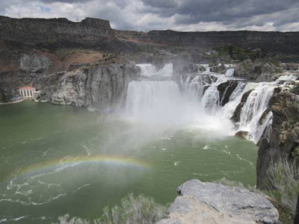
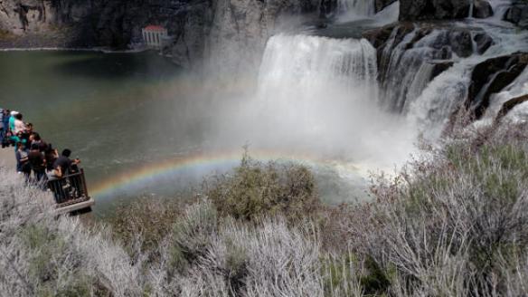
Shoshone Falls complete with rainbow.
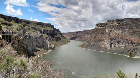
Looking west, down river, from the Shoshone Falls area.
The falls viewing area is located in a city park about two thirds of the way down the canyon wall. The road hugs the cliff down to a parking area and the nice green lawns of the park. There was a big tour bus in the parking area. I’m glad I didn’t meet it on the way down the cliff. It would have used both lanes on some of the tight curves on the road.
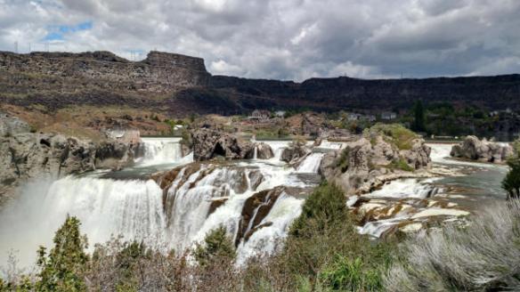
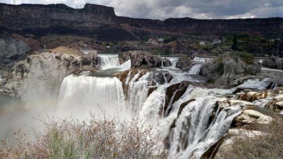
Falls still have a high flow rate.
Another rainbow.
The Shoshone Falls are known as the Niagara of the west. They are 212 feet high about 45 feet higher than Niagara Falls and nearly 1000 feet wide. It doesn’t look higher than Niagara Falls, but the viewing area is many feet above the falls so the angel diminishes the impact of the height. The volume of water going over the falls this year is at a twenty year high. The large amount of run off has allowed the river flow managers to keep the high flow rate. On Wednesday of this week they started cutting back on the flow to allow water for irrigation in the valley. Dams up river are holding back and diverting water into irrigation canals. Ultimately the water flow will be down to just enough to support the hydroelectric plant.
There was plenty of water going over the falls today. The roar of the water could be heard from the viewing areas and plenty of mist was rising from the river. When the sun was out several rainbows were visible. Everybody had a camera from little kids to senior citizens. By far the most common was cell phone cameras, but one gentleman had an SLR on a tripod aimed at falls. I suspect he was taking timed exposures of the water flow.
When I left the falls I turned east to see if the park was more accessible and marked from the other direction. It didn’t seem to be. I ended up heading east away from my RV home on Interstate 84. I probably went fifty miles through farm lands before I decided to reverse course and return to home. I don’t think the crops are all potatoes, but I did finally identify one field that I am pretty sure was planted with potatoes. These were far enough into the growing season that they looked vaguely familiar.
