
Friday April 14th 2017
Today I took a trip to the Hoover Dam and the surrounding area. This is the trip I’d planned to take yesterday, but the wind caused me to postpone the trip. The wind today was very light.

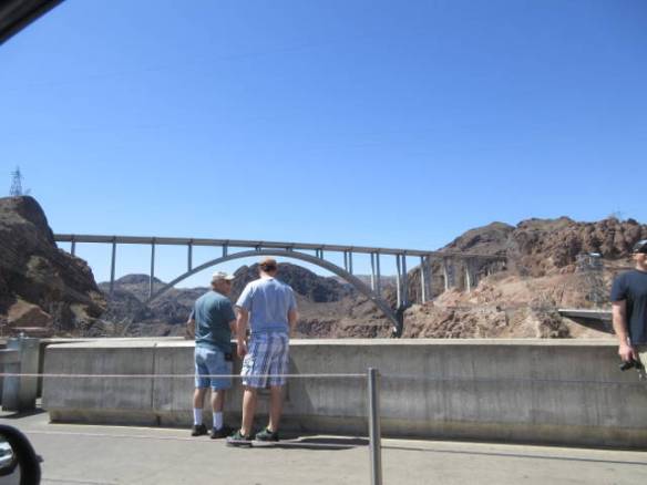
Mike O’Callaghan – Pat Tillman Memorial Bridge from the Hoover Dam access road.

Bridge Facts
Hoover Dam is about 25 miles southeast of Las Vegas. It blocks the Colorado River at Black Canyon to create Lake Mead. To reduce traffic at the dam and to address security concerns the Mike O’Callaghan – Pat Tillman Memorial Bridge across the canyon opened in 2010. The dam, the lake and the bridge are all impressive entities that draw lots of tourists out of Las Vegas every day.
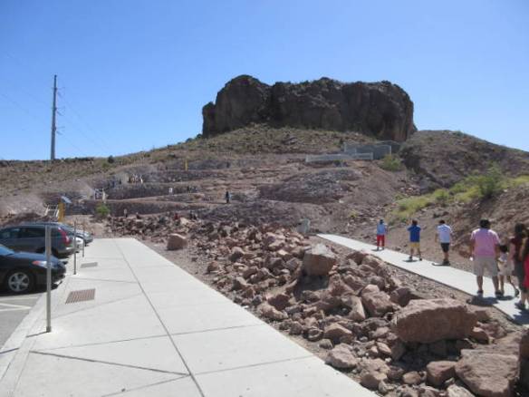
Path to the bridge from the parking lot. Ramp switchbacks and stairs are provided.
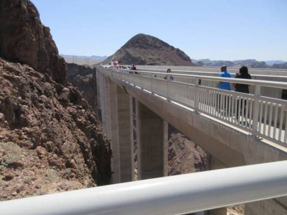
Bridge sidewalk and support structure from the Nevada side of the bridge.
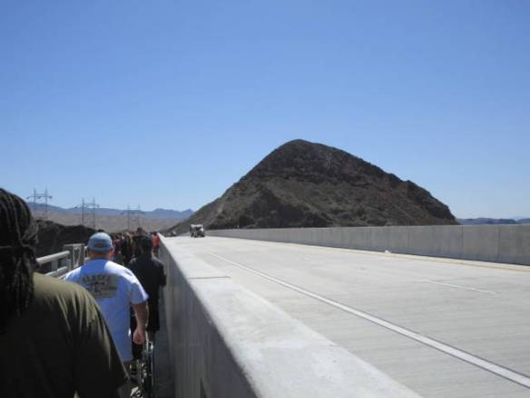
US Highway 93 Northbound lane beside the bridge sidewalk.
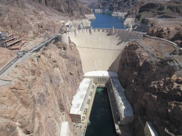
Hoover Dam from the center of the bridge above and south of the dam.
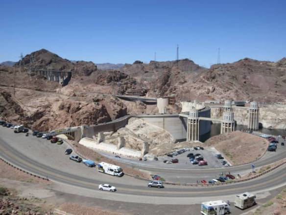
I took a tour of the dam on one of my first visits to Las Vegas. This was before the terror attacks of 9/11. I understand the tour is more restricted since then. My goal today wasn’t the workings of the dam, but to visit the overall area. It was a very busy day. Parking was difficult to find.
My first stop was at the bridge. The parking lot is located at the base of a butte that abuts the bridge. To get to the bridge you need to climb up to the roadway. There are steps and ramps to keep it handicap accessible. Once at the top, you can walk out on a walkway separated from the oncoming traffic by a cement barrier. The other side has an aluminum railing that keeps you from falling 880 feet into the river. I’ve been out on the bridge before and came back even thought I’m not one hundred percent comfortable. The views are worth it. You can see the dam, the river and powerhouses at the base and Lake Mead in behind the dam.
Bridge across the Black Canyon as seen from the top of Hoover Dam. Picture taken out car window while paused for pedestrians.
View from the top of the canyon on the Arizona side of the Colorado River.
After the viewing the dam from the bridge I continued down into the canyon and onto the dam. All of the paid parking locations near the dam were full. I continued across the dam and up the Arizona side. The first place I found to park was at the very top of the climb on the far side. It’s a good thing I took pictures of the bridge as I crossed the dam, because it couldn’t walk back to the dam from my parking location.

Another view of the bridge from the top of Hoover Dam.
After the bridge and dam I stopped to view Lake Mead from the top of a rock hill. The white bands of discolored rock that used to be underwater continue to indicate low the water level. It’s not just a few feet but tens of feet. With all of the demands on the water from the Colorado, it is unlikely that the flow can be slowed enough to ever get the level back up. River is vital to power generation, drinking water and agriculture irrigation for large areas of Southern California, Arizona and Nevada.

Panorama view of Lake Mead.

View of Lake Mead from the visitors center.
At the Lake Mead National Recreation area visitors center the overview movie focuses on the recreational uses of Lake Mead. It only mentions the uses of the water in passing and the low water level is only discussed in one graphic with little narration. I continue to be impressed with the slant the National Park Service manages to apply to their overview movies. Sometimes it for political correctness and other times it to drive home a message. This one seems to be focused on putting a positive spin on everything. I guess it worked. I departed moderately informed and not upset about what I saw. I’ve been to other National Parks were the movie seemed to try and brainwash me with revisionist history so I’m always on guard.
